2000s (21st Century) Maps of Okaloosa County, Florida
Explore 20 historic maps of Okaloosa County from the 2000s (21st Century). These maps offer a rare glimpse into what life looked like during the 2000s — showing old roads, neighborhoods, homes, and landmarks that have changed or disappeared over time.
Whether you're researching your family's past, planning a metal detecting trip, or studying how Okaloosa County's landscape evolved across the 2000s, these high-resolution maps are a powerful tool for exploring the history of this region.
- Focus on a specific era: All maps on this page are from the 2000s, giving you a focused view of this time period.
- See what’s changed: Compare century-old streets, trails, and buildings to today's modern landscape using overlays and satellite layers.
- Research with precision: Use these maps for genealogy, historical research, land use analysis, or educational projects.
- View, download, or print: Maps are fully viewable online in high resolution, and can be downloaded or printed for your own records.
Start exploring Okaloosa County's history through authentic maps from the 2000s. This is your window into the past.
Okaloosa County, FL maps
(20)- 2024 Map of Laurel Hill, 2024 Print
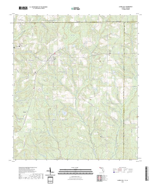 2024 Laurel Hill2024 Print · USGSThe Alabama-Florida state line and the rural reaches of Okaloosa County come alive in this recent survey. Local historians can trace family roots at New Travelers Rest Cem, Almarante Cem, and the old crossroads at Svea.
 - 2024 Map of Baker, 2024 Print
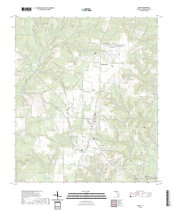 2024 Baker2024 Print · USGSNorth Florida's river country comes to life in this survey of the communities surrounding Baker and Milligan. Genealogists can trace family names through local landmarks like Pyron Chapel Cem, Griffith Cem, and the Griffith Ferry Stretch along the Yellow River.
 - 2024 Map of Hurricane Lake, 2024 Print
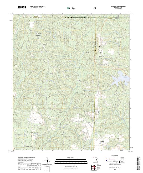 2024 Hurricane Lake2024 Print · USGSThe Florida-Alabama borderlands come to life in this recent survey of the timber and creek country near Munson. Genealogists and local historians can trace family ties at Beaver Creek Cem and Valley Grove Cem or locate the Blackwater Airfield.
 - 2024 Map of Munson, 2024 Print
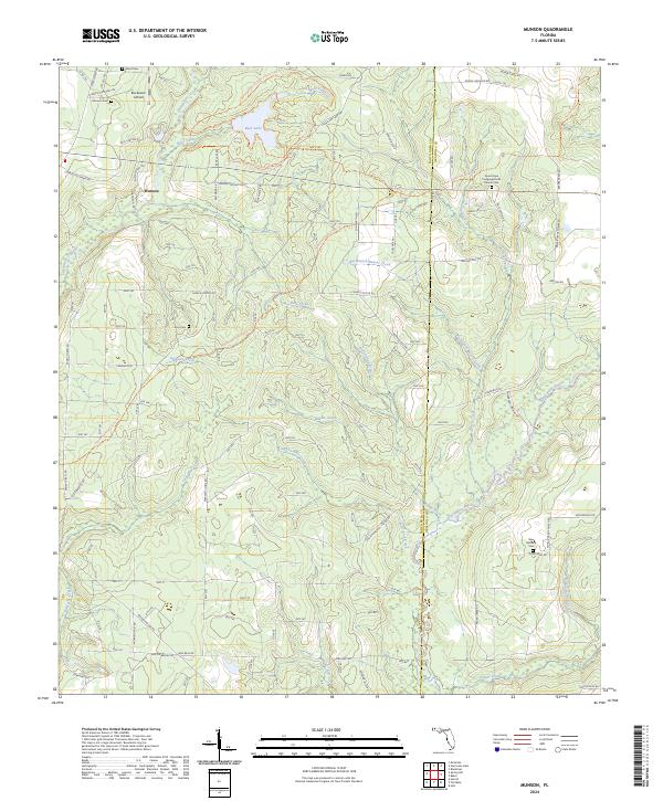 2024 Munson2024 Print · USGSThe Florida Panhandle north of Milton is captured here in recent years, showing a landscape of managed forests and river systems. Genealogists and hikers can trace Munson Cem, the Good Hope Congregational Church Cem, and the path of the Florida National Scenic Trl.
 - 2024 Map of Crestview North, 2024 Print
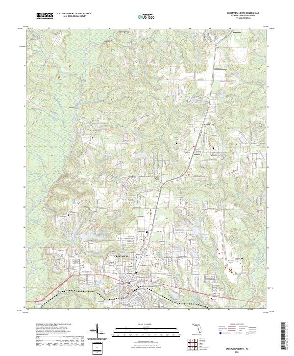 2024 Crestview North2024 Print · USGSNorth Florida's panhandle communities come into focus in this recent survey of the area surrounding the county seat. Researchers can trace family history through sites like the Owen Family Cem, the Okaloosa County Courthouse, and the tracks of the L & N RR.
 - 2024 Map of Blackman, 2024 Print
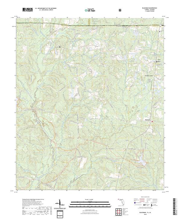 2024 Blackman2024 Print · USGSThe Florida-Alabama state line and the upper reaches of the Blackwater River define this rural landscape in the 2020s. Genealogists and local historians can trace family-named landmarks like Red Oak Cem, Clements Cem, and the settlement at Blackman.
 - 2024 Map of Dorcas, 2024 Print
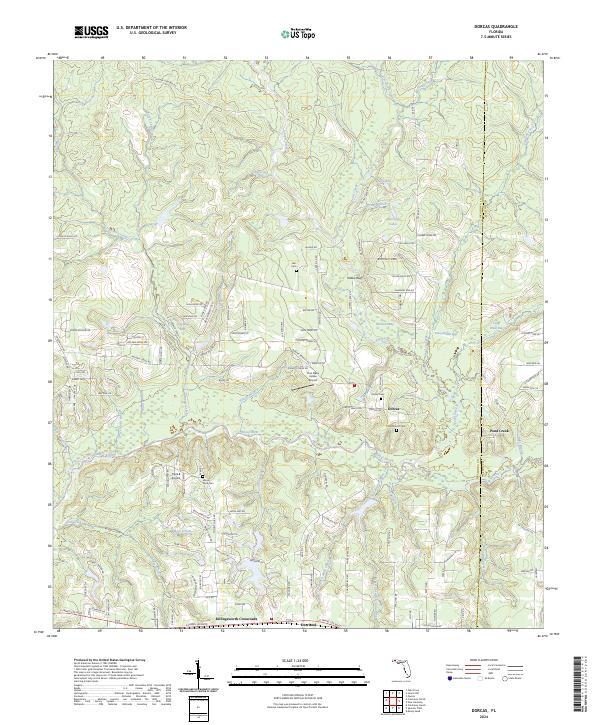 2024 Dorcas2024 Print · USGSNorth Florida’s river-fed lowlands come into focus here, showcasing the small settlements and family burial grounds along the Shoal River. Trace local genealogy and land use through Killingsworth Crossroads, Dorcas, and the historic Old Dorcas Cem.
 - 2024 Map of Holt SW, 2024 Print
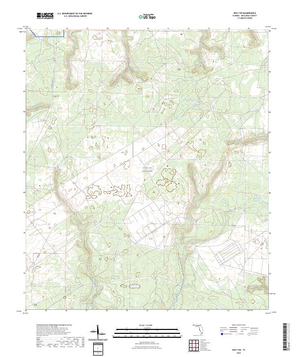 2024 Holt SW2024 Print · USGSIn the Florida panhandle south of Holt, this modern survey reveals the vast wetlands and secure lands of Eglin Air Force Base. Researchers can trace the winding paths of Turtle Creek and East Bay Swamp alongside Military Road 257.
 - 2024 Map of Spencer Flats, 2024 Print
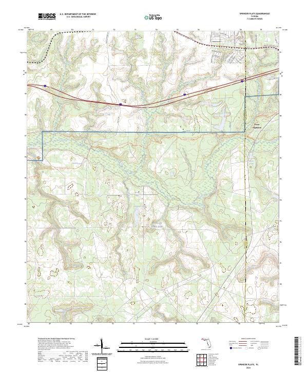 2024 Spencer Flats2024 Print · USGSThe Okaloosa and Walton county line meets at Eglin Air Force Base in the mid-2020s, showing a landscape of tactical reservations and rising residential pockets. Researchers can trace the path of the Florida National Scenic Trl past Walton Pond and the headwaters of Titi Creek.
 - 2024 Map of Crestview South, 2024 Print
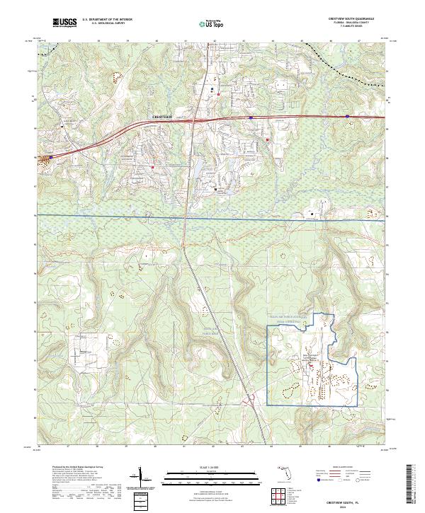 2024 Crestview South2024 Print · USGSFlorida's Panhandle hinterlands meet high-tech aviation in this survey of the region south of Crestview. Genealogists and hikers can trace family sites at Antioch Baptist Church Cem or follow the Florida National Scenic Trl along the Shoal River.
 - 2024 Map of Niceville, 2024 Print
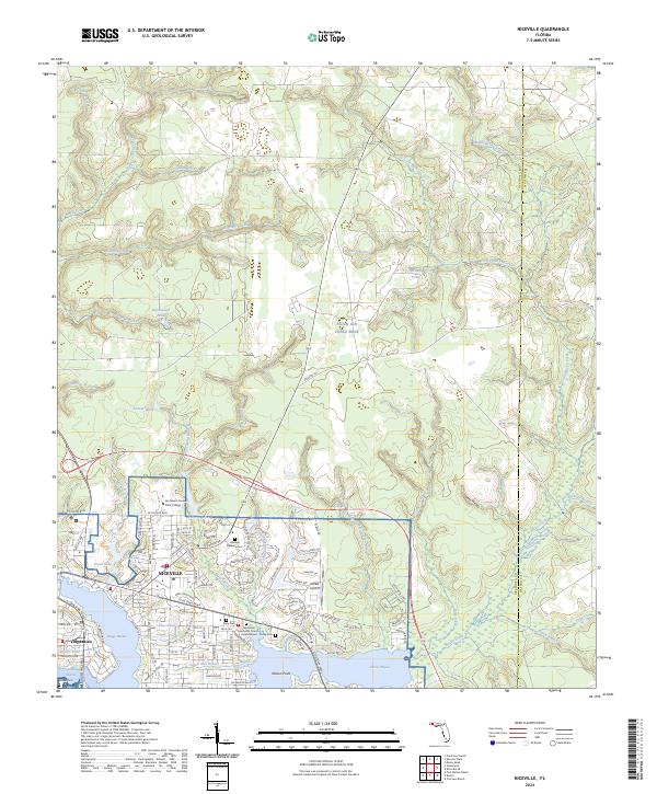 2024 Niceville2024 Print · USGSThe coastal settlements of Niceville and Valparaiso are shown in high detail during their modern development alongside Eglin Air Force Base. Researchers can trace local history at Heritage Gardens Cem or follow the winding Boggy Bayou shoreline to Nelson Point.
 - 2024 Map of Valparaiso, 2024 Print
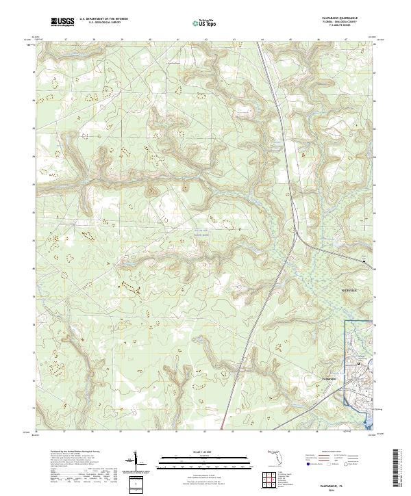 2024 Valparaiso2024 Print · USGSThe coastal and military landscape of the Florida Panhandle is shown here in detail during the 2020s. Genealogists and researchers can trace the modern development around Valparaiso and Niceville, locating sites like the Niceville Community Cem and Boggy Bayou.
 - 2024 Map of Floridale, 2024 Print
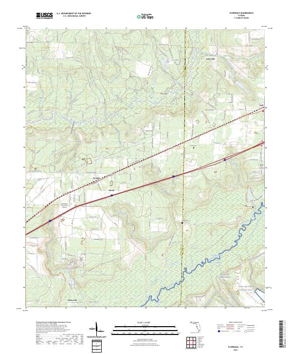 2024 Floridale2024 Print · USGSSanta Rosa and Okaloosa counties are shown in this contemporary study of Florida's riverfront woodlands. Genealogists and historians can trace the vicinity of Kellys Mill, locate family sites at Melvin Cem, or follow the trails through Harold.
 - 2024 Map of Holt, 2024 Print
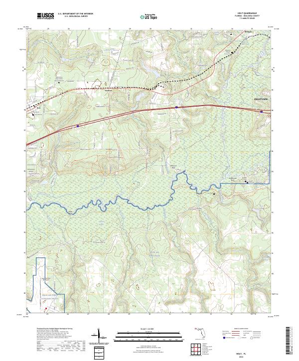 2024 Holt2024 Print · USGSOkaloosa County remains a mix of deep-rooted rural settlements and significant military aviation history in this 2024 survey. Local historians can trace family sites like Beulah Cem alongside modern landmarks like Eglin Air Force Base and the Yellow River State Trail.
 - 2024 Map of Oak Grove, 2024 Print
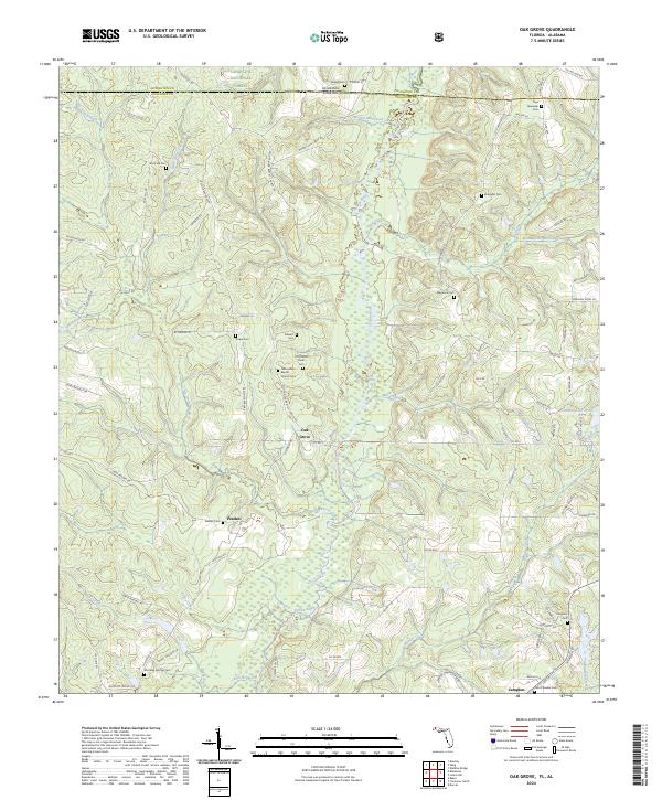 2024 Oak Grove2024 Print · USGSNorth Florida and South Alabama meet in this 2024 study of the river-bottom lands and forests near the state line. Genealogists and local historians can trace family ties through numerous rural burial sites including Scipio Cem, Peaden Cem, and Stewart Cem.
 - 2024 Map of Harold SE, 2024 Print
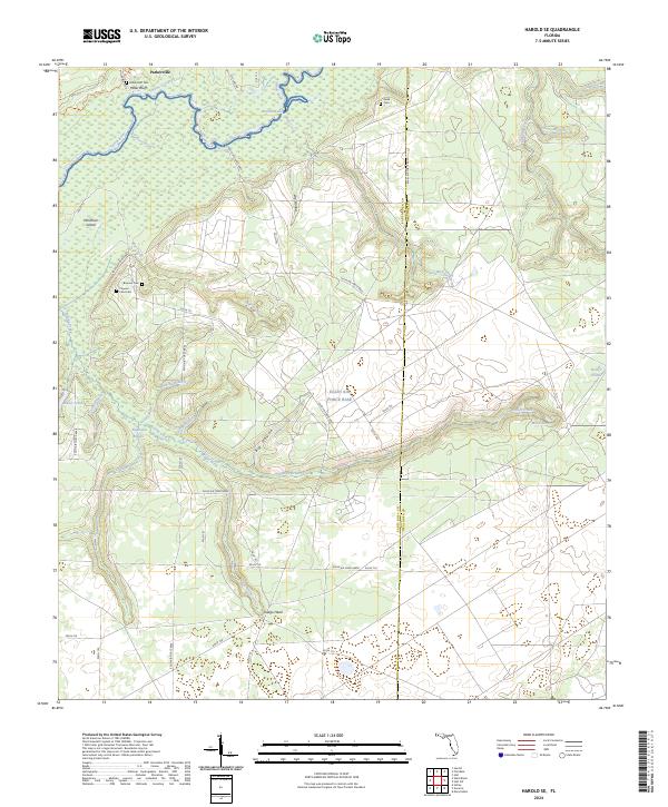 2024 Harold SE2024 Print · USGSThe Yellow River corridor and Eglin Air Force Base dominate this part of the Florida Panhandle in the early twenty-first century. Genealogists and local researchers can locate several rural burial sites, including Miller Bluff Cem and Faulk Cem, alongside the small settlement of Indigo Head.
 - 2025 Map of Navarre, 2025 Print
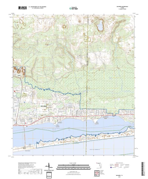 2025 Navarre2025 Print · USGSNavarre and the Santa Rosa Sound shoreline are depicted here in the mid-2020s, showing the intersection of coastal growth and vast military lands. Researchers can trace local development near Wynnehaven Beach, the Fort Walton Beach Airport, and the protected Gulf Islands National Seashore.
 - 2025 Map of Destin, 2025 Print
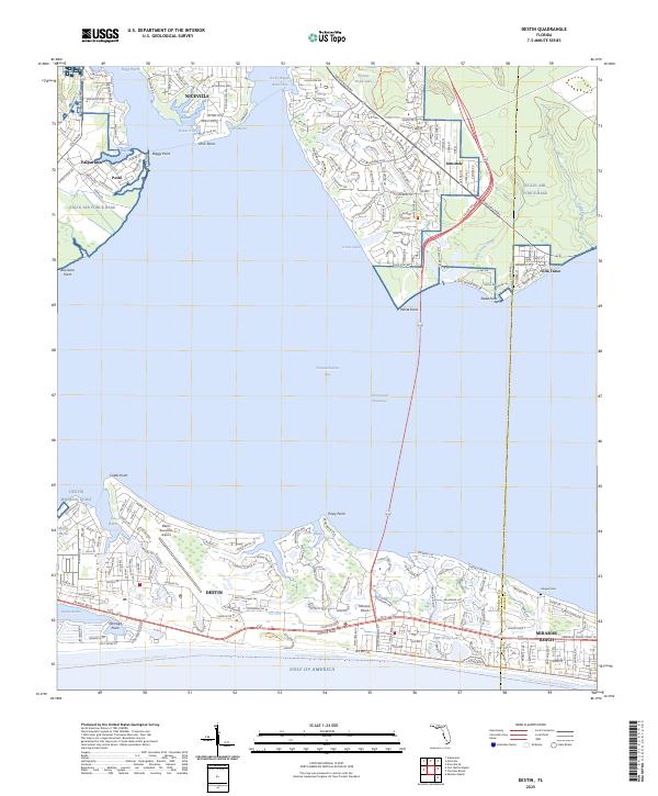 2025 Destin2025 Print · USGSCoastal Florida's evolving maritime landscape is documented here during the mid-2020s, showing the dense development between the Gulf and the bay. Researchers can trace the layout of Niceville, locate the Haugen Cem, and study the sprawling grounds of Eglin Air Force Base.
 - 2025 Map of Mary Esther, 2025 Print
 2025 Mary Esther2025 Print · USGSCoastal Florida's military and residential landscape is revealed in this contemporary survey of the panhandle. Researchers can trace local heritage through sites like the Jesse Rogers Memorial Cem and the University of West Florida-Emerald Coast.
 - 2025 Map of Fort Walton Beach, 2025 Print
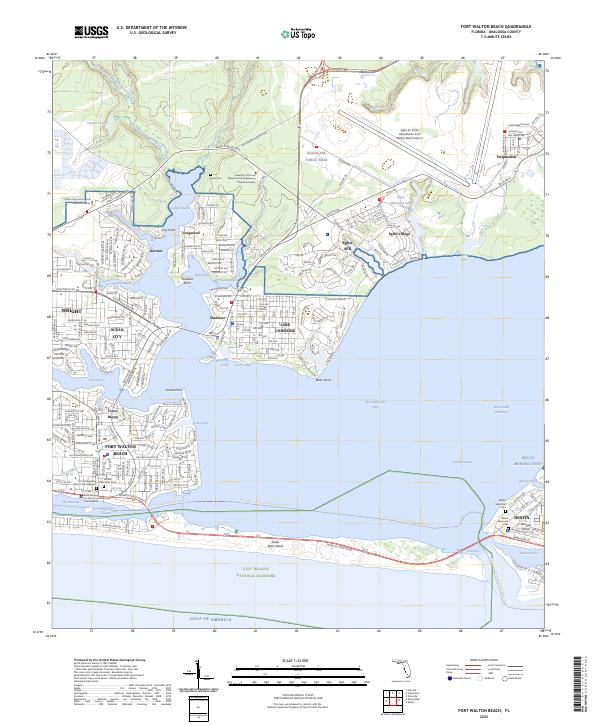 2025 Fort Walton Beach2025 Print · USGSThe Florida Panhandle coast and its complex bayous are shown here in the mid-2020s, highlighting the integration of military and civilian landscapes. Genealogists can locate specific sites like Marler Memorial Cem and Brooks Memorial Cem among the settlements of Destin and Valparaiso.
End of results
Showing maps 1-20 of 20
Top cities of Okaloosa County
- Crestview historical maps
- Fort Walton Beach historical maps
- Destin historical maps
- Niceville historical maps
- Valparaiso historical maps
- Mary Esther historical maps
See more
Frequently asked questions
- What are the different types of historical maps available for Okaloosa County?
- What is the oldest map of Okaloosa County?
- Where can I purchase historical maps of Okaloosa County for my home or office?
- Where can I download high-res historical maps of Okaloosa County?
- Are there historical topographic maps available for Okaloosa County?
- Is there historical aerial imagery available for Okaloosa County?
- Where are historical maps of Okaloosa County sourced from?