Old Maps of Niceville, Florida for Academic Research
Study the evolution of Niceville with 14 high-resolution historic maps. Whether you're teaching, researching, or modeling changes in land use, these maps provide essential visual documentation of urban, environmental, and geographic change.
- Analyze long-term change: Track patterns in development, transportation, and natural features.
- Ideal for environmental or urban studies: Support academic projects with primary historical map data.
- Use in the classroom or lab: Educators and researchers rely on these maps to bring historical context to life.
These maps are a powerful tool for teaching, research, and visualizing how Niceville has changed over the decades.
Niceville, FL maps
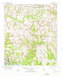
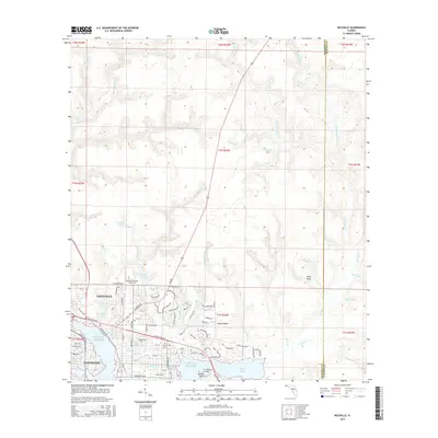
(14)- 1934 Map of Niceville
 1934 Niceville1934 Print · USGSThe Florida Panhandle in the mid-thirties reveals a landscape of tidal bayous and managed pine forests. Researchers can trace early infrastructure like the Bolton Turpentine Still, State Convict Camp No 12, and the path of the Old Spanish Trail.
 - 1936 Map of Niceville
 1936 Niceville1936 Print · USGSThe Okaloosa and Walton County line area is documented here in the mid-1930s, showing the transition from northern rail towns to coastal settlements. You can trace early family landmarks and infrastructure like Early Cem, Spencer Flats, and the Ramer Lookout Tower.4 unique versions available
 - 1956 Map of Niceville
 1956 Niceville1956 Print · USGSCoastal Okaloosa and Walton Counties are shown in the mid-fifties as the military and aviation presence expanded around the Choctawhatchee Bay. Genealogists and historians can locate early airstrips like Pierce Field, the rail stop at Deerland, and local landmarks like Mt Sinai Ch.3 unique versions available
 - 1957 Map of Pensacola, 1967 Print
 1957 Pensacola1967 Print · USGSThe Florida Panhandle and Alabama coast are seen here at the height of the Cold War, showcasing a unique mix of military aviation and emerging beach tourism. Genealogists and local historians can trace legacy sites like Old Corry Field, the lumber town of Bagdad, and the coastal reaches of Santa Rosa Island.3 unique versions available
 - 1959 Map of Pensacola
 1959 Pensacola1959 Print · USGSThe Florida Panhandle and Alabama coast come alive in this late fifties survey of military aviation and maritime life. Genealogists can trace family roots in Bagdad, Loxley, and Milton while mapping the rails of the Louisville and Nashville.
 - 1960 Map of Pensacola
 1960 Pensacola1960 Print · USGSThe Florida Panhandle and Alabama's eastern shore are shown during a period of rapid military and coastal growth. Genealogists and historians can trace the mid-century footprints of Warrington, the Pensacola NAS (Chevalier), and the Blackwater River timber lands.
 - 1970 Map of Niceville, 1972 Print
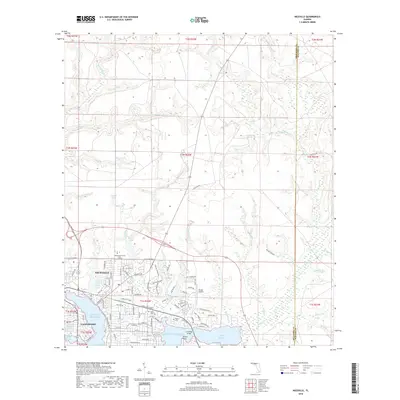
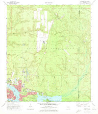 1970 Niceville1972 Print · USGSNiceville and Valparaiso are shown here at the start of the 1970s, shaped by the waters of Boggy Bayou and the expansion of Eglin Air Force Base. Trace local history through Rocky Cem, Pinecrest Community Ch, and the old Claypit sites.4 unique versions available
 - 1978 Map of Crestview, 1982 Print
 1978 Crestview1982 Print · USGSThe Florida Panhandle and southern Alabama borderlands appear here in the late seventies as the military and timber industries shaped the landscape. Genealogists can trace family roots through small settlements like Cannon Town or Svea, and locate old sites like Aux Field No 4 (Abandoned).2 unique versions available
 - 1994 Map of Niceville, 1999 Print
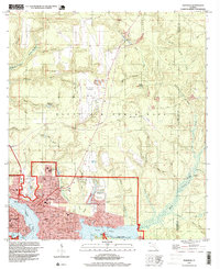 1994 Niceville1999 Print · USGSCoastal Okaloosa County is shown in the mid-1990s as the communities of Niceville and Valparaiso expanded around the bayous. Researchers can find local landmarks like Okaloosa Walton Jr College, Sunset Cem, and the Pinecrest Community.
 - 2012 Map of Niceville, 2012 Print
 2012 Niceville2012 Print · USGSCovers Niceville, including Valparaiso, Okaloosa County, and other nearby areas
 - 2015 Map of Niceville, 2015 Print
 2015 Niceville2015 Print · USGSCovers Niceville, including Valparaiso, Okaloosa County, and other nearby areas
 - 2018 Map of Niceville, 2018 Print
 2018 Niceville2018 Print · USGSCovers Niceville, including Valparaiso, Okaloosa County, and other nearby areas
 - 2021 Map of Niceville, 2021 Print
 2021 Niceville2021 Print · USGSCovers Niceville, including Valparaiso, Okaloosa County, and other nearby areas
 - 2024 Map of Niceville, 2024 Print
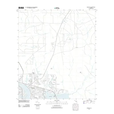
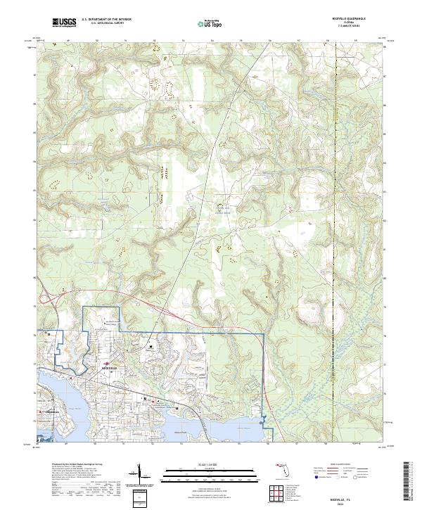 2024 Niceville2024 Print · USGSThe coastal settlements of Niceville and Valparaiso are shown in high detail during their modern development alongside Eglin Air Force Base. Researchers can trace local history at Heritage Gardens Cem or follow the winding Boggy Bayou shoreline to Nelson Point.
End of results
Showing maps 1-14 of 14
Top cities near Niceville
- Crestview historical maps
- Fort Walton Beach historical maps
- Destin historical maps
- Miramar Beach historical maps
- Valparaiso historical maps
- Mary Esther historical maps
See more
Frequently asked questions
- What are the different types of historical maps available for Niceville?
- What is the oldest map of Niceville?
- Where can I purchase historical maps of Niceville for my home or office?
- Where can I download high-res historical maps of Niceville?
- Are there historical topographic maps available for Niceville?
- Is there historical aerial imagery available for Niceville?
- Where are historical maps of Niceville sourced from?