Old Maps of Fort De Soto, Florida for Academic Research
Study the evolution of Fort De Soto with 15 high-resolution historic maps. Whether you're teaching, researching, or modeling changes in land use, these maps provide essential visual documentation of urban, environmental, and geographic change.
- Analyze long-term change: Track patterns in development, transportation, and natural features.
- Ideal for environmental or urban studies: Support academic projects with primary historical map data.
- Use in the classroom or lab: Educators and researchers rely on these maps to bring historical context to life.
These maps are a powerful tool for teaching, research, and visualizing how Fort De Soto has changed over the decades.
Fort De Soto, FL maps
(15)- 1921 Map of Fort De Soto
 1921 Fort De Soto1921 Print · USGSThe Florida coast at the start of the twenties reveals a landscape of isolated military outposts and emerging rail towns along the Gulf. Genealogists and historians can trace early families in Bradentown, locate the U.S. Quarantine Station, and follow the Seaboard Air Line tracks.2 unique versions available
 - 1944 Map of Anna Maria
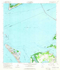
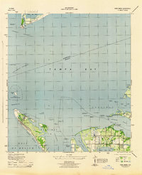 1944 Anna Maria1944 Print · USGSCoastal Manatee County is captured during the mid-forties, showing the early layout of Anna Maria and the mainland groves of Palma Sola. Trace the old shoreline landmarks from the Municipal Pier to the ancient Portavant Mound and the isolated Passage Key.2 unique versions available
 - 1956 Map of Tampa, 1964 Print
 1956 Tampa1964 Print · USGSThe Florida Gulf Coast thrived in the mid-fifties, from the bustling docks of Tampa to the quiet shores of Sanibel. Genealogists and historians can trace old rail lines like the Atlantic Coast Line or find early layouts of Port Charlotte and Bokeelia.2 unique versions available
 - 1959 Map of Tampa
 1959 Tampa1959 Print · USGSThe Florida Gulf Coast appears in this late fifties survey during a period of steady coastal growth and established rail commerce. Researchers can trace historic neighborhoods and transit lines from Tampa to St Petersburg, or locate landmarks like Mac Dill AFB and Boca Grande.
 - 1960 Map of Tampa
 1960 Tampa1960 Print · USGSThe Florida Gulf Coast was undergoing a major transformation at the start of the sixties, with new bridges linking burgeoning cities across the bays. Researchers can trace the mid-century footprints of St Petersburg and Tampa, or locate coastal landmarks like Mac Dill AFB and the Sunshine Skyway.2 unique versions available
 - 1964 Map of Anna Maria, 1965 Print
 1964 Anna Maria1965 Print · USGSAnna Maria and the Manatee River shoreline are caught here in the mid-1960s, showing a mix of growing coastal settlements and preserved archaeological sites. Genealogists and historians can locate the Palma Sola Cem, Portavant Indian Mound, and the old Palma Sola Airport.3 unique versions available
 - 1972 Map of Tampa, 1974 Print
 1972 Tampa1974 Print · USGSThe Florida Gulf Coast appears in a period of significant growth during the early seventies, from the urban centers of the bay to the quiet southern keys. Researchers can trace the expansion of St Petersburg or locate family sites near Safety Harbor, Valrico, and Boca Ciega.
 - 1981 Map of St Petersburg, 1983 Print
 1981 St Petersburg1983 Print · USGSThe Tampa Bay region is shown here in the early eighties as the urban centers of St Petersburg and Tampa expanded along the coastline. Genealogists and historians can trace rail lines like the Seaboard Coast Line and landmarks from Mac Dill Air Force Base to the Sunshine Skyway.
 - 1988 Map of St Petersburg
 1988 St Petersburg1988 Print · USGSThe Florida Gulf Coast reached a peak of late-twentieth-century development as seen in this late-1980s look at the growing corridor from St Petersburg to Port Charlotte. Researchers can trace the expansion of coastal infrastructure, including MacDill Air Force Base, the Seaboard System RR, and regional parks like Fort De Soto Park.
 - 2012 Map of Anna Maria, 2012 Print
 2012 Anna Maria2012 Print · USGSCovers Fort De Soto, including Bradenton, Holmes Beach, and other nearby areas
 - 2015 Map of Anna Maria, 2015 Print
 2015 Anna Maria2015 Print · USGSCovers Fort De Soto, including Bradenton, Holmes Beach, and other nearby areas
 - 2018 Map of Anna Maria, 2018 Print
 2018 Anna Maria2018 Print · USGSCovers Fort De Soto, including Bradenton, Holmes Beach, and other nearby areas
 - 2021 Map of Anna Maria, 2021 Print
 2021 Anna Maria2021 Print · USGSCovers Fort De Soto, including Bradenton, Holmes Beach, and other nearby areas
 - 2024 Map of Anna Maria, 2024 Print
 2024 Anna Maria2024 Print · USGSCovers Fort De Soto, including Bradenton, Holmes Beach, and other nearby areas
 - 2025 Map of Anna Maria, 2025 Print
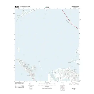
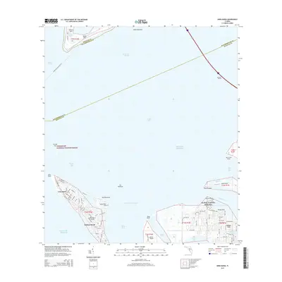
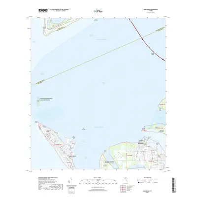
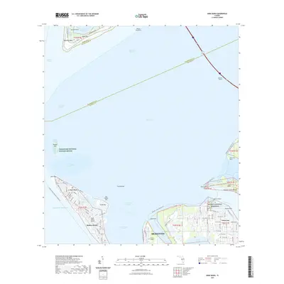
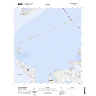
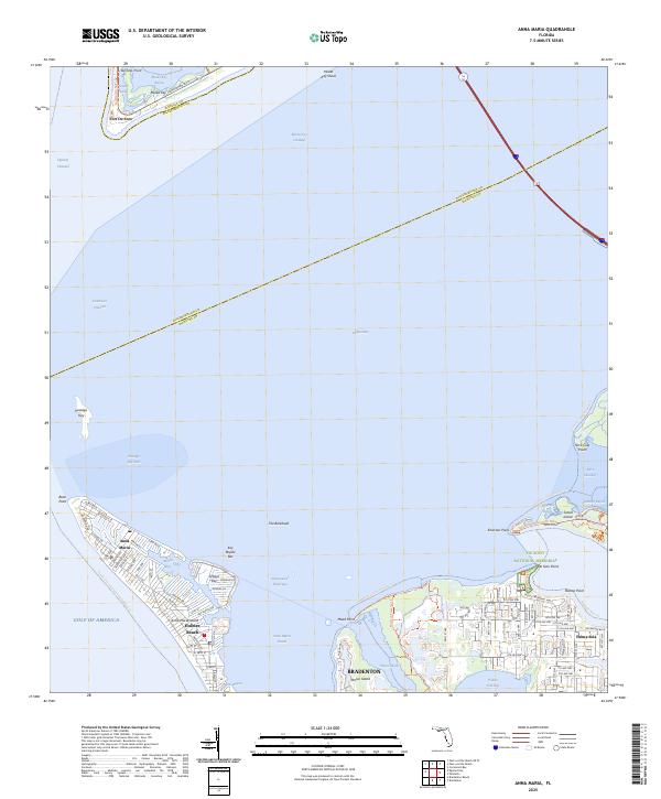 2025 Anna Maria2025 Print · USGSThe Florida Gulf Coast near the entrance to Tampa Bay comes to life on this detailed map. Local historians and genealogists can trace coastal developments around Anna Maria and Palma Sola, or locate landmarks like Fort De Soto and the De Soto National Memorial.
End of results
Showing maps 1-15 of 15
Top cities near Fort De Soto
- Tampa historical maps
- Saint Petersburg historical maps
- Bradenton historical maps
- Lealman historical maps
- Seminole historical maps
- Palmetto historical maps
See more
Frequently asked questions
- What are the different types of historical maps available for Fort De Soto?
- What is the oldest map of Fort De Soto?
- Where can I purchase historical maps of Fort De Soto for my home or office?
- Where can I download high-res historical maps of Fort De Soto?
- Are there historical topographic maps available for Fort De Soto?
- Is there historical aerial imagery available for Fort De Soto?
- Where are historical maps of Fort De Soto sourced from?