Old Maps of Gandy, Florida for Academic Research
Study the evolution of Gandy with 24 high-resolution historic maps. Whether you're teaching, researching, or modeling changes in land use, these maps provide essential visual documentation of urban, environmental, and geographic change.
- Analyze long-term change: Track patterns in development, transportation, and natural features.
- Ideal for environmental or urban studies: Support academic projects with primary historical map data.
- Use in the classroom or lab: Educators and researchers rely on these maps to bring historical context to life.
These maps are a powerful tool for teaching, research, and visualizing how Gandy has changed over the decades.
Gandy, FL maps
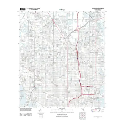
(24)- 1921 Map of St Petersburg
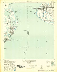
 1921 St Petersburg1921 Print · USGSThe Pinellas Peninsula just after the First World War shows a world of mangrove swamps, tidal bayous, and emerging settlements. Genealogists and local historians can trace early neighborhood footprints and coastal landmarks from Pinellas Park and Lealman to the growing streets of St. Petersburg.2 unique versions available
 - 1943 Map of St Petersburg
 1943 St Petersburg1943 Print · USGSThe Pinellas peninsula thrived during the mid-forties as a center for aviation and maritime training. Researchers can trace early urban development and transit lines like Tyrone Blvd, or locate local landmarks including Albert Whitted Airport and Royal Palm Cem.
 - 1943 Map of Port Tampa
 1943 Port Tampa1943 Print · USGSThe Tampa Bay shoreline during World War II reveals a mix of wartime military expansion and early suburban development. Genealogists and historians can trace the foundations of Snell Isle, the industrial works at Port Tampa, and the early layout of MacDill Field.
 - 1947 Map of Port Tampa
 1947 Port Tampa1947 Print · USGSThe Florida coast just after the war shows the expansion of military and maritime infrastructure along Old Tampa Bay. Genealogists and historians can trace the early layouts of Shore Acres and Snell Isle or locate landmarks like the Port Tampa Dock.3 unique versions available
 - 1947 Map of St Petersburg
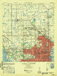 1947 St Petersburg1947 Print · USGSThe Pinellas peninsula emerged into a new era of growth following the war, as urban limits expanded toward Pinellas Park and Gulfport. Local historians can trace early neighborhood schools like Euclid School and landmark institutions such as Albert Whitted Airport or the Dog Track.
 - 1956 Map of St. Petersburg, 1957 Print
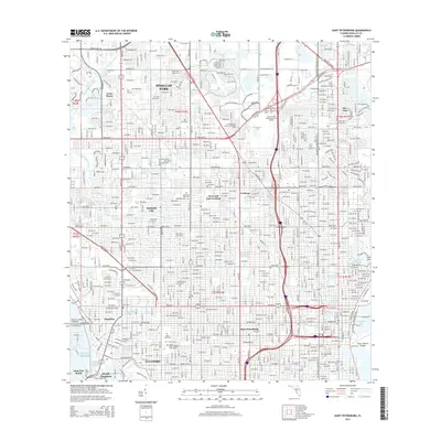
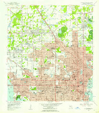 1956 St. Petersburg1957 Print · USGSMid-century St. Petersburg shows a bustling coastal city during its post-war growth phase between the Gulf and the bay. Researchers can trace historic schools and aviation landmarks like Farragut Academy, St Jude Sch, and Whitted Airport.5 unique versions available
 - 1956 Map of Port Tampa, 1957 Print
 1956 Port Tampa1957 Print · USGSThe Tampa Bay shoreline was a hub of military and industrial activity in the mid-fifties, with the sprawling Mac Dill Air Force Base facing the growing suburbs of St Petersburg. Researchers can trace the era's infrastructure from the Gandy Bridge to the rail-fed Port Tampa Dock.6 unique versions available
 - 1956 Map of Tampa, 1964 Print
 1956 Tampa1964 Print · USGSThe Florida Gulf Coast thrived in the mid-fifties, from the bustling docks of Tampa to the quiet shores of Sanibel. Genealogists and historians can trace old rail lines like the Atlantic Coast Line or find early layouts of Port Charlotte and Bokeelia.2 unique versions available
 - 1959 Map of Tampa
 1959 Tampa1959 Print · USGSThe Florida Gulf Coast appears in this late fifties survey during a period of steady coastal growth and established rail commerce. Researchers can trace historic neighborhoods and transit lines from Tampa to St Petersburg, or locate landmarks like Mac Dill AFB and Boca Grande.
 - 1960 Map of Tampa
 1960 Tampa1960 Print · USGSThe Florida Gulf Coast was undergoing a major transformation at the start of the sixties, with new bridges linking burgeoning cities across the bays. Researchers can trace the mid-century footprints of St Petersburg and Tampa, or locate coastal landmarks like Mac Dill AFB and the Sunshine Skyway.2 unique versions available
 - 1972 Map of Tampa, 1974 Print
 1972 Tampa1974 Print · USGSThe Florida Gulf Coast appears in a period of significant growth during the early seventies, from the urban centers of the bay to the quiet southern keys. Researchers can trace the expansion of St Petersburg or locate family sites near Safety Harbor, Valrico, and Boca Ciega.
 - 1981 Map of St Petersburg, 1983 Print
 1981 St Petersburg1983 Print · USGSThe Tampa Bay region is shown here in the early eighties as the urban centers of St Petersburg and Tampa expanded along the coastline. Genealogists and historians can trace rail lines like the Seaboard Coast Line and landmarks from Mac Dill Air Force Base to the Sunshine Skyway.
 - 1988 Map of St Petersburg
 1988 St Petersburg1988 Print · USGSThe Florida Gulf Coast reached a peak of late-twentieth-century development as seen in this late-1980s look at the growing corridor from St Petersburg to Port Charlotte. Researchers can trace the expansion of coastal infrastructure, including MacDill Air Force Base, the Seaboard System RR, and regional parks like Fort De Soto Park.
 - 1998 Map of Saint Petersburg, 2001 Print
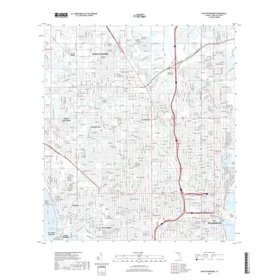
 1998 Saint Petersburg2001 Print · USGSThe Florida Suncoast's urban expansion is on full display here as the suburbs of Saint Petersburg and Pinellas Park mature. Researchers can locate specific neighborhood landmarks like Farragut Academy, Albert Whitted Airport, and the Royal Palm Cemetery.
 - 2012 Map of Saint Petersburg, 2012 Print
 2012 Saint Petersburg2012 Print · USGSCovers Gandy, including Saint Petersburg, Pinellas Park, and other nearby areas
 - 2012 Map of Port Tampa, 2012 Print
 2012 Port Tampa2012 Print · USGSCovers Gandy, including Tampa, Saint Petersburg, and other nearby areas
 - 2015 Map of Port Tampa, 2015 Print
 2015 Port Tampa2015 Print · USGSCovers Gandy, including Tampa, Saint Petersburg, and other nearby areas
 - 2015 Map of Saint Petersburg, 2015 Print
 2015 Saint Petersburg2015 Print · USGSCovers Gandy, including Saint Petersburg, Pinellas Park, and other nearby areas
 - 2018 Map of Saint Petersburg, 2018 Print
 2018 Saint Petersburg2018 Print · USGSCovers Gandy, including Saint Petersburg, Pinellas Park, and other nearby areas
 - 2018 Map of Port Tampa, 2018 Print
 2018 Port Tampa2018 Print · USGSCovers Gandy, including Tampa, Saint Petersburg, and other nearby areas
 - 2021 Map of Port Tampa, 2021 Print
 2021 Port Tampa2021 Print · USGSCovers Gandy, including Tampa, Saint Petersburg, and other nearby areas
 - 2021 Map of Saint Petersburg, 2021 Print
 2021 Saint Petersburg2021 Print · USGSCovers Gandy, including Saint Petersburg, Pinellas Park, and other nearby areas
 - 2024 Map of Saint Petersburg, 2024 Print
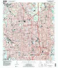
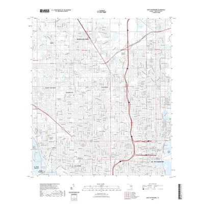
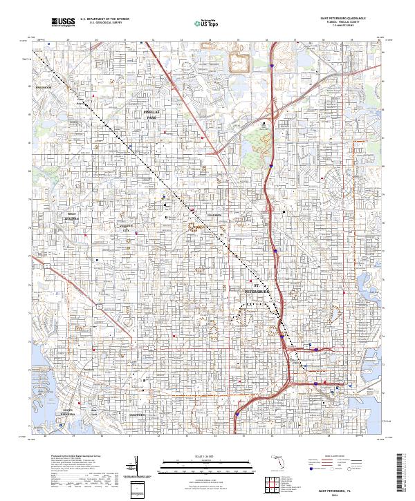 2024 Saint Petersburg2024 Print · USGSSt. Petersburg and the lower Pinellas peninsula are captured in high resolution in this recent survey. Researchers can trace modern property boundaries and landmarks like Albert Whitted Airport, Pinellas Park, and the University of South Florida Saint Petersburg.
 - 2024 Map of Port Tampa, 2024 Print
 2024 Port Tampa2024 Print · USGSThe northern reaches of the bay area come alive in this survey of the Interbay Peninsula and St. Petersburg waterfront. Researchers can trace modern coastal development from MacDill Air Force Base to the residential canals of Venetian Isles.
End of results
Showing maps 1-24 of 24
Top cities near Gandy
- Tampa historical maps
- Saint Petersburg historical maps
- Clearwater historical maps
- Largo historical maps
- Palm Harbor historical maps
- Pinellas Park historical maps
See more
Frequently asked questions
- What are the different types of historical maps available for Gandy?
- What is the oldest map of Gandy?
- Where can I purchase historical maps of Gandy for my home or office?
- Where can I download high-res historical maps of Gandy?
- Are there historical topographic maps available for Gandy?
- Is there historical aerial imagery available for Gandy?
- Where are historical maps of Gandy sourced from?