
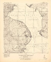
1921 Map of St Petersburg
USGS Topo · Published 1921About this map
St. Petersburg and its surrounding littoral landscape are documented here during a period of early coastal development, based on field work directed by Col. W. M. Black. The geography is defined by the intricate peninsular coastlines of Old Tampa Bay and Boca Ciega Bay, featuring a network of tidal inlets like Papy's Bayou and Smack Bayou. Early infrastructure is evident in the 24.4 Ft. Dredged Channel leading toward Port Tampa and the presence of a Brick Road near Culbreath Bayou. Inland, the map reveals scattered settlements such as Pinellas Park and Lealman, alongside more established areas like Seven Oaks and Bay View. The prevalence of named points such as Sunrise Pt. and Papy's Pt. suggests a landscape where navigation and shoreline access were central to the local economy and social structure before the mid-century population boom.
Find a feature on this map
36 named features on this map. Tap any name to fly to it.
Don’t see what you’re looking for? This feature index may not catch every label — zoom into the map to look around manually.
Map Details
Editions of this 1921 St Petersburg Map
2 editions found
Other maps of this area

1921 · Sand Key
USGS Topo · 1:62,500

1921 · Tampa
USGS Topo · 1:62,500

1921 · Fort De Soto
USGS Topo · 1:62,500

1942 · Cockroach Bay
USGS Topo · 1:31,680

1943 · St Petersburg
USGS Topo · 1:31,680

1943 · Gandy Bridge
USGS Topo · 1:31,680

1943 · Pass-A-Grille
USGS Topo · 1:31,680

1943 · Bay Pines
USGS Topo · 1:31,680

1943 · Safety Harbor
USGS Topo · 1:31,680

1943 · Dunedin
USGS Topo · 1:31,680