Old Maps of Safety Harbor, Pinellas County for Hiking & Exploration
Hike through history with 21 historic maps of Safety Harbor. Explore old trails, ghost towns, and forgotten backroads — perfect for outdoor adventurers and local explorers.
- Rediscover forgotten places: Map out old mining camps, roads, and footpaths that no longer exist on modern maps.
- Layer with modern tools: Combine with LiDAR or satellite views to plan hikes through historical terrain.
- Made for exploration: Popular among hikers, overlanders, and local history lovers.
Use these maps to find adventure and explore the hidden past of Safety Harbor.
Safety Harbor, Pinellas County maps
(21)- 1921 Map of St Petersburg
 1921 St Petersburg1921 Print · USGSCovers Safety Harbor, including Tampa, Saint Petersburg, and other nearby areas2 unique versions available
 - 1943 Map of Safety Harbor
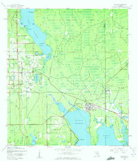
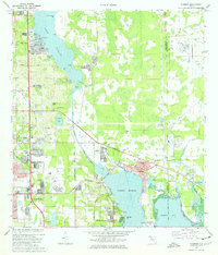
 1943 Safety Harbor1943 Print · USGSCovers Safety Harbor, including Saint Petersburg, Clearwater, and other nearby areas
 - 1943 Map of Oldsmar, 1961 Print
 1943 Oldsmar1961 Print · USGSCovers Safety Harbor, including Clearwater, East Lake, and other nearby areas2 unique versions available
 - 1944 Map of Oldsmar
 1944 Oldsmar1944 Print · USGSCovers Safety Harbor, including Clearwater, East Lake, and other nearby areas
 - 1947 Map of Safety Harbor, 1952 Print
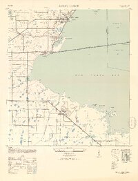 1947 Safety Harbor1952 Print · USGSCovers Safety Harbor, including Saint Petersburg, Clearwater, and other nearby areas2 unique versions available
 - 1952 Map of Safety Harbor
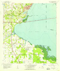
 1952 Safety Harbor1952 Print · USGSCovers Safety Harbor, including Saint Petersburg, Clearwater, and other nearby areas
 - 1955 Map of Plant City, 1966 Print
 1955 Plant City1966 Print · USGSCovers Safety Harbor, including Tampa, Lakeland, and other nearby areas6 unique versions available
 - 1956 Map of Safety Harbor, 1957 Print
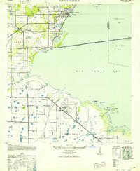
 1956 Safety Harbor1957 Print · USGSCovers Safety Harbor, including Saint Petersburg, Clearwater, and other nearby areas5 unique versions available
 - 1956 Map of Tampa, 1964 Print
 1956 Tampa1964 Print · USGSCovers Safety Harbor, including Tampa, Saint Petersburg, and other nearby areas2 unique versions available
 - 1958 Map of Plant City
 1958 Plant City1958 Print · USGSCovers Safety Harbor, including Tampa, Lakeland, and other nearby areas
 - 1959 Map of Plant City
 1959 Plant City1959 Print · USGSCovers Safety Harbor, including Tampa, Lakeland, and other nearby areas
 - 1959 Map of Tampa
 1959 Tampa1959 Print · USGSCovers Safety Harbor, including Tampa, Saint Petersburg, and other nearby areas
 - 1960 Map of Tampa
 1960 Tampa1960 Print · USGSCovers Safety Harbor, including Tampa, Saint Petersburg, and other nearby areas2 unique versions available
 - 1964 Map of Plant City
 1964 Plant City1964 Print · USGSCovers Safety Harbor, including Tampa, Lakeland, and other nearby areas
 - 1972 Map of Tampa, 1974 Print
 1972 Tampa1974 Print · USGSCovers Safety Harbor, including Tampa, Saint Petersburg, and other nearby areas
 - 1974 Map of Oldsmar, 1976 Print
 1974 Oldsmar1976 Print · USGSCovers Safety Harbor, including Clearwater, East Lake, and other nearby areas2 unique versions available
 - 1978 Map of Tarpon Springs, 1982 Print
 1978 Tarpon Springs1982 Print · USGSCovers Safety Harbor, including Tampa, Lakeland, and other nearby areas2 unique versions available
 - 1981 Map of St Petersburg, 1983 Print
 1981 St Petersburg1983 Print · USGSCovers Safety Harbor, including Tampa, Saint Petersburg, and other nearby areas
 - 1988 Map of St Petersburg
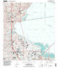
 1988 St Petersburg1988 Print · USGSCovers Safety Harbor, including Tampa, Saint Petersburg, and other nearby areas
 - 1995 Map of Oldsmar, 2000 Print
 1995 Oldsmar2000 Print · USGSCovers Safety Harbor, including Clearwater, East Lake, and other nearby areas
 - 1998 Map of Safety Harbor, 2001 Print
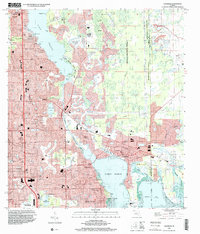
 1998 Safety Harbor2001 Print · USGSCovers Safety Harbor, including Saint Petersburg, Clearwater, and other nearby areas
End of results
Showing maps 1-21 of 21
Frequently asked questions
- What are the different types of historical maps available for Safety Harbor?
- What is the oldest map of Safety Harbor?
- Where can I purchase historical maps of Safety Harbor for my home or office?
- Where can I download high-res historical maps of Safety Harbor?
- Are there historical topographic maps available for Safety Harbor?
- Is there historical aerial imagery available for Safety Harbor?
- Where are historical maps of Safety Harbor sourced from?