Old Maps of Putnam County, Florida for Metal Detecting
Plan your next treasure hunt with 167 historic maps of Putnam County. Find old homesites, ghost towns, trails, and gathering spots that may be lost to time — perfect for identifying promising metal detecting locations.
- Locate forgotten sites: Uncover places like long-lost settlements, abandoned rail lines, or gathering spots.
- Plan better hunts: Use map overlays combined with LiDAR or satellite views to narrow in on historically rich areas.
- Made for detectorists: Thousands of hobbyists use these maps to discover relics, coins, and hidden history.
Use these historic maps to boost your research and find new opportunities beneath the surface of Putnam County.
Putnam County, FL maps
(167)- 1893 Map of Citra, 1960 Print
 1893 Citra1960 Print · USGSMarion County in the late nineteenth century was a hub of industrial mining and railroad expansion. Genealogists and historians can trace the early phosphate boom at the French Phosphate Mines or locate old rail stops in Citra, McIntosh, and Anthony.
 - 1895 Map of Citra
 1895 Citra1895 Print · USGSNorthern Marion County and southern Alachua County are shown here in the 1890s, when phosphate mining and citrus transport drove the local economy. Trace the old rail lines and explore the sites of the French Phosphate Mines, Citra, and McIntosh.6 unique versions available
 - 1912 Map of Palatka
 1912 Palatka1912 Print · USGSFlorida's St. Johns River corridor comes alive in the early twentieth century, showing a landscape defined by steamboat routes and citrus-belt railroads. Genealogists and historians can trace old community hubs like Yelvington PO, the Hardin Memorial Church, and the winding Rodman Lumber RR.
 - 1915 Map of Palatka
 1915 Palatka1915 Print · USGSFlorida's riverfront and rail corridors are captured here just after the turn of the century as Palatka thrived as a major transport junction. Researchers can trace family-named landmarks and vanished rural infrastructure like Sutherlands Still, Baptizing Lake, and Seven Pines School.6 unique versions available
 - 1915 Map of Interlachen
 1915 Interlachen1915 Print · USGSThe Florida interior around the lake-heavy Putnam and Marion county lines is shown here in the years before widespread drainage and development. Researchers can trace the early rail stops at Florahome and Mannville or locate rural landmarks like Magnolia Church and the Cedar Landing Ferry.
 - 1916 Map of Interlachen
 1916 Interlachen1916 Print · USGSFlorida's lake-filled interior at the start of the Great War is a landscape of scattered rail towns and expansive wetlands. Genealogists and local historians can trace family roots through old settlements like Interlachen, Putnam Hall, and Kenwood Heights, or locate the rural Roscola School and Conch School.6 unique versions available
 - 1938 Map of Hawthorn
 1938 Hawthorn1938 Print · USGSAlachua County in the late thirties is a landscape of intersecting railroads and sprawling lakeside settlements. Genealogists and historians can trace the foundations of Hawthorn, locate remote burial sites like Riley Cem, and explore the rail junctions at Micanopy Junction.
 - 1942 Map of Ates Creek
 1942 Ates Creek1942 Print · USGSNorthern Florida's training grounds and rural settlements come into focus during the early mobilization of the Second World War. Researchers can trace the military layout of Camp Blanding alongside the agricultural colony at Penney Farms and the springs of Gold Head Branch.
 - 1943 Map of Hawthorn, 1963 Print
 1943 Hawthorn1963 Print · USGSAlachua County during the early war years reveals a landscape defined by its great lakes and a dual-railroad economy. Researchers can trace the routes of the Seaboard Air Line, locate rural landmarks like Ochwilla Church, or find family roots at Providence Cem and Drummond Cem.
 - 1944 Map of Interlachen
 1944 Interlachen1944 Print · USGSNorth-central Florida's rail-and-water network is captured here in the 1940s, centered on the bustling junction at Interlachen. Genealogists and historians can trace riverside activity at Cedar Landing Ferry and early rural education sites like Congo Sch.
 - 1947 Map of Bostwick
 1947 Bostwick1947 Print · USGSThe Saint Johns River valley in the late 1940s reveals a landscape defined by its waterways and timber-era rail lines. Researchers can trace historic river access at Clay Landing and Picolata, or follow the Atlantic Coast Line through Bostwick.
 - 1949 Map of Rice Creek, 1953 Print
 1949 Rice Creek1953 Print · USGSIn the late 1940s, the borderlands between Clay and Putnam Counties remained a dense mosaic of wetlands and winding waterways. Researchers can trace the pristine hydrology of the region through Georges Lake and the paths of Etonia Creek and Rice Creek.3 unique versions available
 - 1949 Map of Bostwick, 1953 Print
 1949 Bostwick1953 Print · USGSNorthern Putnam County's rural landscape is captured here in the late forties, showing the region's timber and rail-based settlement pattern. Genealogists can trace family locations near Sun Garden, Hancock, and De Coy Ch, or locate the old Bostwick Airport.5 unique versions available
 - 1949 Map of Keuka, 1953 Print
 1949 Keuka1953 Print · USGSFlorida's lake country near the Marion and Putnam county line was a network of river landings and rail stops in the late 1940s. Genealogists and historians can trace community roots at Edgar Community Ch, find old crossings like Brumbridge Ferry, and locate early riverfront points at Agnews Landing.6 unique versions available
 - 1949 Map of Baywood, 1953 Print
 1949 Baywood1953 Print · USGSPutnam County in the late 1940s reveals a Florida landscape of cypress swamps and railway settlements. Researchers can trace family history at Mannville Cem or locate the early industry of Peat Cuttings near the Southern and Atlantic Coast Line railroads.3 unique versions available
 - 1949 Map of Rodman, 1953 Print
 1949 Rodman1953 Print · USGSInland Florida in the late 1940s was a land of timber mills and riverfront landings. Trace the early boundaries of the Ocala National Forest and locate historical sites like Rainbow Ranch, Rodman, and the riverside Cedar Landing.3 unique versions available
 - 1949 Map of Gold Head Branch, 1953 Print
 1949 Gold Head Branch1953 Print · USGSThe solution-lake country of North Florida is captured here just after the war, showing the intersection of rural life and state-protected wilderness. Researchers can trace the boundaries of Gold Head Branch State Park or locate the Cadero Ch and the Mobile Target Range.3 unique versions available
 - 1949 Map of Putnam Hall, 1953 Print
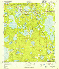 1949 Putnam Hall1953 Print · USGSThe lake-strewn interior of Putnam and Clay counties is captured here in the late 1940s, highlighting a landscape of rail-connected settlements. Genealogists and researchers can trace old trackside communities like Florahome, Putnam Hall, and Grandin along the Southern railroad line.3 unique versions available
 - 1949 Map of Riverdale, 1953 Print
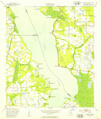 1949 Riverdale1953 Print · USGSThe St. Johns River corridor comes alive in the late 1940s, showing the intersection of three counties and the riverfront communities that thrived there. Genealogists and historians can trace old landings and rail stops like West Tocoi, Federal Point, and the station at Riverdale.4 unique versions available
 - 1949 Map of Ates Creek, 1955 Print
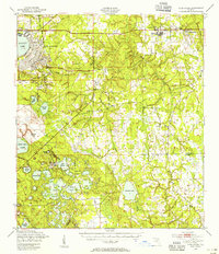 1949 Ates Creek1955 Print · USGSClay County during the post-war era shows a landscape transitioning between military readiness and civilian growth. Researchers can locate the sprawling Camp Blanding facilities, the planned community of Penney Farms, and historic sites like Beulah Cem.2 unique versions available
 - 1949 Map of Interlachen, 1955 Print
 1949 Interlachen1955 Print · USGSPutnam County's lake-rich interior is captured here just after the war, showing the distinct citrus and rail-centered settlements of the era. Genealogists can locate family landmarks like Mt Bethel Ch, Johnson Park Sch, and the unique Peat Cuttings near Florahome.3 unique versions available
 - 1949 Map of Bostwick, 1955 Print
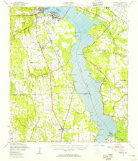 1949 Bostwick1955 Print · USGSThe St. Johns River corridor comes to life in the late 1940s, showing a landscape of military installations and quiet river landings. Researchers can trace family roots at Shiloh Ch or Bostwick, and locate vanished river hubs like Picolata and Tocoi.
 - 1954 Map of Gainesville, 1965 Print
 1954 Gainesville1965 Print · USGSMid-century North Central Florida comes into focus as a landscape of timber, rails, and river towns along the Gulf. Trace family roots in established centers like Gainesville or follow the path of the Suwannee River to the coastal docks of Cedar Key.3 unique versions available
 - 1954 Map of Daytona Beach, 1974 Print
 1954 Daytona Beach1974 Print · USGSNortheast Florida is captured in the mid-1950s, showing the transition from river-based commerce to coastal tourism. Researchers can trace the Florida East Coast rail lines and find historic sites like Castillo de San Marcos Nat Mon and Palatka.
 - 1958 Map of Daytona Beach
 1958 Daytona Beach1958 Print · USGSThe Florida coast and St. Johns River valley are captured in the late 1950s, showing a landscape defined by citrus-belt rail towns and Atlantic shorelines. Genealogists can trace family roots through riverside settlements like Palatka and Welaka or coastal hubs like Daytona Beach.2 unique versions available
Showing maps 1-25 of 167
Top cities of Putnam County
- Palatka historical maps
- Crescent City historical maps
- Interlachen historical maps
- Pomona Park historical maps
- Welaka historical maps
Frequently asked questions
- What are the different types of historical maps available for Putnam County?
- What is the oldest map of Putnam County?
- Where can I purchase historical maps of Putnam County for my home or office?
- Where can I download high-res historical maps of Putnam County?
- Are there historical topographic maps available for Putnam County?
- Is there historical aerial imagery available for Putnam County?
- Where are historical maps of Putnam County sourced from?