1940s Maps of Palm Valley, Saint Johns County
Explore 3 historic maps of Palm Valley from the 1940s. These maps offer a rare glimpse into what life looked like during the 1940s — showing old roads, neighborhoods, homes, and landmarks that have changed or disappeared over time.
Whether you're researching your family's past, planning a metal detecting trip, or studying how Palm Valley's landscape evolved across the 1940s, these high-resolution maps are a powerful tool for exploring the history of this region.
- Focus on a specific era: All maps on this page are from the 1940s, giving you a focused view of this time period.
- See what’s changed: Compare century-old streets, trails, and buildings to today's modern landscape using overlays and satellite layers.
- Research with precision: Use these maps for genealogy, historical research, land use analysis, or educational projects.
- View, download, or print: Maps are fully viewable online in high resolution, and can be downloaded or printed for your own records.
Start exploring Palm Valley's history through authentic maps from the 1940s. This is your window into the past.
Palm Valley, Saint Johns County maps
(3)- 1948 Map of Jacksonville
 1948 Jacksonville1948 Print · USGSNortheast Florida and Southeast Georgia's coastal waterways and railroad towns are captured here in the years following the war. Genealogists can trace family connections through river towns like St Marys or identify long-standing military landmarks like Jacksonville NAS.
 - 1948 Map of Jacksonville Beach, 1958 Print
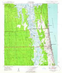 1948 Jacksonville Beach1958 Print · USGSJacksonville’s coastal suburbs and the marshy barrier islands are shown in detail during the late 1940s. Genealogists and researchers can trace early family sites at Tillotson Cemetery or follow the development of Beach Boulevard.3 unique versions available
 - 1949 Map of Jacksonville Beach
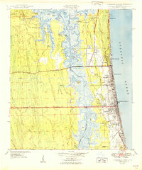 1949 Jacksonville Beach1949 Print · USGSCoastal Florida is in a period of rapid post-war expansion as residential neighborhoods push eastward toward the Atlantic. Genealogists and local researchers can locate early landmarks like Donner, Tillotson Cem, and Fletcher High Sch amidst a changing landscape of new roads.2 unique versions available
End of results
Showing maps 1-3 of 3
Frequently asked questions
- What are the different types of historical maps available for Palm Valley?
- What is the oldest map of Palm Valley?
- Where can I purchase historical maps of Palm Valley for my home or office?
- Where can I download high-res historical maps of Palm Valley?
- Are there historical topographic maps available for Palm Valley?
- Is there historical aerial imagery available for Palm Valley?
- Where are historical maps of Palm Valley sourced from?