Old Maps of Sarasota County, Florida for Academic Research
Study the evolution of Sarasota County with 147 high-resolution historic maps. Whether you're teaching, researching, or modeling changes in land use, these maps provide essential visual documentation of urban, environmental, and geographic change.
- Analyze long-term change: Track patterns in development, transportation, and natural features.
- Ideal for environmental or urban studies: Support academic projects with primary historical map data.
- Use in the classroom or lab: Educators and researchers rely on these maps to bring historical context to life.
These maps are a powerful tool for teaching, research, and visualizing how Sarasota County has changed over the decades.
Sarasota County, FL maps
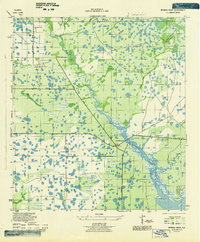
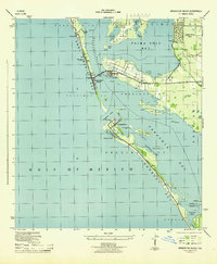
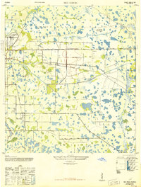
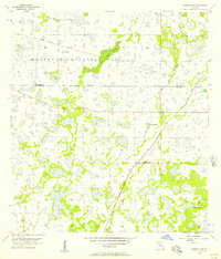
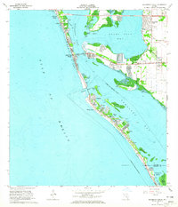
(147)- 1943 Map of Laurel, 1961 Print
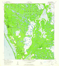 1943 Laurel1961 Print · USGSSarasota County's coastal landscape appears in the early 1940s as a network of rail-side settlements and tidal bays. Genealogists can trace family footprints near Laurel Sch or along the Seaboard Air Line and Casey Key.
 - 1944 Map of Bird Keys
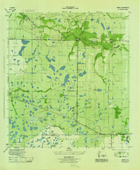
 1944 Bird Keys1944 Print · USGSCoastal Sarasota County is captured here in the mid-1940s, showing the early layout of the barrier islands and mainland before modern shoreline changes. Trace family property and early settlements like White Beach, Vamo, and the shoreline at Midnight Pass.2 unique versions available
 - 1944 Map of Sarasota
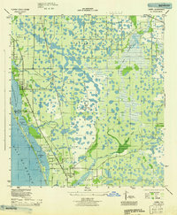
 1944 Sarasota1944 Print · USGSSarasota and its neighboring keys are shown here during the mid-1940s, a period of significant coastal development and wartime infrastructure. Researchers can trace the layout of early neighborhoods like Beverly Terrace or locate local landmarks such as the Booker Schools and the Primitive Church.2 unique versions available
 - 1944 Map of Lower Myakka Lake
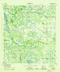
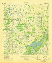
 1944 Lower Myakka Lake1944 Print · USGSSarasota County's interior is captured here in the mid-1940s, highlighting the wild wetlands and early state parkland. Genealogists and historians can locate vanished outposts like Shiney Town and Harris Camp or trace the early path of the Atlantic Coast Line.2 unique versions available
 - 1944 Map of Myakka River
 1944 Myakka River1944 Print · USGSSarasota County during the mid-forties is depicted as a landscape of river marshes and military training grounds. Genealogists and historians can trace old roads like Jackson Road and locate the wartime Bombing Area or Evans Fishing Camp.2 unique versions available
 - 1944 Map of Verna
 1944 Verna1944 Print · USGSThe Florida interior along the Manatee and Sarasota county line is captured here in the mid-1940s. Genealogists and researchers can trace the early layout of Verna and Waterbury, or locate local landmarks like Bethany Church and the long Old RR Grade.2 unique versions available
 - 1944 Map of Laurel
 1944 Laurel1944 Print · USGSCoastal Sarasota County is seen here during the mid-forties, balancing its identity as a fishing and transport hub with wartime military needs. Genealogists and local historians can trace the foundations of Laurel through the Laurel Sch and Laurel Chapel, or locate the expansive U S Army Bombing Area.
 - 1944 Map of Lorraine
 1944 Lorraine1944 Print · USGSManatee County was a patchwork of wetlands and early settlements during the mid-forties, revealing the landscape before modern suburban expansion. You can trace the historic Old RR Grade, locate the Braden River Cem, and follow the original paths of Rye Grade and Arcadia Road.2 unique versions available
 - 1944 Map of Bradenton Beach
 1944 Bradenton Beach1944 Print · USGSThe Florida Gulf Coast appears here during the mid-forties, showing the early settlement of the barrier islands and wartime infrastructure. Genealogists and coastal historians can trace the footprints of Bradenton Beach, Longbeach, and the Army Firing Range.2 unique versions available
 - 1944 Map of Venice
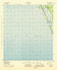
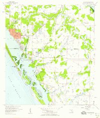
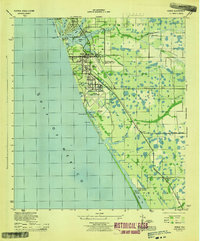 1944 Venice1944 Print · USGSCoastal Sarasota County is captured here during the height of the Second World War as military operations expanded along the Gulf. Researchers can trace the layout of the Venice Army Air Base and locate local landmarks like St Marks Church and the Kentucky Military Institute.3 unique versions available
 - 1944 Map of Miakka
 1944 Miakka1944 Print · USGSSarasota and Manatee counties were characterized by vast wetlands and isolated ranching outposts during the mid-1940s. Genealogists and local historians can trace family-named landmarks like Hi Hat Ranch, the village of Miakka, and the original Atlantic Coast Line rail corridor.3 unique versions available
 - 1947 Map of Bradenton
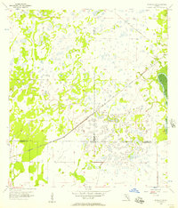
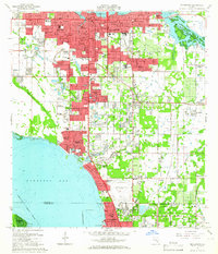
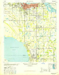 1947 Bradenton1947 Print · USGSCoastal Florida is shown in transition during the late 1940s, from the city streets of Bradenton to the large military installation at the Sarasota US Army Air Base. Researchers can trace the early layout of Whitfield Estates, locate the Manasota Cem, or find the original Prospect School site.
 - 1947 Map of Bee Ridge
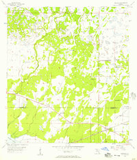
 1947 Bee Ridge1947 Print · USGSSarasota's inland prairie and citrus lands are captured here just after the war, showing a region balanced between agriculture and emerging industry. Genealogists and historians can locate the Ringling Bros Circus Winter Quarters, the Bee Ridge Sch, and the Friendship Ch.2 unique versions available
 - 1956 Map of Murdock, 1957 Print
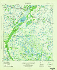
 1956 Murdock1957 Print · USGSThe Florida Gulf Coast backcountry in the mid-fifties was a landscape of expansive sloughs and pioneer rail stops. You can trace the early footprint of Murdock along the Seaboard Air Line and locate historic water sources like Little Salt Spring.3 unique versions available
 - 1956 Map of Murdock SE, 1957 Print
 1956 Murdock SE1957 Print · USGSFlorida's coastal interior in the mid-1950s shows a landscape of expansive wetlands at the meeting point of three counties. Genealogists and historians can trace the Seaboard Air Line Railroad Grade and locate the small settlement of Platt near the Peace River.3 unique versions available
 - 1956 Map of Murdock NE, 1957 Print
 1956 Murdock NE1957 Print · USGSThe Florida interior near the meeting of DeSoto, Sarasota, and Manatee counties is shown here in the mid-1950s. Genealogists and historians can trace the Old Railroad Grade and find local landmarks like Pine Level Ch and Bud Slough.4 unique versions available
 - 1956 Map of Murdock NW, 1957 Print
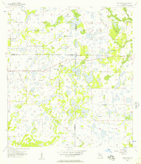
 1956 Murdock NW1957 Print · USGSThe Sarasota and Manatee county line area in the mid-fifties is characterized by extensive wetlands and early water engineering. Genealogists and historians can trace the Old Railroad Grade and the engineered path of the Big Slough Canal through the Myakka River State Park.3 unique versions available
 - 1956 Map of Englewood, 1958 Print
 1956 Englewood1958 Print · USGSThe Gulf Coast between Sarasota and Charlotte counties is captured here in the mid-fifties during its transition from ranching to coastal residential life. Genealogists and local historians can trace early development in Englewood and Grove City, or find landmarks like the Englewood Sch and Placida Ch.4 unique versions available
 - 1956 Map of Tampa, 1964 Print
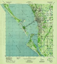
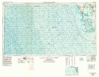
 1956 Tampa1964 Print · USGSThe Florida Gulf Coast thrived in the mid-fifties, from the bustling docks of Tampa to the quiet shores of Sanibel. Genealogists and historians can trace old rail lines like the Atlantic Coast Line or find early layouts of Port Charlotte and Bokeelia.2 unique versions available
 - 1956 Map of Charlotte Harbor, 1982 Print
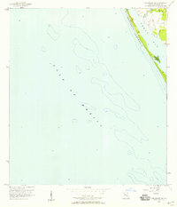
 1956 Charlotte Harbor1982 Print · USGSCoastal Florida in the mid-fifties reveals the early growth of bayside communities and the preservation of vast wetland refuges. Genealogists and historians can trace rail lines like the Seaboard Air Line and find historic waterfront locales from Boca Grande to Punta Gorda.
 - 1957 Map of Englewood NW
 1957 Englewood NW1957 Print · USGSCoastal Sarasota County is captured during the mid-fifties, when the barrier islands remained largely undeveloped. Researchers can trace the original shoreline of Lemon Bay, the winding path of Forked Creek, and the isolated County Landing Field.3 unique versions available
 - 1959 Map of Tampa
 1959 Tampa1959 Print · USGSThe Florida Gulf Coast appears in this late fifties survey during a period of steady coastal growth and established rail commerce. Researchers can trace historic neighborhoods and transit lines from Tampa to St Petersburg, or locate landmarks like Mac Dill AFB and Boca Grande.
 - 1960 Map of Tampa
 1960 Tampa1960 Print · USGSThe Florida Gulf Coast was undergoing a major transformation at the start of the sixties, with new bridges linking burgeoning cities across the bays. Researchers can trace the mid-century footprints of St Petersburg and Tampa, or locate coastal landmarks like Mac Dill AFB and the Sunshine Skyway.2 unique versions available
 - 1964 Map of Bradenton Beach, 1965 Print
 1964 Bradenton Beach1965 Print · USGSThe Florida Gulf Coast appears in the mid-sixties as a landscape of evolving barrier island communities and intricate waterways. Trace the development of Bradenton Beach and Longbeach, or locate landmarks like St Bernards Ch and the Cortez Bridge.5 unique versions available
 - 1964 Map of Bradenton, 1966 Print
 1964 Bradenton1966 Print · USGSBradenton and the Sarasota Bay shoreline are shown here during a mid-century period of rapid coastal growth. Genealogists and local historians can locate early landmarks like Braden Castle, Manatee Jr College, and Oneco.4 unique versions available
Showing maps 1-25 of 147
Top cities of Sarasota County
- North Port historical maps
- Sarasota historical maps
- Venice historical maps
- Englewood historical maps
- South Venice historical maps
- Laurel historical maps
See more
Frequently asked questions
- What are the different types of historical maps available for Sarasota County?
- What is the oldest map of Sarasota County?
- Where can I purchase historical maps of Sarasota County for my home or office?
- Where can I download high-res historical maps of Sarasota County?
- Are there historical topographic maps available for Sarasota County?
- Is there historical aerial imagery available for Sarasota County?
- Where are historical maps of Sarasota County sourced from?