1950s Maps of Pembroke, Georgia
Explore 6 historic maps of Pembroke from the 1950s. These maps offer a rare glimpse into what life looked like during the 1950s — showing old roads, neighborhoods, homes, and landmarks that have changed or disappeared over time.
Whether you're researching your family's past, planning a metal detecting trip, or studying how Pembroke's landscape evolved across the 1950s, these high-resolution maps are a powerful tool for exploring the history of this region.
- Focus on a specific era: All maps on this page are from the 1950s, giving you a focused view of this time period.
- See what’s changed: Compare century-old streets, trails, and buildings to today's modern landscape using overlays and satellite layers.
- Research with precision: Use these maps for genealogy, historical research, land use analysis, or educational projects.
- View, download, or print: Maps are fully viewable online in high resolution, and can be downloaded or printed for your own records.
Start exploring Pembroke's history through authentic maps from the 1950s. This is your window into the past.
Pembroke, GA maps
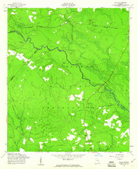
(6)- 1950 Map of Pembroke
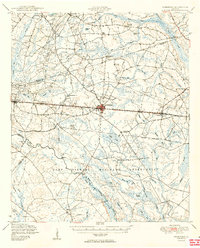 1950 Pembroke1950 Print · USGSIn mid-century Bryan County, the landscape around Pembroke was a mix of vital rail lines and expanding military boundaries. Genealogists and local historians can trace family locations near Beautiful Zion Cem, Ash Branch Church, and the rural Esla Sch.2 unique versions available
 - 1957 Map of Savannah, 1967 Print
 1957 Savannah1967 Print · USGSThe Lowcountry and Georgia coastal plain are shown here in the late fifties, prior to modern expansion. Researchers can trace the rail-and-river economy through the Central of Georgia lines and the Ogeechee River wetlands.4 unique versions available
 - 1958 Map of Groveland, 1961 Print
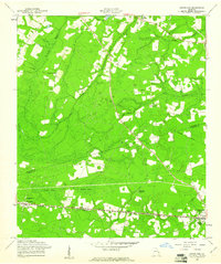 1958 Groveland1961 Print · USGSThe rural borderlands of Bulloch and Bryan Counties are captured here in the late fifties, during the heyday of the Seaboard Air Line railway. Genealogists can trace family roots through several local landmarks like Jerusalem Ch, Reka, and the Beautiful Zion Cem.
 - 1958 Map of Lanier, 1961 Print
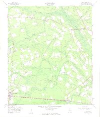 1958 Lanier1961 Print · USGSThe Bryan County countryside comes into focus in the late fifties as the Seaboard Air Line rail traffic moved through Pembroke and Lanier. Trace rural landmarks like the Ash Branch Ch and Stevens Grove Cem among the winding wetlands of Mill Creek Bay.3 unique versions available
 - 1958 Map of Letford, 1961 Print
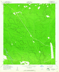 1958 Letford1961 Print · USGSBryan County was undergoing significant transformation in the late fifties as military expansion integrated local lands. Researchers can trace the remnants of earlier communities through Letford (Site), the Old Railroad Grade, and rural landmarks like Beulah Ch.3 unique versions available
 - 1958 Map of Willie, 1961 Print
 1958 Willie1961 Print · USGSLiberty County was undergoing a major transformation in the late fifties as military expansion reshaped the rural landscape. Genealogists and historians can locate the former Willie settlement and trace ancestral roots at Jerusalem Cem or Salem Cem.3 unique versions available
End of results
Showing maps 1-6 of 6
Top cities near Pembroke
Frequently asked questions
- What are the different types of historical maps available for Pembroke?
- What is the oldest map of Pembroke?
- Where can I purchase historical maps of Pembroke for my home or office?
- Where can I download high-res historical maps of Pembroke?
- Are there historical topographic maps available for Pembroke?
- Is there historical aerial imagery available for Pembroke?
- Where are historical maps of Pembroke sourced from?