Old Maps of Savannah, Georgia for Metal Detecting
Plan your next treasure hunt with 78 historic maps of Savannah. Find old homesites, ghost towns, trails, and gathering spots that may be lost to time — perfect for identifying promising metal detecting locations.
- Locate forgotten sites: Uncover places like long-lost settlements, abandoned rail lines, or gathering spots.
- Plan better hunts: Use map overlays combined with LiDAR or satellite views to narrow in on historically rich areas.
- Made for detectorists: Thousands of hobbyists use these maps to discover relics, coins, and hidden history.
Use these historic maps to boost your research and find new opportunities beneath the surface of Savannah.
Savannah, GA maps
(78)- 1920 Map of Meldrim
 1920 Meldrim1920 Print · USGSCoastal Georgia during the early post-war period is defined here by the winding Ogeechee River and a busy intersection of rail lines. Genealogists and researchers can trace family roots near Clyde or locate rural landmarks like Zion Church and Miller Chapel.
 - 1920 Map of Limerick, 1928 Print
 1920 Limerick1928 Print · USGSThe Georgia coast at the end of the Great War reveals a landscape shaped by tidal rivers and burgeoning timber railroads. Genealogists and local historians can trace family roots through the settlements of Limerick, Sunbury, and Riceboro, or locate the historic Midway Ch. and the coastal defenses of Fort Morris.
 - 1942 Map of Meldrim
 1942 Meldrim1942 Print · USGSThe Ogeechee River corridor and its railway junctions are captured here in a series of surveys finalized just before the mid-century. Researchers can trace the layout of early settlements like Meldrim and Ellabel or locate ancestral sites at Miller Chapel and Zion Church.
 - 1942 Map of Savannah
 1942 Savannah1942 Print · USGSCoastal Georgia and the South Carolina borderlands come alive in this wartime survey of the Savannah riverfront. Genealogists and historians can trace industrial housing at Port Wentworth Colored Village, river landmarks like Fort Jackson, and the footprint of the Ogeechee Canal.
 - 1944 Map of Limerick, 1945 Print
 1944 Limerick1945 Print · USGSCoastal Georgia during the mid-forties reveals a landscape transitioning between established agricultural settlements and expanding military grounds. Genealogists and researchers can trace local families through many Art Well locations and historic community centers like Midway Ch, Limerick, and Riceboro.
 - 1944 Map of Ossabaw Island, 1963 Print
 1944 Ossabaw Island1963 Print · USGSCoastal Georgia's barrier islands and river networks come to life in this mid-century survey of the Ogeechee and Skidaway basins. Researchers can locate historical sites like Fort McAllister, the Kilkenny Club, and the vanished Cheves Mill Chimney among the tidal marshes.
 - 1945 Map of Ossabaw Island
 1945 Ossabaw Island1945 Print · USGSThe Georgia coast at the end of the war is a complex world of tidal rivers and historic fortifications. Genealogists and local historians can trace family-named sites and landmarks like Cheves Mill Chimney, Adams Chimney, and the Kilkenny Club among the winding creeks.
 - 1946 Map of Brunswick, 1948 Print
 1946 Brunswick1948 Print · USGSCoastal Georgia in the mid-forties reveals a landscape defined by the Camp Stewart Military Reservation and the sprawling barrier islands. Genealogists and historians can trace the rail-and-river network through inland towns like Ludowici and Jesup, or locate coastal landmarks like the St Simon Light.
 - 1947 Map of Savannah
 1947 Savannah1947 Print · USGSCoastal Georgia and South Carolina are captured here in the mid-forties, showing the rail-and-river networks of the Lowcountry. Genealogists and researchers can trace old crossroads and river towns from Statesboro to Beaufort, alongside military sites like Camp Stewart and Parris Island.
 - 1948 Map of Brunswick
 1948 Brunswick1948 Print · USGSCoastal Georgia in the late 1940s is defined here by its labyrinthine barrier islands and the massive footprint of Camp Stewart. Genealogists and historians can trace the rail-tied growth of Jesup and Hinesville or locate coastal landmarks like St Simon Light.
 - 1948 Map of Savannah
 1948 Savannah1948 Print · USGSThe Georgia and South Carolina Lowcountry comes alive in this post-war survey of the coast and its river-fed hinterlands. Genealogists and historians can trace rail lines like the Central of Georgia RR and find established settlements such as Isle of Hope and Sylvania.
 - 1948 Map of Limerick, 1964 Print
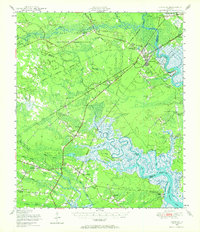 1948 Limerick1964 Print · USGSCoastal Georgia's river-fed landscapes are captured here just after the war, showing the deep-rooted settlements of Liberty and Bryan counties. Genealogists can locate family sites among numerous landmarks like Dorchester Academy, Fort Morris, and the Old Dorchester Cem.
 - 1950 Map of Meldrim
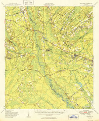 1950 Meldrim1950 Print · USGSCoastal Georgia in the late forties is defined by the rail lines and river swamps that connect inland towns like Meldrim and Blitchton. Genealogists can trace family landmarks and rural life at the Scaffletown School, Bethesda Ch, and Blitch Cem.2 unique versions available
 - 1950 Map of Limerick
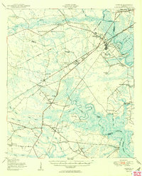 1950 Limerick1950 Print · USGSThe Georgia lowcountry at the mid-century mark shows a transition from coastal plantations to military and industrial expansion. Genealogists and historians can trace family roots through numerous sites like Dorchester Academy, Sunbury, and Scratchy Hall Cem.2 unique versions available
 - 1955 Map of Garden City, 1957 Print
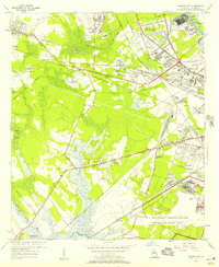 1955 Garden City1957 Print · USGSGarden City and the western outskirts of Savannah are shown here during a period of rapid aviation and rail expansion in the mid-fifties. Genealogists and historians can locate family landmarks like Silk Hope, the Lincoln Memorial Cem, and early recreational sites such as the Oglethorpe Speedway.2 unique versions available
 - 1955 Map of Port Wentworth, 1957 Print
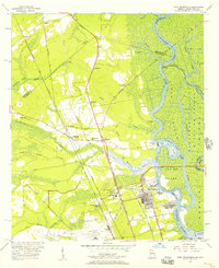 1955 Port Wentworth1957 Print · USGSCoastal Georgia at the mid-century reveals a complex landscape of river commerce and expanding rail networks north of Savannah. Genealogists and historians can trace family-named sites like Meinhard, Cherokee Hill Cem, and the old Goshen Ch as they appeared before modern development.2 unique versions available
 - 1955 Map of Savannah, 1957 Print
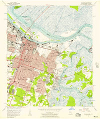 1955 Savannah1957 Print · USGSMid-century Savannah is shown in detail as it expands from its riverfront core into residential neighborhoods and across tidal marshes. Genealogists and historians can trace family locations through established areas like Ardsley Park, numerous local schools, and prominent sites like Bonaventure Cemetery or the Hunter Air Force Base.3 unique versions available
 - 1956 Map of Brunswick, 1968 Print
 1956 Brunswick1968 Print · USGSThe Georgia coast in the mid-twentieth century is a wild expanse of barrier islands and massive river deltas. You can trace the development of the maritime economy and military presence at Brunswick, or locate historic sites like Fort Frederica National Monument and Harris Neck National Wildlife Refuge.2 unique versions available
 - 1957 Map of Burroughs, 1959 Print
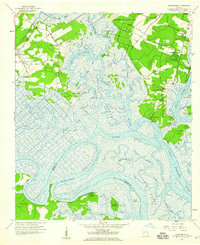 1957 Burroughs1959 Print · USGSCoastal Chatham County in the late fifties shows a landscape of tidal marshes and rising suburbs south of Savannah. Researchers can locate Fort McAllister and old riverfront settlements like Vernonburg, Coffee Bluff, and the rail stop at Burroughs.3 unique versions available
 - 1957 Map of Isle of Hope, 1959 Print
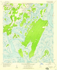 1957 Isle of Hope1959 Print · USGSCoastal Georgia's intricate island and marsh network is captured here in the late fifties, showcasing the communities south of Savannah. Researchers can locate family landmarks like Wormsloe, the Water Orphanage at Bethesda, and historic settlements such as Pin Point and Sandfly.2 unique versions available
 - 1957 Map of Savannah, 1967 Print
 1957 Savannah1967 Print · USGSThe Lowcountry and Georgia coastal plain are shown here in the late fifties, prior to modern expansion. Researchers can trace the rail-and-river economy through the Central of Georgia lines and the Ogeechee River wetlands.4 unique versions available
 - 1958 Map of Meldrim SE, 1961 Print
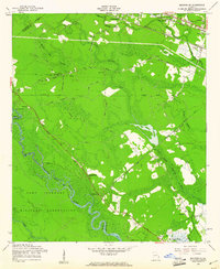 1958 Meldrim SE1961 Print · USGSThe Ogeechee River corridor is shown in the late fifties as rail lines like the Central of Georgia connect local towns. Researchers can trace family sites like Hopeton Plantation, Ennis Cem, and Spring Hill Ch.4 unique versions available
 - 1958 Map of Meldrim, 1961 Print
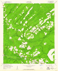 1958 Meldrim1961 Print · USGSThe Effingham and Chatham county line in the late fifties was a land of timber and tracks centered on the railroad junction at Meldrim. Researchers can trace old rural communities through sites like Marlow Sch, Union Ch, and the crossing of the Central of Georgia railroad.4 unique versions available
 - 1958 Map of Richmond Hill, 1961 Print
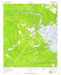 1958 Richmond Hill1961 Print · USGSCoastal Georgia in the late fifties is defined here by the winding Ogeechee and the rise of the town of Richmond Hill. Researchers can trace family history through numerous rural cemeteries and church sites, including Strathy Hall Cem, Bryan Neck Ch, and Rabbit Hill.3 unique versions available
 - 1960 Map of Savannah
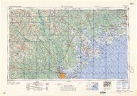 1960 Savannah1960 Print · USGSCoastal Georgia and the South Carolina Lowcountry are captured in the late fifties, showcasing the intricate web of islands and tidal rivers before modern expansion. Researchers can trace the rail lines of the Atlantic Coast Line or locate sites like Parris Island, Beaufort, and the Tybee Lighthouse.
Showing maps 1-25 of 78
Top cities near Savannah
- Pooler historical maps
- Richmond Hill historical maps
- Georgetown historical maps
- Garden City historical maps
- Port Wentworth historical maps
- Skidaway Island historical maps
See more
Top neighborhoods of Savannah
- Clearview historical maps
- DeRenne Terrace historical maps
- Staley Heights historical maps
- Brookview historical maps
- Kensington Park historical maps
- Tremont Park historical maps
See more
Frequently asked questions
- What are the different types of historical maps available for Savannah?
- What is the oldest map of Savannah?
- Where can I purchase historical maps of Savannah for my home or office?
- Where can I download high-res historical maps of Savannah?
- Are there historical topographic maps available for Savannah?
- Is there historical aerial imagery available for Savannah?
- Where are historical maps of Savannah sourced from?