1950s Maps of Cherokee County, Georgia
Explore 8 historic maps of Cherokee County from the 1950s. These maps offer a rare glimpse into what life looked like during the 1950s — showing old roads, neighborhoods, homes, and landmarks that have changed or disappeared over time.
Whether you're researching your family's past, planning a metal detecting trip, or studying how Cherokee County's landscape evolved across the 1950s, these high-resolution maps are a powerful tool for exploring the history of this region.
- Focus on a specific era: All maps on this page are from the 1950s, giving you a focused view of this time period.
- See what’s changed: Compare century-old streets, trails, and buildings to today's modern landscape using overlays and satellite layers.
- Research with precision: Use these maps for genealogy, historical research, land use analysis, or educational projects.
- View, download, or print: Maps are fully viewable online in high resolution, and can be downloaded or printed for your own records.
Start exploring Cherokee County's history through authentic maps from the 1950s. This is your window into the past.
Cherokee County, GA maps
(8)- 1950 Map of Waleska
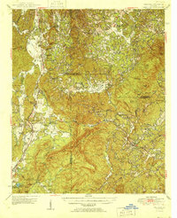 1950 Waleska1950 Print · USGSMid-century Northwest Georgia reveals a network of mountain ridges and creek-bottom farms connected by the Louisville and Nashville rail line. Genealogists can trace early landmarks like the County Home, Richardson Cemetery, and rural schools like Oak Hill School.2 unique versions available
 - 1955 Map of Rome
 1955 Rome1955 Print · USGSThe tri-state borderlands of Georgia, Alabama, and Tennessee appear in the mid-fifties as a landscape of ridge-and-valley industry and river navigation. Genealogists can trace family footprints near Chattanooga, the iron works of Gadsden, and textile towns like Trion or Summerville.
 - 1956 Map of Kennesaw, 1957 Print
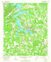
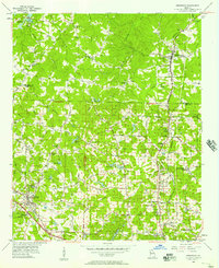 1956 Kennesaw1957 Print · USGSCobb and Cherokee counties are captured in the mid-1950s during a period of steady growth along the Louisville and Nashville rail line. Researchers can trace old property boundaries across the 20th District and locate local landmarks like Wooten Lake, Bascomb, and Chastains Lakes.5 unique versions available
 - 1956 Map of Mountain Park, 1957 Print
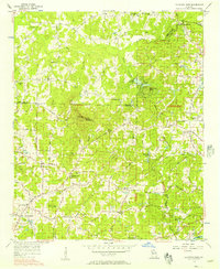 1956 Mountain Park1957 Print · USGSNorth Georgia in the mid-fifties remains a world of country churches and winding rural roads across the Cobb and Cherokee county lines. Trace family history through landmarks like Wesley Chapel, the Mountain View Sch, and the old crossing at Arnold Mill.6 unique versions available
 - 1956 Map of Roswell, 1957 Print
 1956 Roswell1957 Print · USGSNorthern Fulton County in the mid-fifties remains a world of quiet crossroads and rural parishes before the modern expansion. Researchers can trace ancestral locations at Crabapple, Newtown, and Lebanon Ch, or locate the County Prison Camp and Rock Quarry.5 unique versions available
 - 1956 Map of Acworth, 1957 Print
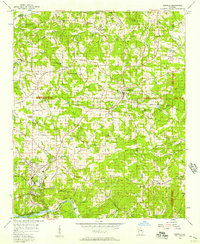
 1956 Acworth1957 Print · USGSAcworth and the surrounding Cobb County hills are shown here in the mid-1950s as the reservoir changed the landscape. Trace early roads and community centers like Mars Hill Ch, the Drive-in Theater, and the Nashville Chattanooga and St Louis line.6 unique versions available
 - 1956 Map of Birmingham, 1957 Print
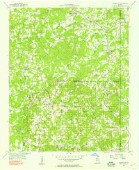 1956 Birmingham1957 Print · USGSNorth Georgia in the mid-1950s reveals a landscape of tight-knit rural communities and family-named roads. Trace your heritage through the Union Hill Sch, the Holbrook Campground, and country churches like Boiling Spring Ch.4 unique versions available
 - 1958 Map of Rome, 1966 Print
 1958 Rome1966 Print · USGSNorthwest Georgia and neighboring Tennessee and Alabama are captured here in the late fifties, showcasing a landscape of high ridges and river valleys. Researchers can trace historic rail lines like the Seaboard Air Line RR and explore the bounds of Cloudland Canyon State Park or Fort Oglethorpe.3 unique versions available
End of results
Showing maps 1-8 of 8
Top cities of Cherokee County
- Woodstock historical maps
- Canton historical maps
- Holly Springs historical maps
- Ball Ground historical maps
- Waleska historical maps
Frequently asked questions
- What are the different types of historical maps available for Cherokee County?
- What is the oldest map of Cherokee County?
- Where can I purchase historical maps of Cherokee County for my home or office?
- Where can I download high-res historical maps of Cherokee County?
- Are there historical topographic maps available for Cherokee County?
- Is there historical aerial imagery available for Cherokee County?
- Where are historical maps of Cherokee County sourced from?