Old Maps of Cherokee County, Georgia for Academic Research
Study the evolution of Cherokee County with 131 high-resolution historic maps. Whether you're teaching, researching, or modeling changes in land use, these maps provide essential visual documentation of urban, environmental, and geographic change.
- Analyze long-term change: Track patterns in development, transportation, and natural features.
- Ideal for environmental or urban studies: Support academic projects with primary historical map data.
- Use in the classroom or lab: Educators and researchers rely on these maps to bring historical context to life.
These maps are a powerful tool for teaching, research, and visualizing how Cherokee County has changed over the decades.
Cherokee County, GA maps
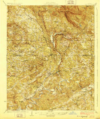
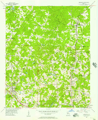
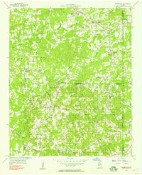
(131)- 1890 Map of Suwanee
 1890 Suwanee1890 Print · USGSNorth Georgia in the 1890s was a landscape of river-powered commerce and gold prospecting. Genealogists and historians can trace family-named river crossings like Jones Ferry and Pirkle's Ferry or locate the historic Kin Mori Gold Mine.
 - 1890 Map of Cartersville
 1890 Cartersville1890 Print · USGSNorthwest Georgia in the late nineteenth century was a landscape of burgeoning rail junctions and river-powered industry. Researchers can trace the roots of families and commerce at McDaniel's Station, Warford's Roads, and the many industrial sites along the Etowah River.
 - 1891 Map of Cartersville
 1891 Cartersville1891 Print · USGSNorth Georgia in the late nineteenth century was defined by its winding river crossings and the arrival of the iron horse. Trace the paths of early travel through Wooley's Ferry, identify old family operations like Hall's Mill, and locate rail stops at McDaniel's Station.
 - 1894 Map of Suwanee
 1894 Suwanee1894 Print · USGSNorth Georgia in the late nineteenth century was a landscape of river ferries and rising industry, from marble quarries to gold mines. Genealogists can trace family landmarks like Fields Cross Roads, the Kin Mori Gold Mine, and Fort Buffington.6 unique versions available
 - 1896 Map of Cartersville
 1896 Cartersville1896 Print · USGSNorth Georgia in the late nineteenth century was a rugged landscape of river crossings and mountain ridges. Trace the old ferry routes like Akeman Ferry or locate vanished industrial sites such as Marine Mill and the early works at Cement.4 unique versions available
 - 1907 Map of Acworth, 1954 Print
 1907 Acworth1954 Print · USGSNorthern Georgia's river-and-rail corridor is captured here at the start of the twentieth century. Genealogists can trace family roots near Acworth and Kennesaw or locate old crossings like Island Mills Ferry and Steels Bridge.
 - 1909 Map of Acworth
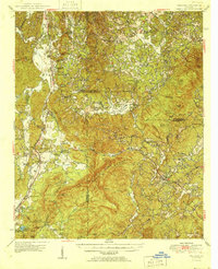
 1909 Acworth1909 Print · USGSNorth Georgia at the turn of the century shows a landscape of river ferries and emerging rail towns before the creation of modern reservoirs. Genealogists can trace family footprints near Acworth and Woodstock, or locate historic crossings like Island Mills Ferry and Steels Bridge.
 - 1926 Map of Tate, 1968 Print
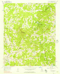
 1926 Tate1968 Print · USGSNorthern Georgia's ridge-and-valley corridor is captured here in the mid-twenties, showcasing a landscape of mining and rail commerce. Trace early industrial sites like the Franklin Gold Mine and old crossroads like Ball Ground or Nelson.
 - 1928 Map of Tate
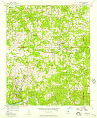
 1928 Tate1928 Print · USGSNorth Georgia’s mineral and mountain heritage comes to life in the late 1920s as the rail line connects the marble and gold districts. Researchers can locate family roots at the Franklin Gold Mine, Old Damascus Church, or Burroughs Crossroads.
 - 1947 Map of Waleska, 1964 Print
 1947 Waleska1964 Print · USGSNorthwestern Georgia’s rural landscape is captured here in the late 1940s as mountain communities and small mill towns were linked by the Louisville and Nashville rail line. Researchers can trace the heritage of Waleska and Fairmount through local landmarks like Erwin Mill, Oak Hill Sch, and the Hutchinson Cem.
 - 1950 Map of Waleska
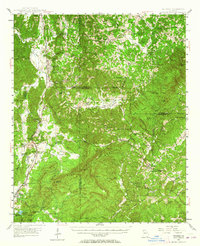
 1950 Waleska1950 Print · USGSMid-century Northwest Georgia reveals a network of mountain ridges and creek-bottom farms connected by the Louisville and Nashville rail line. Genealogists can trace early landmarks like the County Home, Richardson Cemetery, and rural schools like Oak Hill School.2 unique versions available
 - 1955 Map of Rome
 1955 Rome1955 Print · USGSThe tri-state borderlands of Georgia, Alabama, and Tennessee appear in the mid-fifties as a landscape of ridge-and-valley industry and river navigation. Genealogists can trace family footprints near Chattanooga, the iron works of Gadsden, and textile towns like Trion or Summerville.
 - 1956 Map of Kennesaw, 1957 Print
 1956 Kennesaw1957 Print · USGSCobb and Cherokee counties are captured in the mid-1950s during a period of steady growth along the Louisville and Nashville rail line. Researchers can trace old property boundaries across the 20th District and locate local landmarks like Wooten Lake, Bascomb, and Chastains Lakes.5 unique versions available
 - 1956 Map of Mountain Park, 1957 Print
 1956 Mountain Park1957 Print · USGSNorth Georgia in the mid-fifties remains a world of country churches and winding rural roads across the Cobb and Cherokee county lines. Trace family history through landmarks like Wesley Chapel, the Mountain View Sch, and the old crossing at Arnold Mill.6 unique versions available
 - 1956 Map of Roswell, 1957 Print
 1956 Roswell1957 Print · USGSNorthern Fulton County in the mid-fifties remains a world of quiet crossroads and rural parishes before the modern expansion. Researchers can trace ancestral locations at Crabapple, Newtown, and Lebanon Ch, or locate the County Prison Camp and Rock Quarry.5 unique versions available
 - 1956 Map of Acworth, 1957 Print
 1956 Acworth1957 Print · USGSAcworth and the surrounding Cobb County hills are shown here in the mid-1950s as the reservoir changed the landscape. Trace early roads and community centers like Mars Hill Ch, the Drive-in Theater, and the Nashville Chattanooga and St Louis line.6 unique versions available
 - 1956 Map of Birmingham, 1957 Print
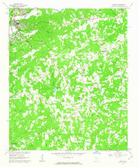
 1956 Birmingham1957 Print · USGSNorth Georgia in the mid-1950s reveals a landscape of tight-knit rural communities and family-named roads. Trace your heritage through the Union Hill Sch, the Holbrook Campground, and country churches like Boiling Spring Ch.4 unique versions available
 - 1958 Map of Rome, 1966 Print
 1958 Rome1966 Print · USGSNorthwest Georgia and neighboring Tennessee and Alabama are captured here in the late fifties, showcasing a landscape of high ridges and river valleys. Researchers can trace historic rail lines like the Seaboard Air Line RR and explore the bounds of Cloudland Canyon State Park or Fort Oglethorpe.3 unique versions available
 - 1961 Map of Rome
 1961 Rome1961 Print · USGSNorthwest Georgia and neighboring Tennessee and Alabama are shown here at a moment of significant mid-century growth. Researchers can trace the rail networks of the Central of Georgia or locate landmarks within Chickamauga and Chattanooga Nat Military Park.
 - 1961 Map of South Canton, 1963 Print
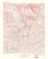
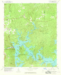
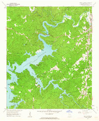 1961 South Canton1963 Print · USGSCherokee County enters a new era of recreation and industry in the early sixties as the reservoir waters reshape the local valleys. Researchers can trace the Louisville and Nashville rail line through Holly Springs or locate rural landmarks like Sutallee and Fields Chapel.4 unique versions available
 - 1961 Map of Allatoona Dam, 1963 Print
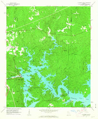 1961 Allatoona Dam1963 Print · USGSBartow and Cherokee counties are shown here just as the reservoir was becoming a regional recreation hub in the early sixties. Genealogists can trace old family burial grounds like Kay Cem and Goodson Cem, or locate rural landmarks like Stamp Creek Ch and Laffingal.4 unique versions available
 - 1961 Map of Canton, 1963 Print
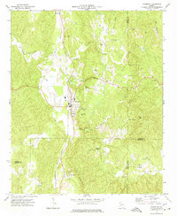
 1961 Canton1963 Print · USGSCherokee County in the early sixties centers on the industrial growth of Canton and the winding Etowah River. Local historians can trace family roots through numerous country landmarks like Pugh Cem, Carmichael Crossroads, and Indian Knoll Ch.4 unique versions available
 - 1963 Map of Rome
 1963 Rome1963 Print · USGSThe tri-state corner of Georgia, Alabama, and Tennessee is captured here during a period of massive reservoir expansion and post-war growth. Genealogists and historians can trace the rail corridors of the Southern Ry or locate landmarks like Fort Oglethorpe and Cloudland Canyon State Park.
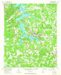
 - 1968 Map of Allatoona Dam, 1969 Print
 1968 Allatoona Dam1969 Print · USGSBartow County's landscape shows the full impact of the mid-century reservoir projects as recreation and nature preserves take hold in the late 1960s. Trace local family roots at Rowland Spring Cem or explore the site of the Allatoona Dam and its surrounding parklands.
 - 1972 Map of Fairmount, 1974 Print
 1972 Fairmount1974 Print · USGSFairmount and the Salacoa Valley are shown in the early seventies as the railroad and rural highway networks defined life in North Georgia. Researchers can trace family sites at Shiloh Cem, the remote community of Ryo, and the quarries near Funkhouser.2 unique versions available
Showing maps 1-25 of 131
Top cities of Cherokee County
- Woodstock historical maps
- Canton historical maps
- Holly Springs historical maps
- Ball Ground historical maps
- Waleska historical maps
Frequently asked questions
- What are the different types of historical maps available for Cherokee County?
- What is the oldest map of Cherokee County?
- Where can I purchase historical maps of Cherokee County for my home or office?
- Where can I download high-res historical maps of Cherokee County?
- Are there historical topographic maps available for Cherokee County?
- Is there historical aerial imagery available for Cherokee County?
- Where are historical maps of Cherokee County sourced from?