Old Maps of Clinch County, Georgia
Explore 159 old maps of Clinch County, spanning from 1953 to today. These high-resolution historic maps reveal how streets, neighborhoods, landmarks, and natural features evolved over time — perfect for genealogy, metal detecting, research, and local history exploration.
What you can do with these maps:
- See how Clinch County changed over time: Compare historical maps to modern-day views to trace roads, homesites, rail lines & more.
- View detailed metadata: Each map includes creators, publishers, year, scale, and archive source.
- Overlay maps with satellite & LiDAR: Visualize the past alongside modern tools to explore terrain & human change.
- Trusted historical sources: Maps sourced from the USGS, Library of Congress, and other archives.
- Access maps your way: View online, download high-res files, or order prints for personal or research use.
Start exploring old maps of Clinch County to uncover forgotten places, hidden landmarks, and the deep history beneath your feet.
Clinch County, GA maps
(159)- 1953 Map of Waycross, 1967 Print
 1953 Waycross1967 Print · USGSSouth Georgia's agricultural and rail heartland is captured here in the mid-1950s, showing a vast network of timber and farming towns. Researchers can trace the rail lines connecting Waycross and Tifton or locate landmarks like Jefferson Davis State Park and Lake Blackshear.2 unique versions available
 - 1954 Map of Valdosta, 1967 Print
 1954 Valdosta1967 Print · USGSThe South Georgia and North Florida borderlands are captured here in the mid-fifties, showing the deep timber and wetland networks of the coastal plain. Researchers can trace the path of the Atlantic Coast Line through Valdosta or explore the interior of the Okefenokee Swamp.2 unique versions available
 - 1955 Map of Council, 1956 Print
 1955 Council1956 Print · USGSThe Georgia-Florida borderlands come into focus in the mid-1950s, showing a landscape of deep cypress swamps and isolated rail stops. Researchers can trace the Southern railroad through Council or follow the historic Watson Line across Pinhook Swamp.4 unique versions available
 - 1956 Map of Sargent, 1957 Print
 1956 Sargent1957 Print · USGSThe Florida-Georgia borderlands are captured here in the mid-1950s, highlighting the wild interior where the Southern railroad bisects the great swamps. Trace the isolated outposts of Sargent and Ewing or explore the drainage of White Arm Bay.
 - 1958 Map of Valdosta
 1958 Valdosta1958 Print · USGSSouth Georgia and North Florida are captured here in the mid-fifties, showing the vast Okefenokee Swamp and the vital timber and rail corridors connecting the two states. Researchers can locate the footprint of Moody Air Force Base, trace the Live Oak Perry and Gulf railroad, or find early community sites like Bakers Mill and Paradise Church.
 - 1958 Map of Waycross
 1958 Waycross1958 Print · USGSSoutheast Georgia in the late fifties remains a landscape of deep river basins and vital rail junctions. Genealogists and historians can trace family-named landmarks and rural hubs like Union Church, South Georgia College, and the sprawling Okefenokee Swamp.2 unique versions available
 - 1959 Map of Valdosta
 1959 Valdosta1959 Print · USGSThe Georgia-Florida borderlands in the mid-fifties reveal a landscape of massive blackwater swamps and emerging military aviation hubs. Genealogists and historians can trace rail-stop towns like Fargo and Stockton or explore the interior reaches of the Okefenokee Swamp and Billys Island.
 - 1966 Map of The Pocket, 1967 Print
 1966 The Pocket1967 Print · USGSThe Suwannee River headwaters and the southern Okefenokee Swamp are captured here in the mid-1960s. Researchers can trace the path of a Dismantled Logging Tram and locate family-named landmarks like Mixons Hammock and Jack Island.
 - 1966 Map of Cravens Island, 1968 Print
 1966 Cravens Island1968 Print · USGSWare County and the Okefenokee Swamp are captured in this mid-century photomap during an era of experimental cartography. Researchers can trace the heritage of the timber industry through a Dismantled Logging Tram and local landmarks like Mc Leods Mill.
 - 1967 Map of Strange Island
 1967 Strange Island1967 Print · USGSThe Georgia wetlands in the late sixties reveal a landscape defined by the vast Okefenokee Swamp. Trace the history of regional timber harvesting through a Dismantled Tram Logging route and locate remote points like Indian Mound Island.2 unique versions available
 - 1967 Map of Spooner, 1968 Print
 1967 Spooner1968 Print · USGSSoutheast Georgia's dense marshlands are captured in detail during the late 1960s as federal surveyors mapped the hydrologic complexity of the Okefenokee Swamp. Genealogists and historians can locate isolated points of interest like Antioch Ch, the junction at The Wye, and the historic Dismal Logging Tram.2 unique versions available
 - 1967 Map of Colon, 1968 Print
 1967 Colon1968 Print · USGSClinch County was a center of timber and swamp navigation in the late sixties, where rail lines met the great wetlands. Genealogists and historians can trace the Southern railroad through Colon or locate the Retreat Logging Tram and Vessels Ford.
 - 1967 Map of Sargent, 1968 Print
 1967 Sargent1968 Print · USGSThe Georgia-Florida borderlands come alive in this late-sixties experimental survey, where the great southern swamps meet the rail line. Researchers can trace the Southern railroad through the Okefenokee Swamp past Sargent and Moorehead.
 - 1967 Map of Fargo, 1969 Print
 1967 Fargo1969 Print · USGSDeep in South Georgia during the late sixties, the SUWANNEE RIVER and SOUTHERN RAILWAY shaped the rural landscape near Fargo. Trace old routes like the WOODPECKER ROUTE or find landmarks like Rives Landing and Vickers Crossing.2 unique versions available
 - 1968 Map of Homerville East, 1969 Print
 1968 Homerville East1969 Print · USGSClinch County in the late sixties shows a landscape of rail-driven settlements and expansive southern wetlands. Genealogists can locate family landmarks like New Pine Grove Ch and Shiloh Ch, or trace the rail corridor through Argyle and Travisville.3 unique versions available
 - 1968 Map of Midway, 1970 Print
 1968 Midway1970 Print · USGSClinch County was a landscape of dense pine forests and swampy bays in the late sixties. Genealogists and local historians can trace family locations through Griffis Cem, Hard Scramble Cem, and the rural community at Midway.
 - 1968 Map of Needmore, 1970 Print
 1968 Needmore1970 Print · USGSThe South Georgia swamplands near the Clinch and Echols County line appear here in the late sixties as a landscape of timber camps and winding creeks. Local historians can trace the foundations of Needmore, the riverside Log Landing, and rural landmarks like Bethel Ch or the Old Railroad Grade.2 unique versions available
 - 1968 Map of Headlight, 1970 Print
 1968 Headlight1970 Print · USGSClinch County in the late sixties reveals a landscape of southern Georgia timberlands and wetlands woven together by rail and road. Genealogists and local historians can trace the Southern line through Headlight, explore the reaches of McGarrity Bay, and locate the small settlement of Ernest.2 unique versions available
 - 1968 Map of Manor, 1970 Print
 1968 Manor1970 Print · USGSSouth Georgia's wetland landscape comes into focus in the late 1960s as a region defined by its rail hubs and vast bays. Genealogists and researchers can trace the vicinity of Manor and Glenmore, identifying local landmarks like Providence Ch and the High School.2 unique versions available
 - 1968 Map of Cogdell, 1970 Print
 1968 Cogdell1970 Print · USGSIn the late 1960s, the rural community of Cogdell was a landscape of remote bays and creeks where three Georgia counties met. Genealogists and historians can trace family locations near Zion Hill Ch or along the old Stage Road and Suwannee Creek.2 unique versions available
 - 1971 Map of Thelma, 1976 Print
 1971 Thelma1976 Print · USGSClinch and Echols County landscapes are captured in the early 1970s, showing a region defined by extensive wetlands and rail transit. Researchers can locate specific family-named landmarks like Starling Ford, Wilkerson Lake, and the community of Thelma.
 - 1971 Map of Du Pont, 1976 Print
 1971 Du Pont1976 Print · USGSClinch County was a landscape of deep timber and rail junctions in the early seventies, captured here through detailed orthophotography. Genealogists and local historians can locate Olive Leaf Ch, Eason Cem, and the rail lines of the Seaboard and Coast Line.
 - 1971 Map of Stockton, 1976 Print
 1971 Stockton1976 Print · USGSStockton and the surrounding Georgia wetlands are captured here in the early seventies as the railroad still dictated the local geography. Researchers can find New Prospect Ch and trace the many family-named depressions like Epsey Bay and Lightsey Bay.
 - 1971 Map of Pineland, 1976 Print
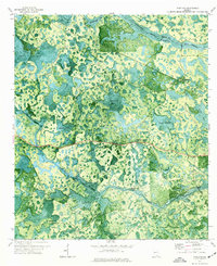 1971 Pineland1976 Print · USGSSouthern Georgia's wetland interior is captured in the early seventies, showing the remote landscape of Echols and Clinch Counties. Researchers can locate named crossings like Brown Ford, the path of an Old Railroad Grade, and the small settlement at Pineland.
 - 1971 Map of Haylow, 1976 Print
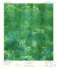 1971 Haylow1976 Print · USGSRailroad crossroads and extensive wetlands define this south Georgia landscape in the early 1970s. Genealogists and local historians can trace rail-side settlements like Haylow and Withers or locate family landmarks near Boggy Bay and Sasser Lake.
Showing maps 1-25 of 159
Top cities of Clinch County
- Homerville historical maps
- Fargo historical maps
- Argyle historical maps
- Du Pont historical maps
- Ernest historical maps
Frequently asked questions
- What are the different types of historical maps available for Clinch County?
- What is the oldest map of Clinch County?
- Where can I purchase historical maps of Clinch County for my home or office?
- Where can I download high-res historical maps of Clinch County?
- Are there historical topographic maps available for Clinch County?
- Is there historical aerial imagery available for Clinch County?
- Where are historical maps of Clinch County sourced from?