1900s (20th Century) Maps of Moultrie, Georgia
Explore 8 historic maps of Moultrie from the 1900s (20th Century). These maps offer a rare glimpse into what life looked like during the 1900s — showing old roads, neighborhoods, homes, and landmarks that have changed or disappeared over time.
Whether you're researching your family's past, planning a metal detecting trip, or studying how Moultrie's landscape evolved across the 1900s, these high-resolution maps are a powerful tool for exploring the history of this region.
- Focus on a specific era: All maps on this page are from the 1900s, giving you a focused view of this time period.
- See what’s changed: Compare century-old streets, trails, and buildings to today's modern landscape using overlays and satellite layers.
- Research with precision: Use these maps for genealogy, historical research, land use analysis, or educational projects.
- View, download, or print: Maps are fully viewable online in high resolution, and can be downloaded or printed for your own records.
Start exploring Moultrie's history through authentic maps from the 1900s. This is your window into the past.
Moultrie, GA maps
(8)- 1953 Map of Waycross, 1967 Print
 1953 Waycross1967 Print · USGSSouth Georgia's agricultural and rail heartland is captured here in the mid-1950s, showing a vast network of timber and farming towns. Researchers can trace the rail lines connecting Waycross and Tifton or locate landmarks like Jefferson Davis State Park and Lake Blackshear.2 unique versions available
 - 1958 Map of Waycross
 1958 Waycross1958 Print · USGSSoutheast Georgia in the late fifties remains a landscape of deep river basins and vital rail junctions. Genealogists and historians can trace family-named landmarks and rural hubs like Union Church, South Georgia College, and the sprawling Okefenokee Swamp.2 unique versions available
 - 1974 Map of Pineboro, 1977 Print
 1974 Pineboro1977 Print · USGSColquitt County is captured here in the mid-seventies, showing a landscape of rural schoolhouses and family-named churches. Researchers can trace the legacy of Spence Field or find old community centers like Barbers and the Reedy Creek Sch.2 unique versions available
 - 1978 Map of Coolidge
 1978 Coolidge1978 Print · USGSSouthern Georgia’s agricultural heartland is captured here in the late seventies, showing the rural communities along the Colquitt and Thomas county line. Genealogists and local historians can trace family-named sites like Murphy Cem and County Line Cem or locate the Jr Academy in Coolidge.2 unique versions available
 - 1978 Map of Moultrie
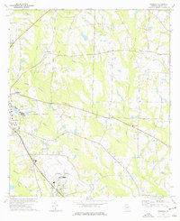
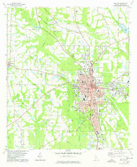 1978 Moultrie1978 Print · USGSMoultrie and its surrounding Colquitt County farmlands are captured in the late seventies as the region's rail and river networks evolved. Trace local history through sites like Strong Cem, the Old Railroad Grade, and Giles Millpond.2 unique versions available
 - 1978 Map of Berlin West
 1978 Berlin West1978 Print · USGSSouth Georgia's rural landscape at the edge of the Colquitt and Brooks county line reveals a network of farming communities and rail lines in the late seventies. Researchers can trace family roots at Sardis Ch Cem, visit the settlement of Berlin, or follow the Georgia Northern Railroad.2 unique versions available
 - 1979 Map of Moultrie, 1980 Print
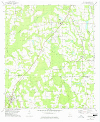
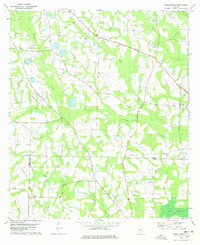
 1979 Moultrie1980 Print · USGSSouth Georgia’s agricultural heartland is documented here in the late 1970s, showcasing the intricate rail and river networks of Colquitt and Tift Counties. Researchers can trace historic settlements along the Georgia Northern railroad or locate landmarks like Spence Air Force Auxiliary Field and Banks Lake.2 unique versions available
 - 1988 Map of Waycross
 1988 Waycross1988 Print · USGSSouth Georgia's wiregrass and timber country is documented here in the late eighties, centered on the vital rail junction of Waycross. Genealogists and historians can trace the rural landscape from Okefenokee up to the Ocmulgee, finding sites like Lumber City and Jefferson Davis Memorial State Park.
End of results
Showing maps 1-8 of 8
Top cities near Moultrie
- Omega historical maps
- Norman Park historical maps
- Doerun historical maps
- Berlin historical maps
- Coolidge historical maps
- Funston historical maps
See more
Top neighborhoods of Moultrie
Frequently asked questions
- What are the different types of historical maps available for Moultrie?
- What is the oldest map of Moultrie?
- Where can I purchase historical maps of Moultrie for my home or office?
- Where can I download high-res historical maps of Moultrie?
- Are there historical topographic maps available for Moultrie?
- Is there historical aerial imagery available for Moultrie?
- Where are historical maps of Moultrie sourced from?