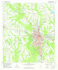
1978 Map of Moultrie
USGS Topo · Published 1978About this map
The Ochlockonee River and Okapilco Creek converge south of the city, anchoring a landscape where agricultural heritage meets growing industrial footprints. During the late 1970s, Moultrie served as a significant rail hub, with the Georgia Northern and Seaboard Coast Line tracks intersecting in the town center. The industrial sector is evidenced by several Industrial Waste Ponds and a Substation north of the main settlement. Genealogy researchers can locate several family and community landmarks, including Strong Cem and Pinecrest Memorial Cem, alongside local schools like Okapilco Sch and Cox Sch. The presence of an Old Railroad Grade near Sloans Creek provides a tangible link to the area's changing transportation infrastructure, while local recreation is noted at the Sunset Country Club and the Fairgrounds on the eastern edge of town.
Find a feature on this map
65 named features on this map. Tap any name to fly to it.
Don’t see what you’re looking for? This feature index may not catch every label — zoom into the map to look around manually.
Map Details
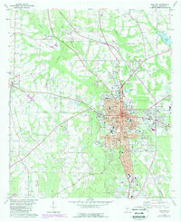
Editions of this 1978 Moultrie Map
2 editions found
Other maps of this area

1953 · Waycross
USGS Topo · 1:250,000

1956 · Doerun
USGS Topo · 1:62,500

1958 · Waycross
USGS Topo · 1:250,000

1973 · Norman Park
USGS Topo · 1:24,000
1974 · Doerun
USGS Topo · 1:24,000
1974 · Sigsbee
USGS Topo · 1:24,000

1974 · Pineboro
USGS Topo · 1:24,000
1974 · Hartsfield
USGS Topo · 1:24,000
1977 · Chastain
USGS Topo · 1:24,000
1978 · Coolidge
USGS Topo · 1:24,000