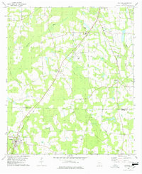
1978 Map of Coolidge
USGS Topo · Published 1978About this map
The boundary between Colquitt Co and Thomas Co bisects this landscape, where the agricultural plains of southern Georgia meet the winding course of the Ochlockonee River. The settlement of Coolidge anchors the southwestern corner, characterized by its grid of streets and the Jr Academy. To the north, the small community of Murphy sits near the junction of several rural roads, home to Temple Ch and New Hope Ch.
Find a feature on this map
30 named features on this map. Tap any name to fly to it.
Don’t see what you’re looking for? This feature index may not catch every label — zoom into the map to look around manually.
Map Details
Editions of this 1978 Coolidge Map
2 editions found
Other maps of this area

1953 · Waycross
USGS Topo · 1:250,000

1954 · Valdosta
USGS Topo · 1:250,000

1957 · Thomasville
USGS Topo · 1:62,500

1958 · Valdosta
USGS Topo · 1:250,000

1958 · Waycross
USGS Topo · 1:250,000

1959 · Valdosta
USGS Topo · 1:250,000

1961 · Quitman
USGS Topo · 1:62,500

1974 · Pineboro
USGS Topo · 1:24,000
1974 · Hartsfield
USGS Topo · 1:24,000
1975 · Merrillville
USGS Topo · 1:24,000