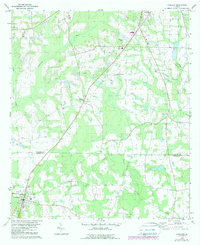
1978 Map of Coolidge
USGS Topo · Published 1988About this map
The Ochlockonee River and Little River converge in the northwestern corner of this quadrangle, defining a landscape marked by wide wetlands and agricultural clearing. The town of Coolidge serves as the primary hub in the southwest, featuring the Jr Academy and proximity to County-Line Cem. A rural network of family and community landmarks is scattered throughout the region, including small settlements like Murphy and Autreyville.
Find a feature on this map
28 named features on this map. Tap any name to fly to it.
Don’t see what you’re looking for? This feature index may not catch every label — zoom into the map to look around manually.
Map Details
Editions of this 1978 Coolidge Map
2 editions found
Other maps of this area

1953 · Waycross
USGS Topo · 1:250,000

1954 · Valdosta
USGS Topo · 1:250,000

1957 · Thomasville
USGS Topo · 1:62,500

1958 · Valdosta
USGS Topo · 1:250,000

1958 · Waycross
USGS Topo · 1:250,000

1959 · Valdosta
USGS Topo · 1:250,000

1961 · Quitman
USGS Topo · 1:62,500

1974 · Pineboro
USGS Topo · 1:24,000
1974 · Hartsfield
USGS Topo · 1:24,000
1975 · Merrillville
USGS Topo · 1:24,000