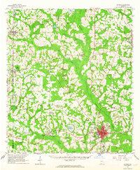
1961 Map of Quitman
USGS Topo · Published 1964About this map
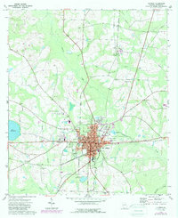
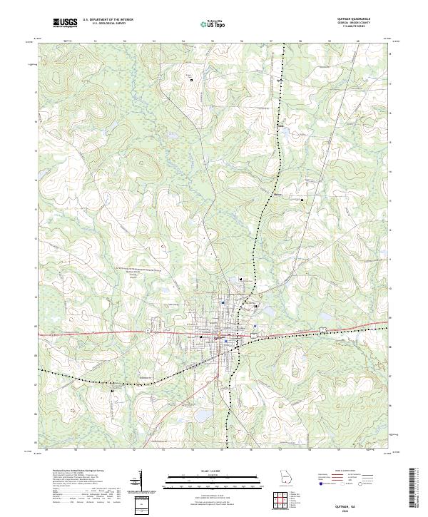
Quitman serves as the focal point of this Brooks County landscape, situated at the junction of the Atlantic Coast Line Railroad and the Southern Railway. The map reveals a highly developed rural network defined by numerous community landmarks, such as the County Training Sch and the Coast Armory. To the west, the Georgia Northern Railway connects the settlements of Pavo and Barwick, passing near water features like Pope Millpond and Dry Lake. The terrain is characterized by a high density of rural churches and family-named cemeteries, including the Hunter Cem and Robinson Cem, which highlight the deeply rooted social geography of the era. Extensive creek systems, notably Okapilco Creek and Piscola Creek, wind through the territory, punctuated by landmarks like Kennedy Hill and the distinctive geological features known as The Sinks near the southern border.
Find a feature on this map
72 named features on this map. Tap any name to fly to it.
Don’t see what you’re looking for? This feature index may not catch every label — zoom into the map to look around manually.
Map Details
Editions of this 1961 Quitman Map
This is the sole edition of this map. No revisions or reprints were ever made.
Historical Maps of Quitman Through Time
8 maps found