Old Maps of Bainbridge, Georgia for Genealogy
Trace your family roots with 25 historic maps of Bainbridge. These high-res maps reveal old neighborhoods, homesites, landmarks, and streets — helping you uncover where your ancestors lived and how the area evolved over time.
- Explore historic neighborhoods: Identify where your relatives may have lived in the 1800s or 1900s.
- Compare maps over time: Trace the changes in streets, buildings, and landmarks for multi-generational research.
- Perfect for genealogy & ancestry research: Used by family historians and researchers to map out lineage and migration.
These maps are an incredible resource for exploring your personal connection to Bainbridge's past.
Bainbridge, GA maps
(25)- 1954 Map of Tallahassee, 1967 Print
 1954 Tallahassee1967 Print · USGSThe Florida Panhandle and South Georgia are captured here during a period of mid-century growth and military expansion. Researchers can trace the development of Panama City, the footprint of Tyndall Air Force Base, and the rail lines of the Atlantic Coast Line.4 unique versions available
 - 1955 Map of Bainbridge, 1957 Print
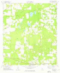
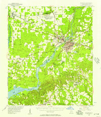 1955 Bainbridge1957 Print · USGSDecatur County, Georgia, during the mid-fifties is captured here as the new reservoir begins to reshape the landscape. Local historians can trace family roots through numerous rural landmarks like Missouri Mission Ch, Green Shade Cem, and the Fowltown PO.
 - 1955 Map of Whigham, 1957 Print
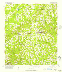 1955 Whigham1957 Print · USGSThe rural landscape of South Georgia comes alive in the mid-1950s, showing a region shaped by dual rail lines and scattered agricultural hamlets. Genealogists and historians can trace family roots through numerous churches and schools like Union Spring Ch and Bell-Dixon Sch, or locate industrial sites such as the local Strip Mines.2 unique versions available
 - 1959 Map of Tallahassee
 1959 Tallahassee1959 Print · USGSFlorida's Panhandle and the Big Bend region appear here in the mid-fifties, showing a landscape defined by its great river systems and developing coast. Trace the early layout of Panama City, the expansive Apalachicola National Forest, and the coastal St Marks Lighthouse.
 - 1960 Map of Tallahassee
 1960 Tallahassee1960 Print · USGSThe Florida Panhandle and southern Georgia are captured here in the mid-twentieth century, showing a region defined by its rivers and military installations. Genealogists and historians can trace the growth of Tallahassee or locate coastal landmarks like the St Marks Lighthouse and Tyndall Air Force Base.
 - 1974 Map of Bainbridge, 1976 Print
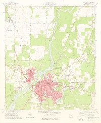 1974 Bainbridge1976 Print · USGSBainbridge sits at a technological and industrial crossroads in the mid-seventies, dominated by the Flint River and the Seaboard Coast Line. Researchers can locate numerous neighborhood landmarks like the Hutto Jr High Sch, Oak City Cem, and Mt Zion Ch.2 unique versions available
 - 1974 Map of Fowlstown, 1976 Print
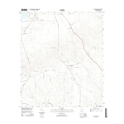
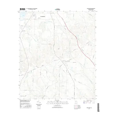
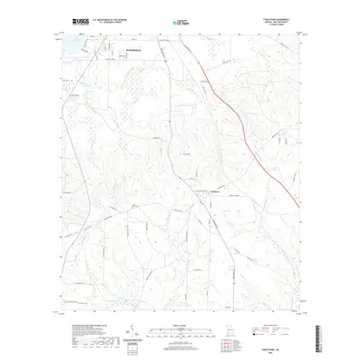
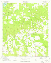 1974 Fowlstown1976 Print · USGSDecatur County in the mid-1970s is captured here at the intersection of the Seaboard Coast Line and the Flint River. Genealogists can trace several community hubs like Fowlstown and find rural landmarks such as Mt Nebo Ch Cem and Emanuel Ch.
 - 1974 Map of Climax North, 1976 Print
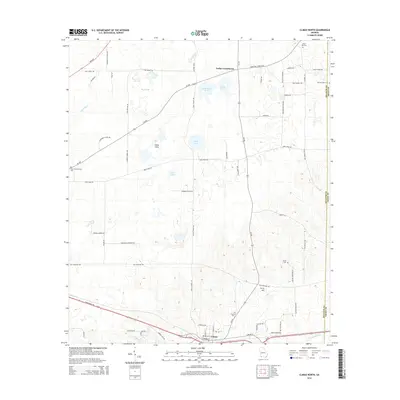
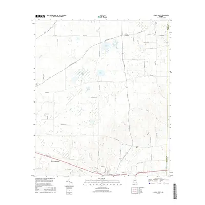
 1974 Climax North1976 Print · USGSThe rural landscape of Decatur County in the mid-1970s reveals a community centered on the rail junction at Climax. Genealogists and local historians can trace rural family roots through numerous sites like Fleatown Cem, Travelers Rest Ch, and Parker Courthouse.
 - 1978 Map of Bainbridge, 1980 Print
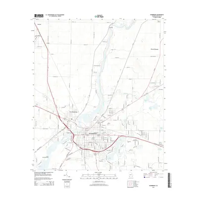
 1978 Bainbridge1980 Print · USGSIn the late seventies, this Georgia-Florida borderland was defined by the confluence of the Flint and Chattahoochee rivers. Trace the region's infrastructure via the Seaboard Coast Line Railroad and find sites like Bainbridge State Hospital.
 - 1988 Map of Tallahassee
 1988 Tallahassee1988 Print · USGSThe Florida Panhandle and South Georgia are captured here in the late eighties, showing the expansion of the regional highway network and coastal growth. Genealogists and historians can trace rail lines like the Seaboard System Railroad or locate family roots in Blountstown, Graceville, or Crawfordville.2 unique versions available
 - 2011 Map of Climax North, 2011 Print
 2011 Climax North2011 Print · USGSCovers Bainbridge, including Climax, Parker Courthouse, and other nearby areas
 - 2011 Map of Fowlstown, 2011 Print
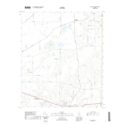
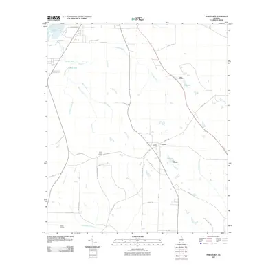 2011 Fowlstown2011 Print · USGSCovers Bainbridge, including Fowlstown, Decatur County, and other nearby areas
 - 2011 Map of Bainbridge, 2011 Print
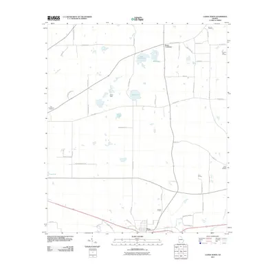
 2011 Bainbridge2011 Print · USGSCovers Bainbridge, including Ausmac, Lynn, and other nearby areas
 - 2014 Map of Bainbridge, 2014 Print
 2014 Bainbridge2014 Print · USGSCovers Bainbridge, including Ausmac, Lynn, and other nearby areas
 - 2014 Map of Climax North, 2014 Print
 2014 Climax North2014 Print · USGSCovers Bainbridge, including Climax, Parker Courthouse, and other nearby areas
 - 2014 Map of Fowlstown, 2014 Print
 2014 Fowlstown2014 Print · USGSCovers Bainbridge, including Fowlstown, Decatur County, and other nearby areas
 - 2017 Map of Climax North, 2017 Print
 2017 Climax North2017 Print · USGSCovers Bainbridge, including Climax, Parker Courthouse, and other nearby areas
 - 2017 Map of Fowlstown, 2017 Print
 2017 Fowlstown2017 Print · USGSCovers Bainbridge, including Fowlstown, Decatur County, and other nearby areas
 - 2017 Map of Bainbridge, 2017 Print
 2017 Bainbridge2017 Print · USGSCovers Bainbridge, including Ausmac, Lynn, and other nearby areas
 - 2020 Map of Fowlstown, 2020 Print
 2020 Fowlstown2020 Print · USGSCovers Bainbridge, including Fowlstown, Decatur County, and other nearby areas
 - 2020 Map of Climax North, 2020 Print
 2020 Climax North2020 Print · USGSCovers Bainbridge, including Climax, Parker Courthouse, and other nearby areas
 - 2020 Map of Bainbridge, 2020 Print
 2020 Bainbridge2020 Print · USGSCovers Bainbridge, including Ausmac, Lynn, and other nearby areas
 - 2024 Map of Climax North, 2024 Print
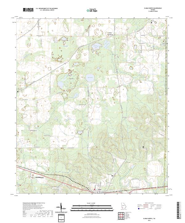 2024 Climax North2024 Print · USGSDecatur County, Georgia, is captured in this modern survey as the town of Climax and the surrounding rural landscapes continue to evolve. Researchers can trace family history at sites like Mars Hill Church Cem, Arline Cem, and the historic Parker Courthouse community.
 - 2024 Map of Bainbridge, 2024 Print
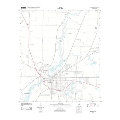
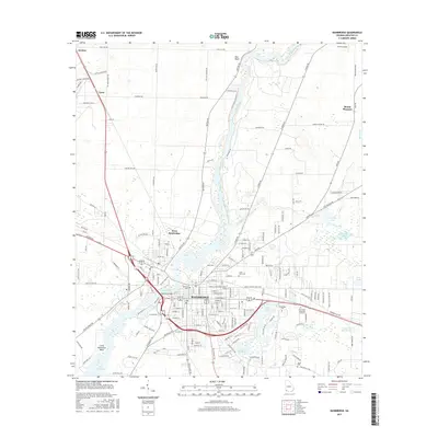
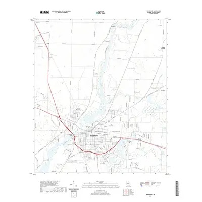
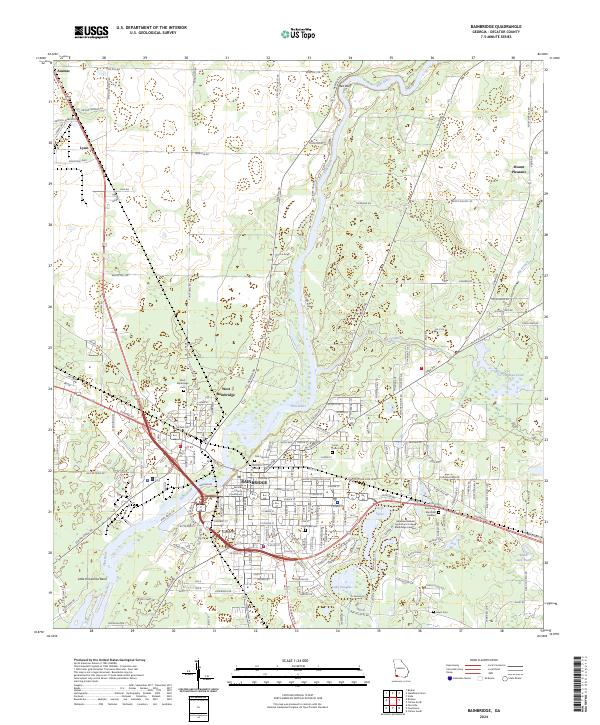 2024 Bainbridge2024 Print · USGSBainbridge and the surrounding Decatur County countryside are shown here in the current decade as the Flint River continues to shape the local landscape. Researchers can locate several historic burial grounds including Oak City Cem and West Bainbridge Cem, or trace the Bird rail line through Lynn.
 - 2024 Map of Fowlstown, 2024 Print
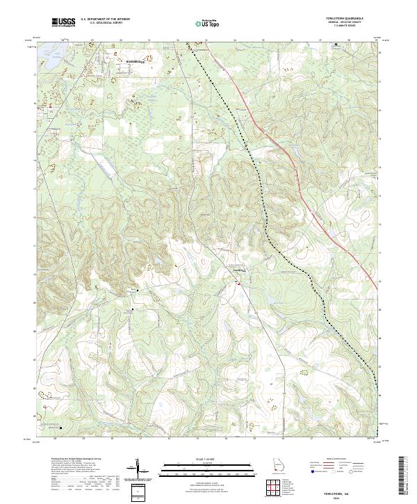 2024 Fowlstown2024 Print · USGSDecatur County at the turn of the twenty-first century reveals a community shaped by the waters of the Florida borderlands. Genealogists and local historians can trace rural roots through Emanuel Church, Green Shade Cemetery, and the settlement of Fowlstown.
End of results
Showing maps 1-25 of 25
Top cities near Bainbridge
Top neighborhoods of Bainbridge
Frequently asked questions
- What are the different types of historical maps available for Bainbridge?
- What is the oldest map of Bainbridge?
- Where can I purchase historical maps of Bainbridge for my home or office?
- Where can I download high-res historical maps of Bainbridge?
- Are there historical topographic maps available for Bainbridge?
- Is there historical aerial imagery available for Bainbridge?
- Where are historical maps of Bainbridge sourced from?