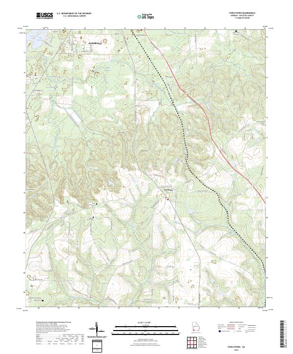
2024 Map of Fowlstown
USGS Topo · Published 2024About this map
Fowlstown and the southern reaches of Bainbridge occupy a landscape defined by the intricate hydrology of southwest Georgia. The terrain transitions from the edges of Lake Seminole in the northwest to the lowlands of Fowlstown Swamp and the elevated ground of Curry Hill. Tributaries like Ballou Creek, Spring Creek, and Willacoochee Creek carve through the agricultural and forested tracts, illustrating the area's historical reliance on these natural drainage systems. Local history is anchored by rural institutions, including Emanuel Church, Mount Nebo Church, and Beulah Thomas Church, alongside family and community landmarks like Green Shade Cemetery and Peterson Cemetery. The road network, including the prominent Tallahassee Road, reflects the area's connectivity between established Georgia settlements and the Florida border, maintaining a pattern of land use that balances small-town growth with significant natural water features.
Find a feature on this map
76 named features on this map. Tap any name to fly to it.
Don’t see what you’re looking for? This feature index may not catch every label — zoom into the map to look around manually.
Map Details
Editions of this 2024 Fowlstown Map
This is the sole edition of this map. No revisions or reprints were ever made.
Other maps of this area

1954 · Tallahassee
USGS Topo · 1:250,000

1955 · Bainbridge
USGS Topo · 1:62,500

1955 · Whigham
USGS Topo · 1:62,500

1955 · Mt Pleasant
USGS Topo · 1:24,000

1956 · Havana North
USGS Topo · 1:24,000

1956 · Dogtown
USGS Topo · 1:24,000

1959 · Tallahassee
USGS Topo · 1:250,000

1960 · Tallahassee
USGS Topo · 1:250,000
1974 · Bainbridge
USGS Topo · 1:24,000
1974 · Faceville
USGS Topo · 1:24,000