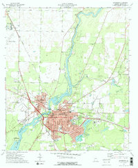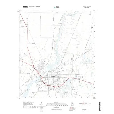
1955 Map of Bainbridge
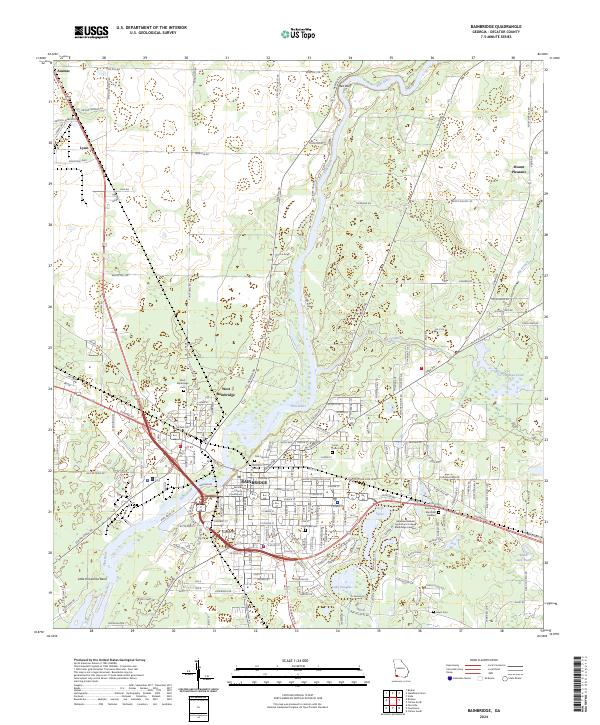
USGS Topo · Published 1957About this map
The Flint River flows through the heart of Decatur County, Georgia, serving as the defining geographic feature of this mid-1950s survey. The landscape is marked by the recently established Jim Woodruff Reservoir to the south, where the spillway elevation 77 indicates a transformative period for local waterways like Butlers Creek and Sanborn Creek. In Bainbridge, the county seat, a dense network of schools such as Hutto High Sch and Jones-Wheat Sch supports the growing community, while the Bainbridge Air Base Contract School occupies a significant tract on the U S Military Reservation to the north.
Find a feature on this map
85 named features on this map. Tap any name to fly to it.
Don’t see what you’re looking for? This feature index may not catch every label — zoom into the map to look around manually.
Map Details
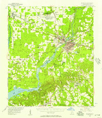
Editions of this 1955 Bainbridge Map
This is the sole edition of this map. No revisions or reprints were ever made.
Historical Maps of Bainbridge Through Time
8 maps found