
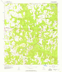
1956 Map of Dogtown
USGS Topo · Published 1957About this map
The Georgia Florida Watson Line bisects this mid-century landscape, marking the transition between Decatur County and Gadsden County. This region is defined by the winding course of Willacoochee Creek, which is fed by tributaries like Fain Mill Creek and Betts Mill Creek. The settlement patterns of the 1950s are centered around a high density of rural religious and educational institutions, including the Oak Grove Sch (Abandoned), St Johns Sch, and Campbell Chapel.
Find a feature on this map
33 named features on this map. Tap any name to fly to it.
Don’t see what you’re looking for? This feature index may not catch every label — zoom into the map to look around manually.
Map Details
Editions of this 1956 Dogtown Map
2 editions found
Other maps of this area

1954 · Tallahassee
USGS Topo · 1:250,000

1955 · Bainbridge
USGS Topo · 1:62,500

1955 · Whigham
USGS Topo · 1:62,500

1955 · Mt Pleasant
USGS Topo · 1:24,000

1956 · Havana North
USGS Topo · 1:24,000

1959 · Tallahassee
USGS Topo · 1:250,000

1959 · Gretna
USGS Topo · 1:24,000

1959 · Quincy
USGS Topo · 1:24,000

1960 · Tallahassee
USGS Topo · 1:250,000
1963 · Havana South
USGS Topo · 1:24,000