Old Maps of Emanuel County, Georgia for Genealogy
Trace your family roots with 138 historic maps of Emanuel County. These high-res maps reveal old neighborhoods, homesites, landmarks, and streets — helping you uncover where your ancestors lived and how the area evolved over time.
- Explore historic neighborhoods: Identify where your relatives may have lived in the 1800s or 1900s.
- Compare maps over time: Trace the changes in streets, buildings, and landmarks for multi-generational research.
- Perfect for genealogy & ancestry research: Used by family historians and researchers to map out lineage and migration.
These maps are an incredible resource for exploring your personal connection to Emanuel County's past.
Emanuel County, GA maps
(138)- 1957 Map of Macon
 1957 Macon1957 Print · USGSMid-century Georgia comes into focus as the river-and-rail economy shifts toward a new era of aviation and highway travel. Trace family roots and vanished landmarks across the Ocmulgee River valley from Macon to the onion fields of Vidalia.
 - 1958 Map of Macon
 1958 Macon1958 Print · USGSMiddle Georgia during the late fifties shows the post-war expansion of Warner Robins alongside the deep-rooted rail hubs of the Central of Georgia line. Researchers can trace the river-bound boundaries of numerous counties and find local landmarks like Veterans Memorial Hospital and Robins AFB.
 - 1964 Map of Macon
 1964 Macon1964 Print · USGSCentral Georgia in the mid-sixties is defined by its major river valleys and a booming military presence. Genealogists and historians can trace the growth of Warner Robins near Robins AFB or locate smaller rural junctions like Allentown and Jeffersonville along the historic Southern railroad lines.2 unique versions available
 - 1970 Map of Cobbtown, 1973 Print
 1970 Cobbtown1973 Print · USGSSoutheast Georgia in the early seventies reveals a landscape of tight-knit rural communities and river-bottom lands. Genealogists can trace family roots at Sunlight Cem and Old Reedy Creek Cem, or locate landmarks like Aline and Cobbtown.2 unique versions available
 - 1970 Map of Oak Park SW, 1973 Print
 1970 Oak Park SW1973 Print · USGSSoutheast Georgia in the early 1970s reveals a patchwork of rural cemeteries and cross-county rail lines at the intersection of Montgomery and Toombs counties. Researchers can trace family history through sites like Mosleytown, Mc Leod Grave, and Blockers Chapel.
 - 1970 Map of Covena, 1973 Print
 1970 Covena1973 Print · USGSCoastal plain settlements and timberlands along the Ohoopee River define this Georgia landscape in the early seventies. Genealogists can trace family landmarks and rural communities through sites like Thigpen Chapel, Wilkes Cem, and the Old Railroad Grade.2 unique versions available
 - 1970 Map of Nunez, 1973 Print
 1970 Nunez1973 Print · USGSEmanuel County in the early seventies shows a rural Georgia landscape shaped by the Ohoopee River and the Central of Georgia rail line. Genealogists can trace family roots at Slater Cem and Youmans Cem, or locate the old Lexsy Sch and Lombard settlement.3 unique versions available
 - 1970 Map of Oak Park, 1973 Print
 1970 Oak Park1973 Print · USGSEmanuel County at the start of the 1970s reveals a landscape of tight-knit rural communities and pine-lined wetlands. Genealogists and local historians can trace family roots through a high density of sites like Morris Cem, White Chapel, and the settlement at Normantown.2 unique versions available
 - 1971 Map of Norristown, 1973 Print
 1971 Norristown1973 Print · USGSThe area surrounding Norristown and Norristown Junction in the early 1970s reveals a quiet landscape of river valleys and country chapels. Genealogists can trace family roots through sites like Hebron Ch, Lambs Ch, and the many unnamed cemeteries scattered near the Little Ohoopee River.
 - 1971 Map of Stillmore, 1973 Print
 1971 Stillmore1973 Print · USGSStillmore was a junction of river and rail at the start of the 1970s, positioned right on the Emanuel and Candler county line. Researchers can trace the path of the Old Railroad Grade or locate family burial sites at Oak Grove Cem and Old Beulah Cem.2 unique versions available
 - 1971 Map of Swainsboro, 1973 Print
 1971 Swainsboro1973 Print · USGSSwainsboro emerged as a bustling regional hub in the early seventies, centered on a critical intersection of rail and road. Local historians can trace the development of the Emanuel County Airport, find country landmarks like Smith Grove Ch, or explore the grounds of Yam Grandy State Park.
 - 1971 Map of Soperton North, 1973 Print
 1971 Soperton North1973 Print · USGSTreutlen and Emanuel Counties are shown in the early seventies as a new highway was cutting across the landscape. Genealogists can trace family roots at Johnson Chapel Cem, Ricks Cem, or the Lookout Tower Harmony Ch.2 unique versions available
 - 1971 Map of Dellwood, 1973 Print
 1971 Dellwood1973 Print · USGSEmanuel and Johnson County rural life is captured here in the early seventies, showing a landscape shaped by creek systems and country chapels. Researchers can trace the path of the Old Railroad Grade or locate family sites near Moxley Cem and Oak Chapel.
 - 1971 Map of Twin City, 1973 Print
 1971 Twin City1973 Print · USGSThe Emanuel County interior is captured here in the early seventies, centered on the growing community of Twin City. Researchers can trace the legacy of rural life through family-linked sites like Rountree Grove Ch, an Old Railroad Grade, and the County Institute.
 - 1971 Map of Twin City SE, 1973 Print
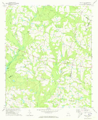 1971 Twin City SE1973 Print · USGSEastern Emanuel County in the early seventies is a landscape of winding creek branches and rural congregations. Trace local family history through numerous landmarks like New Beulah Ch, Watson Pond, and the Old Railroad Grade.2 unique versions available
 - 1971 Map of Garfield, 1973 Print
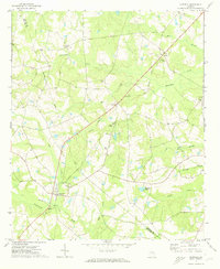 1971 Garfield1973 Print · USGSThe rural Georgia borderlands of Emanuel and Jenkins counties are captured here in the early seventies. Genealogists and local historians can locate many country sanctuaries such as Mt Carmel Ch and Johnson Chapel, or trace the path of the Old Railroad Grade near Garfield.
 - 1971 Map of Canoochee, 1974 Print
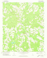 1971 Canoochee1974 Print · USGSCanoochee and the surrounding Emanuel County backcountry are captured in the early seventies as a quiet landscape of small churches and family cemeteries. Genealogists and historians can trace the Old Railroad Grade and locate rural landmarks like Mt Gilead Cem and Noonday Cem.
 - 1971 Map of Summertown, 1974 Print
 1971 Summertown1974 Print · USGSEmanuel County's rural rail corridor is well-preserved in this early 1970s survey of the Georgia backcountry. Genealogists can trace family connections through numerous landmarks like New Hope Ch, Old Dellwood, and the Central of Georgia Railroad.2 unique versions available
 - 1973 Map of Colemans Lake, 1976 Print
 1973 Colemans Lake1976 Print · USGSCoastal plain river life and rural Georgia rail hubs meet in the early 1970s where three counties converge. Genealogists and local historians can trace family church sites like Mt Sinai Ch and Green Grove Ch or explore the river-bottom geography of Seven Cypresses and Franklins Bluff.
 - 1973 Map of Wadley, 1976 Print
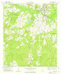 1973 Wadley1976 Print · USGSJefferson and Johnson counties in the mid-1970s show a landscape of timbered swamp and rural rail towns. Researchers can trace the Central of Georgia railroad through Wadley or locate local landmarks like Blounts Chapel Ch and the Old Railroad Grade.2 unique versions available
 - 1974 Map of Kite, 1976 Print
 1974 Kite1976 Print · USGSKite and the surrounding eastern Georgia countryside are captured in the mid-1970s as a landscape of rural churches and family homesteads. Genealogists can trace roots at Gum Log Ch, Pilgrims Rest Ch, or cemeteries like Meeks Cem.
 - 1974 Map of Birdsville, 1976 Print
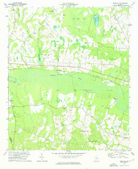 1974 Birdsville1976 Print · USGSThe Ogeechee River corridor in the mid-1970s reveals a landscape shaped by water and rail in Jenkins and Emanuel counties. Genealogists and researchers can trace local landmarks like Buckhead Academy, Rogers Crossing, and numerous rural churches including Ogeechee Ch.
 - 1974 Map of Midville, 1976 Print
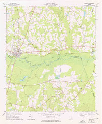 1974 Midville1976 Print · USGSMidville and the Ogeechee River valley are captured here in the mid-1970s, showcasing a landscape defined by swampy oxbows and rural Georgia crossroads. Genealogists can trace family landmarks like Murphree School, Sherrod Cemetery, and Johnsons Grove Church.2 unique versions available
 - 1974 Map of Scott, 1976 Print
 1974 Scott1976 Print · USGSLife in mid-1970s Laurens and Johnson Counties centered on the town of Scott and its network of rural congregations. Researchers can trace family history through numerous landmarks including Beasley Cem, St Pauls Ch, and the Old Railroad Grade.
 - 1974 Map of Adrian, 1976 Print
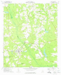 1974 Adrian1976 Print · USGSAdrian and the surrounding pine-country creek bottoms are documented here in the mid-seventies, spanning three Georgia counties. Researchers can trace the legacy of local transport along the Old Railroad Grade and find family sites at Bethsaida Ch or Braswell Cem.
Showing maps 1-25 of 138
Top cities of Emanuel County
- Swainsboro historical maps
- Twin City historical maps
- Stillmore historical maps
- Oak Park historical maps
- Garfield historical maps
- Summertown historical maps
See more
Frequently asked questions
- What are the different types of historical maps available for Emanuel County?
- What is the oldest map of Emanuel County?
- Where can I purchase historical maps of Emanuel County for my home or office?
- Where can I download high-res historical maps of Emanuel County?
- Are there historical topographic maps available for Emanuel County?
- Is there historical aerial imagery available for Emanuel County?
- Where are historical maps of Emanuel County sourced from?