Old Maps of Haralson County, Georgia for Hiking & Exploration
Hike through history with 80 historic maps of Haralson County. Explore old trails, ghost towns, and forgotten backroads — perfect for outdoor adventurers and local explorers.
- Rediscover forgotten places: Map out old mining camps, roads, and footpaths that no longer exist on modern maps.
- Layer with modern tools: Combine with LiDAR or satellite views to plan hikes through historical terrain.
- Made for exploration: Popular among hikers, overlanders, and local history lovers.
Use these maps to find adventure and explore the hidden past of Haralson County.
Haralson County, GA maps
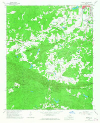
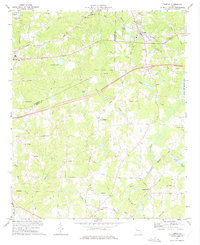
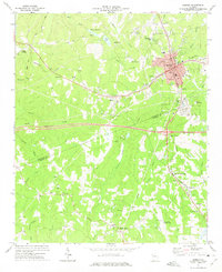
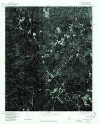
(80)- 1889 Map of Tallapoosa
 1889 Tallapoosa1889 Print · USGSAcross the Georgia and Alabama border in the late nineteenth century, iron furnaces and river mills powered the local economy. Genealogists can trace family homesteads near landmarks like Tecumseh Furnace, Pine Wood Church, and Allgood's Mill.
 - 1892 Map of Tallapoosa
 1892 Tallapoosa1892 Print · USGSThe Georgia-Alabama borderlands at the end of the nineteenth century reveal a landscape of early industry and river-powered mills. Genealogists and historians can trace family-named landmarks like Allgood Mill, Rainwater Ford, and the Tecumseh Furnace ruins.
 - 1897 Map of Tallapoosa
 1897 Tallapoosa1897 Print · USGSThe Georgia and Alabama borderlands are captured here in the late nineteenth century as the railroad and milling industries reshaped the landscape. Researchers can trace family-named sites like Munroe Mill, early crossings at Rainwater Ford, and old depots at Rockrun Station.4 unique versions available
 - 1953 Map of Atlanta, 1965 Print
 1953 Atlanta1965 Print · USGSThe growing Atlanta metro and the industrial corridors of Eastern Alabama are captured here during the mid-century transition. Researchers can trace the rail-to-road shift through hubs like Anniston and La Grange or locate sites within Fort McClellan.2 unique versions available
 - 1957 Map of Atlanta
 1957 Atlanta1957 Print · USGSAtlanta and the Alabama borderlands appear here in the mid-fifties, capturing the region's post-war suburban and industrial transition. Trace the development of early transport hubs and military sites like Fort McPherson, Anniston, and the Kennesaw Mountain National Battlefield Park.
 - 1958 Map of Atlanta
 1958 Atlanta1958 Print · USGSMid-century Georgia and Alabama are shown in this regional study of the corridor between the Chattahoochee River and the Appalachian foothills. Local historians can trace the development of suburban Atlanta alongside vital landmarks like Stone Mountain, Dobbins AFB, and the Seaboard Air Line rail routes.
 - 1958 Map of Carrollton, 1959 Print
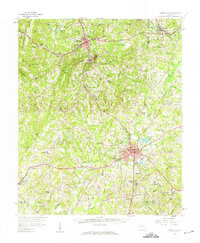 1958 Carrollton1959 Print · USGSCarroll and Haralson Counties come alive in this late 1950s survey of the Tallapoosa River basin during a period of steady growth. Researchers can trace the grounds of West Georgia College or locate vanished rural landmarks like Miller Academy and Smith Chapel.
 - 1958 Map of Buchanan, 1960 Print
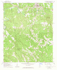
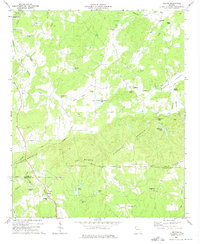
 1958 Buchanan1960 Print · USGSHaralson and Polk Counties are shown in the late fifties as a landscape of ridge-top churches and valley railroads. Genealogists can trace family footprints at Lees Chapel, Abernathys Mill, and along the Central of Georgia Railroad.2 unique versions available
 - 1965 Map of Tallapoosa South, 1968 Print
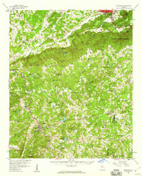
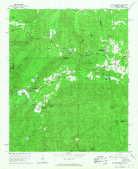
 1965 Tallapoosa South1968 Print · USGSHaralson County and the Alabama borderlands are captured here in the mid-1960s, centered on the transit hub of Tallapoosa. Genealogists and local historians can trace rural family sites like Pleasant Hill School, Antioch Cemetery, and Sanders Church.2 unique versions available
 - 1966 Map of Tallapoosa North, 1967 Print
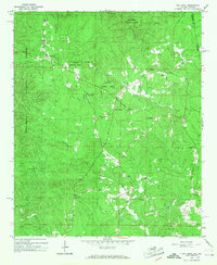
 1966 Tallapoosa North1967 Print · USGSThe Alabama and Georgia borderlands in the 1960s were defined by the winding Tallapoosa River and a network of rural congregations. Genealogists and local historians can locate several rural landmarks including the West Haralson Sch, Steadman Missionary Cem Ch, and Pleasant Hill Ch.
 - 1966 Map of Benedict, 1967 Print
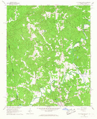
 1966 Benedict1967 Print · USGSThe rural borderlands of Polk and Haralson counties are captured here in the mid-1960s, showing a landscape shaped by high ridges and rail lines. Genealogists and local historians can locate several country churches like Macedonia Ch and family-named landmarks such as Akes and Brewster Mtn.2 unique versions available
 - 1966 Map of Borden Springs, 1967 Print
 1966 Borden Springs1967 Print · USGSSettlements along the Alabama-Georgia border were defined by the railroads and furnace industry in the 1960s. Genealogists and historians can locate family landmarks like Arrington Chapel Cem, the site of Tecumseh Furnace, and Borden Wheeler Springs.3 unique versions available
 - 1966 Map of Oak Level, 1968 Print
 1966 Oak Level1968 Print · USGSCleburne County, Alabama, is captured in the mid-1960s as a landscape of national forest and quiet rural settlements along the Georgia border. Genealogists and hikers can trace old family sites and mountain congregations at Oak Level, Mars Hill Cem, and Campground Ch.3 unique versions available
 - 1973 Map of Draketown, 1975 Print
 1973 Draketown1975 Print · USGSHaralson and Carroll counties are shown in the early seventies, centered on a rural network of churches and creek-side homesteads. Genealogists and historians can locate family burial sites at Haney Cem and Union Hill Cem, or trace long-standing congregations like District Line Ch.2 unique versions available
 - 1973 Map of Temple, 1975 Print
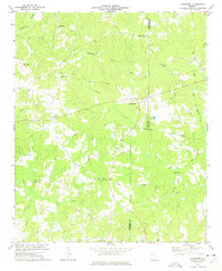
 1973 Temple1975 Print · USGSTemple and Bremen were regional hubs in the early 1970s as the rail and road networks expanded through Georgia. Local historians can trace family roots through numerous landmark churches and schools like Miller Academy, Old Concord Ch, and Liberty Cem.2 unique versions available
 - 1973 Map of Felton, 1975 Print
 1973 Felton1975 Print · USGSThe rural border of Polk and Haralson Counties is documented here in the early 1970s, showing a landscape of ridgelines and mountain valleys. Researchers can trace families and communities through landmarks like Felton, Hightower Falls, and old country churches such as Bethlehem Ch and Youngs Grove Ch.2 unique versions available
 - 1973 Map of Buchanan, 1975 Print
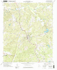 1973 Buchanan1975 Print · USGSHaralson County in the early seventies centers on the rail-side hub of Buchanan and its surrounding network of rural creek valleys. Genealogists and historians can locate numerous landmarks including Abernathys Mill, Poseyville Ch, and Estavanko Cem.2 unique versions available
 - 1973 Map of Rockmart South, 1975 Print
 1973 Rockmart South1975 Print · USGSThe industrial and rural landscape of Polk County comes into focus in the early 1970s, from the rail yards of Rockmart to the banks of the TALLAPOOSA RIVER. Researchers can trace old family settlements and local landmarks like Van Wert, Noah Chapel, and the County Line Cem.2 unique versions available
 - 1973 Map of Bremen, 1975 Print
 1973 Bremen1975 Print · USGSBremen and its surroundings in the early seventies show a landscape shaped by the intersection of the Southern and Central of Georgia railroads. Local historians can trace the development of small settlements like Budapest, Waco, and Mandeville, along with rural institutions like Bethlehem Ch and Jones Sch.2 unique versions available
 - 1975 Map of Borden Springs, 1977 Print
 1975 Borden Springs1977 Print · USGSThe Alabama and Georgia borderlands are captured in clear aerial detail during the mid-1970s. Local history enthusiasts can trace the exact buildings and road networks surrounding Borden Springs and the border settlement of Esom Hill.
 - 1975 Map of Tallapoosa South, 1977 Print
 1975 Tallapoosa South1977 Print · USGSHaralson County's timberlands and rural clearings are captured from the air during the mid-seventies. Researchers can trace the path of the Tallapoosa River and locate homesteads near Lebanon or the southern outskirts of Tallapoosa.
 - 1975 Map of Tallapoosa North, 1977 Print
 1975 Tallapoosa North1977 Print · USGSHaralson County was a patchwork of timber and small farms in the mid-1970s, as shown in this aerial orthophotoquad. Researchers can trace land use and identify early rural structures near Poplar Springs and along the winding Tallapoosa River.
 - 1975 Map of Oak Level, 1977 Print
 1975 Oak Level1977 Print · USGSEastern Cleburne County and the Georgia line are captured in this mid-1970s orthophotograph. Researchers can trace the exact patterns of rural settlement and agriculture around the community of Piney Woods at a 1:24,000 scale.
 - 1981 Map of Anniston, 1982 Print
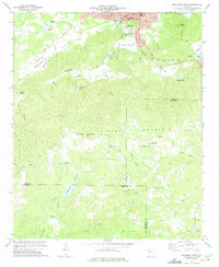
 1981 Anniston1982 Print · USGSNortheast Alabama and the Georgia borderlands come alive in the early eighties, showing a landscape of heavy industry, military outposts, and mountain forests. Genealogists and historians can trace the development of towns like Anniston and Carrollton, or locate landmarks such as Whitesides Mill and Webster Chapel.2 unique versions available
 - 2001 Map of Borden Springs, 2004 Print
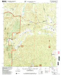 2001 Borden Springs2004 Print · USGSThe Alabama and Georgia state line meets at the turn of the millennium in this detailed survey of the Cleburne and Polk county borderlands. Genealogists and historians can trace old homesteads and local landmarks like Tecumseh Furnace, New Bethel Ch, and Borden Springs.
Showing maps 1-25 of 80
Top cities of Haralson County
Frequently asked questions
- What are the different types of historical maps available for Haralson County?
- What is the oldest map of Haralson County?
- Where can I purchase historical maps of Haralson County for my home or office?
- Where can I download high-res historical maps of Haralson County?
- Are there historical topographic maps available for Haralson County?
- Is there historical aerial imagery available for Haralson County?
- Where are historical maps of Haralson County sourced from?