1950s Maps of Lowndes County, Georgia
Explore 8 historic maps of Lowndes County from the 1950s. These maps offer a rare glimpse into what life looked like during the 1950s — showing old roads, neighborhoods, homes, and landmarks that have changed or disappeared over time.
Whether you're researching your family's past, planning a metal detecting trip, or studying how Lowndes County's landscape evolved across the 1950s, these high-resolution maps are a powerful tool for exploring the history of this region.
- Focus on a specific era: All maps on this page are from the 1950s, giving you a focused view of this time period.
- See what’s changed: Compare century-old streets, trails, and buildings to today's modern landscape using overlays and satellite layers.
- Research with precision: Use these maps for genealogy, historical research, land use analysis, or educational projects.
- View, download, or print: Maps are fully viewable online in high resolution, and can be downloaded or printed for your own records.
Start exploring Lowndes County's history through authentic maps from the 1950s. This is your window into the past.
Lowndes County, GA maps
(8)- 1953 Map of Waycross, 1967 Print
 1953 Waycross1967 Print · USGSSouth Georgia's agricultural and rail heartland is captured here in the mid-1950s, showing a vast network of timber and farming towns. Researchers can trace the rail lines connecting Waycross and Tifton or locate landmarks like Jefferson Davis State Park and Lake Blackshear.2 unique versions available
 - 1954 Map of Valdosta, 1967 Print
 1954 Valdosta1967 Print · USGSThe South Georgia and North Florida borderlands are captured here in the mid-fifties, showing the deep timber and wetland networks of the coastal plain. Researchers can trace the path of the Atlantic Coast Line through Valdosta or explore the interior of the Okefenokee Swamp.2 unique versions available
 - 1956 Map of Clyattville, 1957 Print
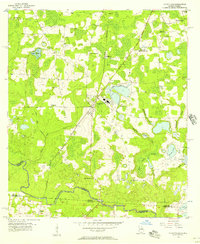 1956 Clyattville1957 Print · USGSThe Georgia-Florida border country comes into focus in the mid-fifties, centered on the railroad town of Clyattville. Genealogists can trace family roots at Forest Grove Cem and numerous rural houses of worship like Benevolence Ch.3 unique versions available
 - 1956 Map of Nankin, 1957 Print
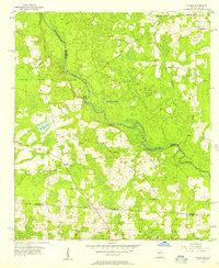 1956 Nankin1957 Print · USGSGeorgia's border with Florida in the mid-fifties is defined by the winding Withlacoochee River and a landscape of rural congregations. Genealogists can trace family roots through numerous sites like Redland Cem, Antioch Ch, and the settlement of Nankin.2 unique versions available
 - 1956 Map of Octahatchee, 1958 Print
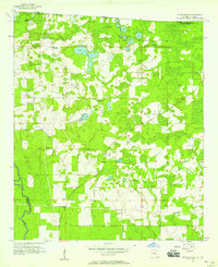 1956 Octahatchee1958 Print · USGSThe Florida-Georgia borderlands near the mid-century were a landscape of cypress swamps and quiet rural outposts. Genealogists can locate family landmarks like McCall Cem and Blair Cem or trace the community around Bellville High Sch and Triumph Ch.2 unique versions available
 - 1958 Map of Valdosta
 1958 Valdosta1958 Print · USGSSouth Georgia and North Florida are captured here in the mid-fifties, showing the vast Okefenokee Swamp and the vital timber and rail corridors connecting the two states. Researchers can locate the footprint of Moody Air Force Base, trace the Live Oak Perry and Gulf railroad, or find early community sites like Bakers Mill and Paradise Church.
 - 1958 Map of Waycross
 1958 Waycross1958 Print · USGSSoutheast Georgia in the late fifties remains a landscape of deep river basins and vital rail junctions. Genealogists and historians can trace family-named landmarks and rural hubs like Union Church, South Georgia College, and the sprawling Okefenokee Swamp.2 unique versions available
 - 1959 Map of Valdosta
 1959 Valdosta1959 Print · USGSThe Georgia-Florida borderlands in the mid-fifties reveal a landscape of massive blackwater swamps and emerging military aviation hubs. Genealogists and historians can trace rail-stop towns like Fargo and Stockton or explore the interior reaches of the Okefenokee Swamp and Billys Island.
End of results
Showing maps 1-8 of 8
Top cities of Lowndes County
- Valdosta historical maps
- Hahira historical maps
- Remerton historical maps
- Dasher historical maps
- Lake Park historical maps
Frequently asked questions
- What are the different types of historical maps available for Lowndes County?
- What is the oldest map of Lowndes County?
- Where can I purchase historical maps of Lowndes County for my home or office?
- Where can I download high-res historical maps of Lowndes County?
- Are there historical topographic maps available for Lowndes County?
- Is there historical aerial imagery available for Lowndes County?
- Where are historical maps of Lowndes County sourced from?