1960s Maps of Lowndes County, Georgia
Explore 5 historic maps of Lowndes County from the 1960s. These maps offer a rare glimpse into what life looked like during the 1960s — showing old roads, neighborhoods, homes, and landmarks that have changed or disappeared over time.
Whether you're researching your family's past, planning a metal detecting trip, or studying how Lowndes County's landscape evolved across the 1960s, these high-resolution maps are a powerful tool for exploring the history of this region.
- Focus on a specific era: All maps on this page are from the 1960s, giving you a focused view of this time period.
- See what’s changed: Compare century-old streets, trails, and buildings to today's modern landscape using overlays and satellite layers.
- Research with precision: Use these maps for genealogy, historical research, land use analysis, or educational projects.
- View, download, or print: Maps are fully viewable online in high resolution, and can be downloaded or printed for your own records.
Start exploring Lowndes County's history through authentic maps from the 1960s. This is your window into the past.
Lowndes County, GA maps
(5)- 1961 Map of Hahira East, 1964 Print
 1961 Hahira East1964 Print · USGSIn the early sixties, this area north of Valdosta shows a landscape of traditional agriculture beginning to meet modern highway development. Genealogists can locate family landmarks like Passmore Cem, Jerusalem Ch, and the rural community at Mineola.4 unique versions available
 - 1961 Map of Valdosta, 1965 Print
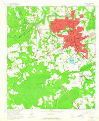 1961 Valdosta1965 Print · USGSValdosta and its surrounding Lowndes County communities are captured in the early sixties as a thriving center of Georgia education and industry. Researchers can trace the footprints of Valdosta State College, locate family sites near Riverhill Cem, or follow the ATLANTIC COAST LINE through West Valdosta.4 unique versions available
 - 1961 Map of Hahira West, 1965 Print
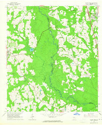 1961 Hahira West1965 Print · USGSBrooks and Lowndes counties in the early sixties reveal a landscape of rural schoolhouses and historic travel routes. Genealogists can locate family burial grounds and congregations like Miller Cem, Second Elizabeth Ch, and the Webb-Miller Sch along the Little River.2 unique versions available
 - 1961 Map of Ousley, 1965 Print
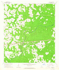 1961 Ousley1965 Print · USGSBrooks and Lowndes counties at the start of the sixties were defined by the winding Withlacoochee River and the steady pulse of the Atlantic Coast Line. Researchers can trace the layout of small rural centers like Ousley and Durden or locate historic congregation sites such as Philadelphia Ch.2 unique versions available
 - 1968 Map of Naylor, 1971 Print
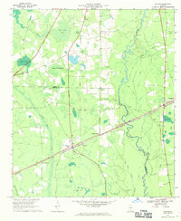 1968 Naylor1971 Print · USGSThe borderlands of Lowndes and Lanier counties are captured here in the late sixties, where the railroad and river define the rural pace of life. Genealogists and local historians can locate St Marys Ch, the community at Naylor, and Foreman Cem.3 unique versions available
End of results
Showing maps 1-5 of 5
Top cities of Lowndes County
- Valdosta historical maps
- Hahira historical maps
- Remerton historical maps
- Dasher historical maps
- Lake Park historical maps
Frequently asked questions
- What are the different types of historical maps available for Lowndes County?
- What is the oldest map of Lowndes County?
- Where can I purchase historical maps of Lowndes County for my home or office?
- Where can I download high-res historical maps of Lowndes County?
- Are there historical topographic maps available for Lowndes County?
- Is there historical aerial imagery available for Lowndes County?
- Where are historical maps of Lowndes County sourced from?