1970s Maps of Danielsville, Georgia
Explore 3 historic maps of Danielsville from the 1970s. These maps offer a rare glimpse into what life looked like during the 1970s — showing old roads, neighborhoods, homes, and landmarks that have changed or disappeared over time.
Whether you're researching your family's past, planning a metal detecting trip, or studying how Danielsville's landscape evolved across the 1970s, these high-resolution maps are a powerful tool for exploring the history of this region.
- Focus on a specific era: All maps on this page are from the 1970s, giving you a focused view of this time period.
- See what’s changed: Compare century-old streets, trails, and buildings to today's modern landscape using overlays and satellite layers.
- Research with precision: Use these maps for genealogy, historical research, land use analysis, or educational projects.
- View, download, or print: Maps are fully viewable online in high resolution, and can be downloaded or printed for your own records.
Start exploring Danielsville's history through authentic maps from the 1970s. This is your window into the past.
Danielsville, GA maps
(3)- 1972 Map of Danielsville South, 1974 Print
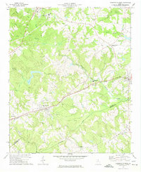 1972 Danielsville South1974 Print · USGSMadison County's agricultural and transit corridors are captured here during the 1970s. Genealogists and historians can trace family locations through numerous rural landmarks like Collier Ch, the Hitchcock Cem, and the path of the Seaboard Coast Line railroad.
 - 1972 Map of Danielsville North, 1974 Print
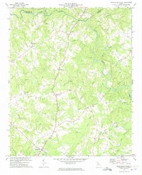 1972 Danielsville North1974 Print · USGSMadison County's rural character is preserved here in the early seventies, showing a landscape of river-fed valleys and quiet crossroads. Genealogists can trace family ties at Bethel Cem, Jones Chapel, and the historic county seat of Danielsville.2 unique versions available
 - 1979 Map of Commerce, 1980 Print
 1979 Commerce1980 Print · USGSThe Georgia and South Carolina Piedmont reached a period of significant regional growth in the late seventies. Genealogists and historians can trace family roots through locations like Blackberry Church, Old Pioneer Cem, and the Gillsville Sch.2 unique versions available
End of results
Showing maps 1-3 of 3
Top cities near Danielsville
- Athens historical maps
- Commerce historical maps
- Royston historical maps
- Nicholson historical maps
- Winterville historical maps
- Comer historical maps
See more
Frequently asked questions
- What are the different types of historical maps available for Danielsville?
- What is the oldest map of Danielsville?
- Where can I purchase historical maps of Danielsville for my home or office?
- Where can I download high-res historical maps of Danielsville?
- Are there historical topographic maps available for Danielsville?
- Is there historical aerial imagery available for Danielsville?
- Where are historical maps of Danielsville sourced from?