Old Maps of McIntosh County, Georgia for Metal Detecting
Plan your next treasure hunt with 140 historic maps of McIntosh County. Find old homesites, ghost towns, trails, and gathering spots that may be lost to time — perfect for identifying promising metal detecting locations.
- Locate forgotten sites: Uncover places like long-lost settlements, abandoned rail lines, or gathering spots.
- Plan better hunts: Use map overlays combined with LiDAR or satellite views to narrow in on historically rich areas.
- Made for detectorists: Thousands of hobbyists use these maps to discover relics, coins, and hidden history.
Use these historic maps to boost your research and find new opportunities beneath the surface of McIntosh County.
McIntosh County, GA maps
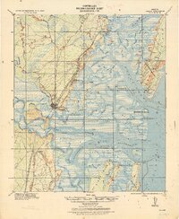
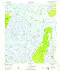
(140)- 1918 Map of Everett City
 1918 Everett City1918 Print · USGSCoastal Georgia at the end of the Great War was a world of vast river swamps and emerging rail junctions. Genealogists and historians can trace family locations through isolated landmarks like Bull Island School, the Ft Barrington Ferry, and the timber-driven siding at Thalmann.2 unique versions available
 - 1920 Map of Sapelo River
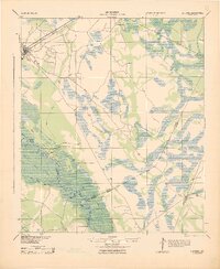
 1920 Sapelo River1920 Print · USGSCoastal McIntosh and Liberty counties were a network of tidal rivers and timber-line railroads during the early twentieth century. Genealogists and historians can trace rail stops like Brewsters Siding, the winding course of the Julienton River, and the landing at Sutherland Bluff.
 - 1920 Map of Cabretta Island
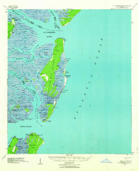
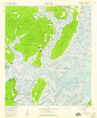
 1920 Cabretta Island1920 Print · USGSCoastal Georgia's barrier islands appear in this post-World War I military survey, showing the intricate marsh and beach terrain. Researchers can locate early triangulation points like Palm 1902 and land features including Sand Hill and Art Well.
 - 1920 Map of Everett City, 1944 Print
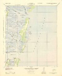
 1920 Everett City1944 Print · USGSCoastal Glynn County was a hub of railroad and river activity during the early twentieth century. Researchers can trace family-named landings and vanished rail stops like Thalmann, the Union Industrial School, and the historic Ft Barrington Ferry.
 - 1921 Map of Darien, 1937 Print
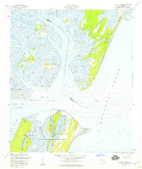
 1921 Darien1937 Print · USGSThe Georgia coast near Darien is captured here in the years following the Great War, showing a landscape defined by rice milling and rail. Genealogists can locate family landmarks like Patterson and Meridian, or industrial sites such as the Butler Rice Mill Chimney.
 - 1928 Map of St Catherines Island
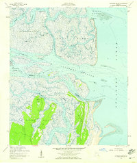
 1928 St Catherines Island1928 Print · USGSCoastal Georgia's intricate barrier islands and marshes are captured here in the early twentieth century. Genealogists and historians can locate specific sites like Bakers House & Chimney, the Quarantine Stack, and Harris.
 - 1943 Map of Ludowici
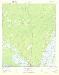
 1943 Ludowici1943 Print · USGSCoastal Georgia in the early 1940s is defined by the winding Altamaha River and the vital rail junctions at Ludowici. Family historians can trace rural settlements like Bobtown and Upper Sensavilla or locate unique landmarks like the Wreck of Louise.4 unique versions available
 - 1943 Map of St Catherines Island, 1963 Print
 1943 St Catherines Island1963 Print · USGSCoastal Liberty County is seen here during the Second World War, showing the detailed shoreline from Ossabaw Island to Sapelo Island. Researchers can find landmark homesteads like Bakers House N Chimney and maritime sites including the Quarantine Flagstaff.2 unique versions available
 - 1943 Map of Sapelo River, 1964 Print
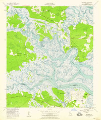
 1943 Sapelo River1964 Print · USGSCoastal McIntosh and Liberty counties appear here during the mid-century, defined by a labyrinth of tidal waterways and remote island settlements. Researchers can trace the legacy of old rail stops and road junctions like Warsaw, Brewsters Siding, and Eulonia Station.
 - 1944 Map of Everett City
 1944 Everett City1944 Print · USGSCoastal Georgia during the mid-forties was a world of rail junctions and river landings tied to the Altamaha. Genealogists and historians can trace rail-side communities like Everett City, rural schoolhouses including Bull Island Sch, and the site of the Fort Barrington Ferry.
 - 1944 Map of Cabretta Island
 1944 Cabretta Island1944 Print · USGSCoastal McIntosh County is captured here in the mid-1940s, showing the intricate barrier island geography before significant modern development. Genealogists and historians can trace family-named points and landmarks like Brinson, Lowe, and the Art Well along the shore of Sapelo Island.
 - 1945 Map of St. Catherine's Island
 1945 St. Catherine's Island1945 Print · USGSThe Georgia coast remained a wild expanse of tidal rivers and barrier islands in the years following the war. Genealogists and researchers can trace family landmarks like Bakers House N Chimney and the strategic maritime infrastructure on Black Beard Island.
 - 1945 Map of Sapelo River
 1945 Sapelo River1945 Print · USGSCoastal Georgia in the mid-1940s reveals a landscape of tidal rivers and strategic military outposts. Genealogists and historians can trace rail-side settlements like Brewsters Siding and Eulonia Station or locate the Harris Neck Bombing Range and Crescent Station PO.
 - 1946 Map of Brunswick, 1948 Print
 1946 Brunswick1948 Print · USGSCoastal Georgia in the mid-forties reveals a landscape defined by the Camp Stewart Military Reservation and the sprawling barrier islands. Genealogists and historians can trace the rail-and-river network through inland towns like Ludowici and Jesup, or locate coastal landmarks like the St Simon Light.
 - 1948 Map of Brunswick
 1948 Brunswick1948 Print · USGSCoastal Georgia in the late 1940s is defined here by its labyrinthine barrier islands and the massive footprint of Camp Stewart. Genealogists and historians can trace the rail-tied growth of Jesup and Hinesville or locate coastal landmarks like St Simon Light.
 - 1954 Map of St Catherines Sound, 1958 Print
 1954 St Catherines Sound1958 Print · USGSCoastal Georgia's intricate salt marshes and barrier islands are captured in the mid-1950s, showing a landscape defined by tidal rivers and the Intracostal Waterway. You can trace old landing sites and local infrastructure like the Yellow Bluff Fishing Camp, Youmans Landing Field, and several island Artesian Wells.2 unique versions available
 - 1954 Map of Sapelo Sound, 1959 Print
 1954 Sapelo Sound1959 Print · USGSThe Georgia coast in the mid-fifties reveals an intricate network of sea islands and tidal marshes before modern development altered the shoreline. Genealogists and historians can trace family-named landmarks and remote artesian wells across Sapelo Island, Blackbeard Island, and Wahoo Island.3 unique versions available
 - 1954 Map of Altamaha Sound, 1959 Print
 1954 Altamaha Sound1959 Print · USGSThe Georgia coast at the edge of the Atlantic was a labyrinth of tidal marshes and remote island outposts in the mid-1950s. Genealogists and coastal historians can trace early landmarks like Butler Point, the winding Intracoastal Waterway, and the pristine stretches of the Wolf Island National Wildlife Refuge.2 unique versions available
 - 1954 Map of Doboy Sound, 1959 Print
 1954 Doboy Sound1959 Print · USGSThe Georgia coast in the mid-1950s is mapped here in detail, from the mainland fishing village of Valona to the private reaches of Sapelo Island. Genealogists and historians can trace family-named sites like Hog Hammock, Patterson Island, and Elm Grove Ch.2 unique versions available
 - 1954 Map of Seabrook, 1959 Print
 1954 Seabrook1959 Print · USGSCoastal Liberty County in the mid-1950s is a landscape of tidal rivers and historic landings at the edge of the Atlantic. Genealogists and historians can trace the foundations of Sunbury, locate the Lebanon Cem, and study the layout of the Harris Neck Airfield.2 unique versions available
 - 1954 Map of Shellman Bluff, 1959 Print
 1954 Shellman Bluff1959 Print · USGSMcIntosh County’s intricate coastline is preserved here in the mid-fifties, showing the tidal rivers and fishing bluffs of the Georgia Lowcountry. Genealogists and historians can trace family-named sites like Shellman Bluff, rural centers like Crescent, and several Artesian Wells.2 unique versions available
 - 1954 Map of Ridgeville, 1959 Print
 1954 Ridgeville1959 Print · USGSCoastal Georgia in the mid-fifties is captured here during a time of river-based commerce and quiet marshland settlements. Genealogists and historians can trace family locations through St Andrews Cem, the Tolomato Spanish Mission Ruins, and small communities like Ardick and Ashintilly.2 unique versions available
 - 1954 Map of Cabretta Inlet, 1959 Print
 1954 Cabretta Inlet1959 Print · USGSThe Georgia barrier islands and their tidal marshes are captured here in the mid-1950s, showing the early boundaries of conservation and local settlement. Researchers can trace the layout of Raccoon Bluff or examine the maritime reaches of Blackbeard Shoal and Cabretta Inlet.
 - 1955 Map of Riceboro, 1959 Print
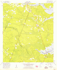 1955 Riceboro1959 Print · USGSCoastal Georgia in the mid-fifties is defined here by the intersection of the Seaboard Air Line Railroad and the vast marshlands of Liberty and McIntosh Counties. Researchers can locate community centers like Riceboro, the First African Ch, and long-standing family landmarks such as Pando Cem.2 unique versions available
 - 1955 Map of Eulonia, 1959 Print
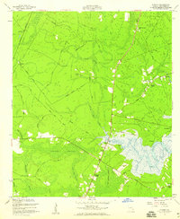 1955 Eulonia1959 Print · USGSCoastal McIntosh County in the mid-1950s is a landscape of tidal rivers and deep swamps tied together by rural roads and timber grades. Researchers can locate family landmarks like Youngs Cem, the Shorter Chapel, and the community at Fairhope.
Showing maps 1-25 of 140
Top cities of McIntosh County
Frequently asked questions
- What are the different types of historical maps available for McIntosh County?
- What is the oldest map of McIntosh County?
- Where can I purchase historical maps of McIntosh County for my home or office?
- Where can I download high-res historical maps of McIntosh County?
- Are there historical topographic maps available for McIntosh County?
- Is there historical aerial imagery available for McIntosh County?
- Where are historical maps of McIntosh County sourced from?