1930s Maps of Raleigh, Georgia
Explore 2 historic maps of Raleigh from the 1930s. These maps offer a rare glimpse into what life looked like during the 1930s — showing old roads, neighborhoods, homes, and landmarks that have changed or disappeared over time.
Whether you're researching your family's past, planning a metal detecting trip, or studying how Raleigh's landscape evolved across the 1930s, these high-resolution maps are a powerful tool for exploring the history of this region.
- Focus on a specific era: All maps on this page are from the 1930s, giving you a focused view of this time period.
- See what’s changed: Compare century-old streets, trails, and buildings to today's modern landscape using overlays and satellite layers.
- Research with precision: Use these maps for genealogy, historical research, land use analysis, or educational projects.
- View, download, or print: Maps are fully viewable online in high resolution, and can be downloaded or printed for your own records.
Start exploring Raleigh's history through authentic maps from the 1930s. This is your window into the past.
Raleigh, GA maps
(2)- 1934 Map of Warm Springs, 1958 Print
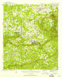 1934 Warm Springs1958 Print · USGSWest-central Georgia at the height of the New Deal era reveals a landscape of therapeutic springs, mountain gaps, and busy rail junctions. Genealogists and historians can locate family landmarks like Williams Chapel, the Warm Springs Foundation, and Chalybeate Springs along the rugged Pine Mountain ridge.7 unique versions available
 - 1936 Map of Warm Springs
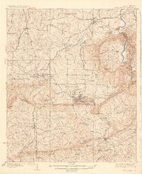 1936 Warm Springs1936 Print · USGSWest-central Georgia at the height of the New Deal era centers on the therapeutic and institutional development of Warm Springs. Researchers can trace the rail-and-road network connecting Manchester and Woodbury or locate landmarks like the Warm Springs Foundation and Ebenezer Cem.4 unique versions available
End of results
Showing maps 1-2 of 2
Top cities near Raleigh
- Manchester historical maps
- Hogansville historical maps
- Pine Mountain historical maps
- Woodbury historical maps
- Greenville historical maps
- Hamilton historical maps
See more
Frequently asked questions
- What are the different types of historical maps available for Raleigh?
- What is the oldest map of Raleigh?
- Where can I purchase historical maps of Raleigh for my home or office?
- Where can I download high-res historical maps of Raleigh?
- Are there historical topographic maps available for Raleigh?
- Is there historical aerial imagery available for Raleigh?
- Where are historical maps of Raleigh sourced from?