Old Maps of Morgan County, Georgia for Academic Research
Study the evolution of Morgan County with 92 high-resolution historic maps. Whether you're teaching, researching, or modeling changes in land use, these maps provide essential visual documentation of urban, environmental, and geographic change.
- Analyze long-term change: Track patterns in development, transportation, and natural features.
- Ideal for environmental or urban studies: Support academic projects with primary historical map data.
- Use in the classroom or lab: Educators and researchers rely on these maps to bring historical context to life.
These maps are a powerful tool for teaching, research, and visualizing how Morgan County has changed over the decades.
Morgan County, GA maps
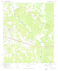
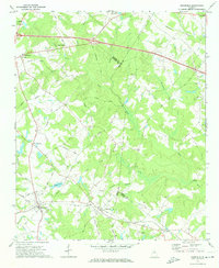
(92)- 1896 Map of Monroe
 1896 Monroe1896 Print · USGSNorth-central Georgia thrives during the late nineteenth century as a hub of river-powered industry and rail expansion. Genealogists and historians can trace family locations near Salem Camp Ground, the local commerce at Carithers Store, and several early crossings like Bells Bridge.5 unique versions available
 - 1953 Map of Athens, 1966 Print
 1953 Athens1966 Print · USGSGeorgia's Piedmont and Savannah River borderlands come alive in this mid-century survey of the region surrounding Athens and Augusta. Trace the rail-and-river economy through the Georgia RR and landmarks like the Fort Gordon Military Reservation.3 unique versions available
 - 1958 Map of Athens
 1958 Athens1958 Print · USGSNorth-central Georgia and the Savannah River valley are captured in the late fifties, showing the region as the new reservoirs were filling. Researchers can trace historic rail lines like the Georgia RR and locate rural landmarks such as Social Circle, Graves Mountain, and the Fort Gordon Military Reservation.
 - 1959 Map of Athens
 1959 Athens1959 Print · USGSNortheast Georgia and the South Carolina borderlands appear here in the mid-fifties, during a decade of infrastructure growth. Genealogists and historians can trace the rail-and-river geography of towns like Social Circle, the sprawl of Fort Gordon Military Reservation, and the newly formed Clark Hill Reservoir.
 - 1963 Map of Athens
 1963 Athens1963 Print · USGSGeorgia's Piedmont and the Savannah River valley are captured in the early sixties as major reservoirs and military installations reshaped the landscape. Researchers can trace the development of Clark Hill Reservoir, locate the Fort Gordon Military Reservation, and find historic towns like Social Circle and Eatonton.
 - 1964 Map of High Shoals, 1965 Print
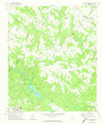
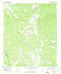
 1964 High Shoals1965 Print · USGSWalton and Oconee counties are separated by the winding Apalachee River in the mid-1960s, showing a landscape of small farms and family cemeteries. Researchers can trace rural landmarks like Good Hope Peters Sch, Snows Mill, and Carlton Cem.2 unique versions available
 - 1964 Map of Watkinsville, 1965 Print
 1964 Watkinsville1965 Print · USGSCentral Georgia in the mid-1960s was defined by the rail corridor connecting Watkinsville to Farmington. Researchers can trace old family burial grounds like Klotts Cem and rural meeting places such as Brown Chapel or the Stroud Sch.3 unique versions available
 - 1971 Map of Rutledge North, 1974 Print
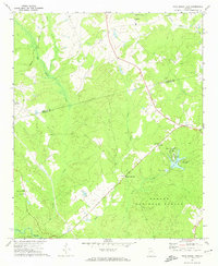
 1971 Rutledge North1974 Print · USGSThe rural communities of Morgan and Walton Counties are captured here in the early 1970s, from the streets of Bostwick to the recreation areas at Lake Rutledge. Genealogists and local historians can trace legacy landmarks like Gibbs Memorial Ch, Chestnut Grove Ch, and the crossroads at Fairplay.2 unique versions available
 - 1971 Map of Social Circle, 1974 Print
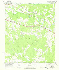
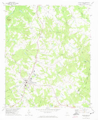 1971 Social Circle1974 Print · USGSSocial Circle and its neighboring rural communities are captured here in the early seventies, centered on the Georgia Railroad corridor. Researchers can locate family landmarks like Annie Mary Ch, Circle View Cem, and the small settlement of Herndonville.3 unique versions available
 - 1972 Map of Buckhead, 1974 Print
 1972 Buckhead1974 Print · USGSThe Oconee and Apalachee rivers meet in this Georgia Piedmont landscape during the early seventies. Genealogists can trace family landmarks like Mt Zion Ch, Moses Chapel, and rural settlements such as Swords and Buckhead along the Georgia railroad line.2 unique versions available
 - 1972 Map of Shady Dale, 1974 Print
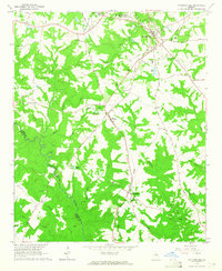
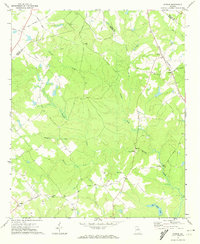
 1972 Shady Dale1974 Print · USGSJasper and Morgan County crossroads are preserved here during the early seventies, centered on the rail-based growth of Shady Dale and Machen. Researchers can trace old family sites and local landmarks like Pleasant Grove Ch and the Central of Georgia rail line.2 unique versions available
 - 1972 Map of Apalachee, 1974 Print
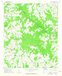
 1972 Apalachee1974 Print · USGSMorgan County and its neighbors are captured here in the early 1970s, showcasing a rural landscape defined by the Apalachee River and small rail-side towns. Genealogists can trace family landmarks like Malloy Chapel, Flat Rock Ch, and the local Cem sites found near Bostwick.2 unique versions available
 - 1972 Map of Harmony, 1974 Print
 1972 Harmony1974 Print · USGSThe Putnam County Piedmont is captured here in the early seventies, as the Oconee National Forest and Oconee River frame rural life. Genealogists can trace family roots at Lone Oak Ch, Ward Chapel, and several scattered cemeteries.3 unique versions available
 - 1972 Map of Rock Eagle Lake, 1974 Print
 1972 Rock Eagle Lake1974 Print · USGSPutnam and Morgan counties in the early seventies reveal a mix of public forest and deep-rooted rural communities. Researchers can trace land tracts near Reids Crossroads, locate the Rock Eagle Monument, and find rural churches like Springfield Ch.
 - 1972 Map of Rutledge South, 1974 Print
 1972 Rutledge South1974 Print · USGSMorgan County is shown in the early seventies as a rural landscape of scattered communities and creek-fed bottomlands. Genealogists and historians can trace family locations through numerous landmarks like Macedonia Ch, Clack Bridge, and Monleys Chapel.2 unique versions available
 - 1972 Map of Farrar, 1974 Print
 1972 Farrar1974 Print · USGSJasper and Newton counties are captured here in the early 1970s, showing a rural landscape of winding creeks and country crossroads. Genealogists can trace family landmarks like Pitts Chapel, Shiloh Ch, and the small community of Farrar along the Central of Georgia rail line.2 unique versions available
 - 1972 Map of Greshamville, 1974 Print
 1972 Greshamville1974 Print · USGSGreene County is captured in the early 1970s, showcasing a landscape defined by the Oconee River and forest land. Genealogists can locate rural landmarks like New Hope Ch, Fork Chapel, and the historic site at Scull Shoals Historic Area.2 unique versions available
 - 1972 Map of Mansfield, 1974 Print
 1972 Mansfield1974 Print · USGSNewton County in the early seventies remains a landscape of rail-connected towns and country churches. Genealogists can trace family names and old landmarks across the Central of Georgia line between Mansfield and the historic Brick Store settlement.2 unique versions available
 - 1972 Map of Madison, 1974 Print
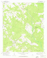
 1972 Madison1974 Print · USGSMadison and its rural surroundings are captured in the early 1970s, showcasing a landscape where traditional rail-lines meet modern development. Genealogists and historians can trace numerous rural congregations like Smyrna Ch and schools such as Pearl Jr High Sch.2 unique versions available
 - 1980 Map of Athens, 1981 Print
 1980 Athens1981 Print · USGSNorth Georgia in the early eighties exhibits a landscape of growing university towns and deep-rooted rail hubs. Genealogists can trace family lands near Social Circle or Watkinsville while following the routes of the Central of Georgia and the Appalachee River.2 unique versions available
 - 1981 Map of Milledgeville
 1981 Milledgeville1981 Print · USGSMiddle Georgia in the early eighties shows a landscape shaped by major reservoirs and deep forests. Genealogists and historians can trace the rail networks of the Southern and Central of Georgia through towns like Monticello and Eatonton.2 unique versions available
 - 1988 Map of Athens
 1988 Athens1988 Print · USGSThe Georgia Piedmont and South Carolina borderlands appear in the late eighties as a landscape of vast reservoirs and growing towns. Researchers can trace the legacy of the Georgia RR connecting Athens and Augusta, or locate landmarks within Oconee National Forest.
 - 2011 Map of Madison, 2011 Print
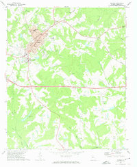
 2011 Madison2011 Print · USGSCovers Morgan County, including Madison, Smyrna, and other nearby areas
 - 2011 Map of Apalachee, 2011 Print
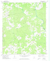
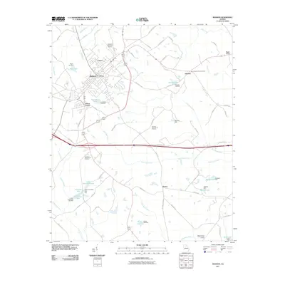
 2011 Apalachee2011 Print · USGSCovers Morgan County, including Bostwick, Apalachee, and other nearby areas
 - 2011 Map of Watkinsville, 2011 Print
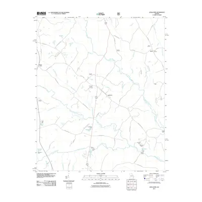
 2011 Watkinsville2011 Print · USGSCovers Morgan County, including Watkinsville, North High Shoals, and other nearby areas
Showing maps 1-25 of 92
Top cities of Morgan County
Frequently asked questions
- What are the different types of historical maps available for Morgan County?
- What is the oldest map of Morgan County?
- Where can I purchase historical maps of Morgan County for my home or office?
- Where can I download high-res historical maps of Morgan County?
- Are there historical topographic maps available for Morgan County?
- Is there historical aerial imagery available for Morgan County?
- Where are historical maps of Morgan County sourced from?