1950s Maps of Murray County, Georgia
Explore 5 historic maps of Murray County from the 1950s. These maps offer a rare glimpse into what life looked like during the 1950s — showing old roads, neighborhoods, homes, and landmarks that have changed or disappeared over time.
Whether you're researching your family's past, planning a metal detecting trip, or studying how Murray County's landscape evolved across the 1950s, these high-resolution maps are a powerful tool for exploring the history of this region.
- Focus on a specific era: All maps on this page are from the 1950s, giving you a focused view of this time period.
- See what’s changed: Compare century-old streets, trails, and buildings to today's modern landscape using overlays and satellite layers.
- Research with precision: Use these maps for genealogy, historical research, land use analysis, or educational projects.
- View, download, or print: Maps are fully viewable online in high resolution, and can be downloaded or printed for your own records.
Start exploring Murray County's history through authentic maps from the 1950s. This is your window into the past.
Murray County, GA maps
(5)- 1951 Map of Calhoun
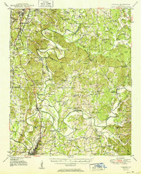 1951 Calhoun1951 Print · USGSMid-century Northwest Georgia reveals a landscape defined by the convergence of the Conasauga and Coosawattee rivers near the historic town of CALHOUN. Genealogists and historians can locate the Resaca Confederate Cemetery, the Cherokee Indian Memorial, and the Echota Village settlement.2 unique versions available
 - 1955 Map of Rome
 1955 Rome1955 Print · USGSThe tri-state borderlands of Georgia, Alabama, and Tennessee appear in the mid-fifties as a landscape of ridge-and-valley industry and river navigation. Genealogists can trace family footprints near Chattanooga, the iron works of Gadsden, and textile towns like Trion or Summerville.
 - 1958 Map of Rome, 1966 Print
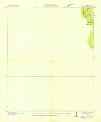
 1958 Rome1966 Print · USGSNorthwest Georgia and neighboring Tennessee and Alabama are captured here in the late fifties, showcasing a landscape of high ridges and river valleys. Researchers can trace historic rail lines like the Seaboard Air Line RR and explore the bounds of Cloudland Canyon State Park or Fort Oglethorpe.3 unique versions available
 - 1959 Map of Dyer Gap
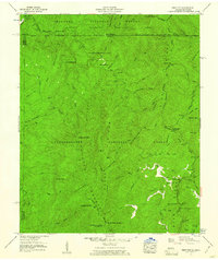
 1959 Dyer Gap1959 Print · USGSThe high ridges of Fannin and Gilmer counties are captured in the mid-twentieth century just as the forest service infrastructure was firmly established. Researchers can trace the old trail networks and mountain passes such as Dyer Gap and Newt Gap, or locate the Flat Top Fire Tower.3 unique versions available
 - 1959 Map of Hemp Top, 1961 Print
 1959 Hemp Top1961 Print · USGSThe high ridges of the Georgia-Tennessee border are documented here in the late fifties, where forest management and deep river valleys meet. Genealogists and hikers can trace old landmarks like Jones Cem, Bethlehem Ch, and the Pounding Mill site.4 unique versions available
End of results
Showing maps 1-5 of 5
Top cities of Murray County
Frequently asked questions
- What are the different types of historical maps available for Murray County?
- What is the oldest map of Murray County?
- Where can I purchase historical maps of Murray County for my home or office?
- Where can I download high-res historical maps of Murray County?
- Are there historical topographic maps available for Murray County?
- Is there historical aerial imagery available for Murray County?
- Where are historical maps of Murray County sourced from?