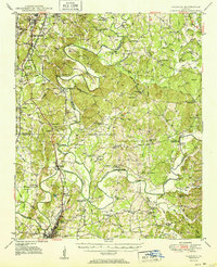
1951 Map of Calhoun
USGS Topo · Published 1951About this map
The Oostanaula River system and its major tributaries, the Conasauga River and Coosawattee River, converge here in North Georgia, creating a complex water-bound landscape that has shaped local history for centuries. In the early 1950s, the terrain south of Tilton remains deeply marked by its past, most notably at the Resaca Confederate Cemetery and the historic Resaca settlement. The cultural geography reflects a significant indigenous heritage, preserved in the map's notation of the Cherokee Indian Memorial, Echota Village, and an Indian Cemetery near the riverbanks.
Find a feature on this map
123 named features on this map. Tap any name to fly to it.
Don’t see what you’re looking for? This feature index may not catch every label — zoom into the map to look around manually.
Map Details
Editions of this 1951 Calhoun Map
2 editions found
Other maps of this area

1886 · Dalton
USGS Topo · 1:125,000

1886 · Ringgold
USGS Topo · 1:125,000

1886 · Rome
USGS Topo · 1:125,000

1890 · Cartersville
USGS Topo · 1:125,000

1891 · Cartersville
USGS Topo · 1:125,000

1892 · Ringgold
USGS Topo · 1:125,000

1892 · Dalton
USGS Topo · 1:125,000

1896 · Cartersville
USGS Topo · 1:125,000

1897 · Dalton
USGS Topo · 1:125,000

1898 · Rome
USGS Topo · 1:125,000