Old Maps of Murray County, Georgia for Genealogy
Trace your family roots with 98 historic maps of Murray County. These high-res maps reveal old neighborhoods, homesites, landmarks, and streets — helping you uncover where your ancestors lived and how the area evolved over time.
- Explore historic neighborhoods: Identify where your relatives may have lived in the 1800s or 1900s.
- Compare maps over time: Trace the changes in streets, buildings, and landmarks for multi-generational research.
- Perfect for genealogy & ancestry research: Used by family historians and researchers to map out lineage and migration.
These maps are an incredible resource for exploring your personal connection to Murray County's past.
Murray County, GA maps
(98)- 1886 Map of Dalton
 1886 Dalton1886 Print · USGSNorthwest Georgia in the 1880s is a landscape of mountain gaps and vital river ferries. Trace family roots and vanished infrastructure from Dalton to Spring Place, including named landmarks like Shackelfords Ferry and Fort Mountain.
 - 1892 Map of Dalton
 1892 Dalton1892 Print · USGSNorthwest Georgia in the late nineteenth century was defined by its river crossings and the emerging rail lines through Dalton. Researchers can trace the Federal Road and locate family landmarks like Newtown Ferry or Talking Rock Mills.
 - 1897 Map of Dalton
 1897 Dalton1897 Print · USGSNorthwest Georgia in the late nineteenth century was a rugged landscape of river crossings and mountain gaps. Genealogists can trace early homesteads and commerce at Praters Mill, Spring Place, and historic river crossings like Montgomery Ferry.4 unique versions available
 - 1911 Map of Cohutta Mtn
 1911 Cohutta Mtn1911 Print · USGSThe Georgia-Tennessee borderlands in the early twentieth century were defined by mountain rail and timber. Genealogists can trace family roots through settlements like Tennga and Crandall or locate historic operations like Hassler Mill along the rail line.2 unique versions available
 - 1913 Map of Cohutta Mtn.
 1913 Cohutta Mtn.1913 Print · USGSThe Georgia and Tennessee borderlands appear here in the years before the Great Depression, centered on the high peaks of the Blue Ridge. Researchers can trace early railroad life along the Louisville & Nashville RR or locate old sites like Cohutta Springs and Hassler Mill.3 unique versions available
 - 1914 Map of Talking Rock, 1960 Print
 1914 Talking Rock1960 Print · USGSThe foothills of North Georgia are captured here before the mid-century, showing the early communities of Talking Rock and Whitestone along the Louisville and Nashville rail line. Researchers can trace family sites at Ball Creek School, locate river crossings like McClouds Ford, and follow the historic FEDERAL ROAD.2 unique versions available
 - 1916 Map of Talking Rock
 1916 Talking Rock1916 Print · USGSNorth Georgia in the years before the Great War is defined by the winding Coosawattee River and the historic Federal Road. Genealogists can trace family landmarks like Cairns Mill, Clouds Ford, and the old Ball Creek School.2 unique versions available
 - 1935 Map of Hemp Top
 1935 Hemp Top1935 Print · USGSHigh in the mountains along the Georgia-Tennessee border in the mid-1930s, this survey documents the ridge-line terrain of the Blue Ridge. Researchers can locate remote landmarks like the Fire Tower on Hemp Top, Ashe Mill, and Dally Gap.
 - 1938 Map of Chatsworth
 1938 Chatsworth1938 Print · USGSMurray and Whitfield counties in the late 1930s show a landscape of river-crossing culture and early aviation infrastructure. Researchers can locate family landmarks like Praters Mill, rural schools such as Deep Springs Sch, and historic river points including Harris Ford.3 unique versions available
 - 1943 Map of Dalton
 1943 Dalton1943 Print · USGSWhitfield and Murray counties come alive in the 1940s, showing the early industrial growth of the carpet capital and the surrounding farming settlements. Researchers can locate family landmarks like Praters Mill, Gregorys Mill, and the many rural sites such as Shiloh Ch or Oak Grove Sch.2 unique versions available
 - 1949 Map of Calhoun, 1965 Print
 1949 Calhoun1965 Print · USGSNorthwest Georgia at mid-century reveals a landscape shaped by river confluences and early transportation routes like the Dixie Highway. Researchers can trace ancestral locations near Echota Village, Resaca Confederate Cemetery, and numerous country churches like Smyrna Church.
 - 1951 Map of Calhoun
 1951 Calhoun1951 Print · USGSMid-century Northwest Georgia reveals a landscape defined by the convergence of the Conasauga and Coosawattee rivers near the historic town of CALHOUN. Genealogists and historians can locate the Resaca Confederate Cemetery, the Cherokee Indian Memorial, and the Echota Village settlement.2 unique versions available
 - 1955 Map of Rome
 1955 Rome1955 Print · USGSThe tri-state borderlands of Georgia, Alabama, and Tennessee appear in the mid-fifties as a landscape of ridge-and-valley industry and river navigation. Genealogists can trace family footprints near Chattanooga, the iron works of Gadsden, and textile towns like Trion or Summerville.
 - 1958 Map of Rome, 1966 Print
 1958 Rome1966 Print · USGSNorthwest Georgia and neighboring Tennessee and Alabama are captured here in the late fifties, showcasing a landscape of high ridges and river valleys. Researchers can trace historic rail lines like the Seaboard Air Line RR and explore the bounds of Cloudland Canyon State Park or Fort Oglethorpe.3 unique versions available
 - 1959 Map of Dyer Gap
 1959 Dyer Gap1959 Print · USGSThe high ridges of Fannin and Gilmer counties are captured in the mid-twentieth century just as the forest service infrastructure was firmly established. Researchers can trace the old trail networks and mountain passes such as Dyer Gap and Newt Gap, or locate the Flat Top Fire Tower.3 unique versions available
 - 1959 Map of Hemp Top, 1961 Print
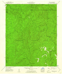 1959 Hemp Top1961 Print · USGSThe high ridges of the Georgia-Tennessee border are documented here in the late fifties, where forest management and deep river valleys meet. Genealogists and hikers can trace old landmarks like Jones Cem, Bethlehem Ch, and the Pounding Mill site.4 unique versions available
 - 1961 Map of Rome
 1961 Rome1961 Print · USGSNorthwest Georgia and neighboring Tennessee and Alabama are shown here at a moment of significant mid-century growth. Researchers can trace the rail networks of the Central of Georgia or locate landmarks within Chickamauga and Chattanooga Nat Military Park.
 - 1963 Map of Rome
 1963 Rome1963 Print · USGSThe tri-state corner of Georgia, Alabama, and Tennessee is captured here during a period of massive reservoir expansion and post-war growth. Genealogists and historians can trace the rail corridors of the Southern Ry or locate landmarks like Fort Oglethorpe and Cloudland Canyon State Park.
 - 1968 Map of Tennga, 1973 Print
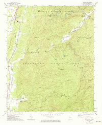 1968 Tennga1973 Print · USGSThe Georgia-Tennessee borderlands appear here in the late sixties, where rail lines and river valleys dictated the pace of life. Genealogists can trace family landmarks like Cohutta Springs, Mt Sumac Ch, and the small siding at Cisco.3 unique versions available
 - 1971 Map of Oakman, 1973 Print
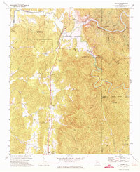 1971 Oakman1973 Print · USGSNorth Georgia’s mountain landscape is captured here during the 1970s as new reservoirs began to reshape the river valleys. Researchers can locate several rural churches and rail-side communities like Oakman, Hopewell Ch, and Sweden near the Louisville and Nashville line.2 unique versions available
 - 1971 Map of Ramhurst, 1974 Print
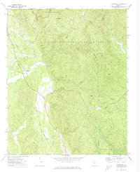 1971 Ramhurst1974 Print · USGSMurray County mountain ridges and rail-line settlements are captured here in the early 1970s. Researchers can locate family landmarks such as Ramsey Cem, trace the LOUISVILLE AND NASHVILLE railroad, or identify areas soon to be submerged by Carters Lake.2 unique versions available
 - 1971 Map of Crandall, 1974 Print
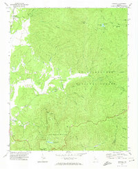 1971 Crandall1974 Print · USGSThe north Georgia mountains in the early seventies reveal a landscape where heavy industry and recreation overlap. Researchers can trace the Louisville and Nashville railroad through Crandall or locate remote sites like Hasslers Mill and Mines.3 unique versions available
 - 1972 Map of Redbud, 1974 Print
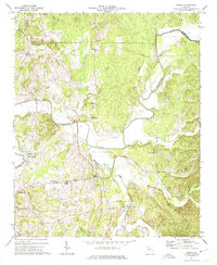 1972 Redbud1974 Print · USGSIn the early 1970s, this area of Gordon County featured a dense network of riverfront settlements and rural churches along the Coosawattee River. Genealogists can trace local landmarks like Redbud Sch, Crane Eater, and family-named points such as Hunts Corner.2 unique versions available
 - 1972 Map of Calhoun North, 1974 Print
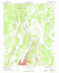 1972 Calhoun North1974 Print · USGSThe river-rich landscape of Gordon County is captured here in the early 1970s as agricultural lands and historic sites meet modern infrastructure. Genealogists and historians can trace family roots at the Resaca Confederate Cem, the New Echota Historical Site, and small settlements like Nance Springs.3 unique versions available
 - 1972 Map of Chatsworth, 1974 Print
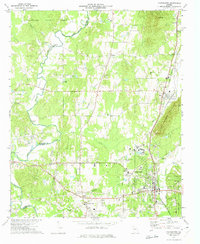 1972 Chatsworth1974 Print · USGSMurray County at the start of the 1970s shows a landscape where the Louisville and Nashville railroad links growing valley towns. Genealogists can locate family-named landmarks like Vann House, Fullers Chapel, and the river crossing at Lower Kings Bridge.3 unique versions available
Showing maps 1-25 of 98
Top cities of Murray County
Frequently asked questions
- What are the different types of historical maps available for Murray County?
- What is the oldest map of Murray County?
- Where can I purchase historical maps of Murray County for my home or office?
- Where can I download high-res historical maps of Murray County?
- Are there historical topographic maps available for Murray County?
- Is there historical aerial imagery available for Murray County?
- Where are historical maps of Murray County sourced from?