Old Maps of Oglethorpe County, Georgia for Academic Research
Study the evolution of Oglethorpe County with 119 high-resolution historic maps. Whether you're teaching, researching, or modeling changes in land use, these maps provide essential visual documentation of urban, environmental, and geographic change.
- Analyze long-term change: Track patterns in development, transportation, and natural features.
- Ideal for environmental or urban studies: Support academic projects with primary historical map data.
- Use in the classroom or lab: Educators and researchers rely on these maps to bring historical context to life.
These maps are a powerful tool for teaching, research, and visualizing how Oglethorpe County has changed over the decades.
Oglethorpe County, GA maps
(119)- 1891 Map of Carnesville
 1891 Carnesville1891 Print · USGSNortheast Georgia in the late nineteenth century is documented here as a landscape of small river settlements and emerging rail towns. Genealogists can trace family roots through locations like Jewellville, Fort Lamar, and the river crossing at Braggs Fy.6 unique versions available
 - 1893 Map of Elberton
 1893 Elberton1893 Print · USGSThe Georgia-South Carolina borderlands come alive in the 1890s, centering on the river-and-rail economy of the Savannah Valley. Genealogists can trace family names and early community hubs through Browns Ferry, Coldwater Church, and Ruckersville.5 unique versions available
 - 1906 Map of Crawfordville
 1906 Crawfordville1906 Print · USGSUpper Georgia and the South Carolina border come alive in this early century survey, showing a landscape defined by river ferries and mining sites. Genealogists can trace family roots through old post offices like Triplett P.O. or find historic crossings like Fishdam Ferry and the Columbia Mines.3 unique versions available
 - 1953 Map of Athens, 1966 Print
 1953 Athens1966 Print · USGSGeorgia's Piedmont and Savannah River borderlands come alive in this mid-century survey of the region surrounding Athens and Augusta. Trace the rail-and-river economy through the Georgia RR and landmarks like the Fort Gordon Military Reservation.3 unique versions available
 - 1954 Map of Greenville, 1965 Print
 1954 Greenville1965 Print · USGSThe Upstate and Northeast Georgia are captured here during a decade of massive transformation as new reservoirs reshaped the Piedmont. Genealogists and hikers can trace the Appalachian Trail over Brasstown Bald or locate old community centers like Demorest, Westminster, and Royston.3 unique versions available
 - 1958 Map of Greenville
 1958 Greenville1958 Print · USGSThe Piedmont and Blue Ridge foothills come alive in this mid-century survey of the Upstate and Northeast Georgia. Trace the regional rail-and-river economy through the Southern Railway corridors and early reservoir developments like Lake Sidney Lanier.
 - 1958 Map of Athens
 1958 Athens1958 Print · USGSNorth-central Georgia and the Savannah River valley are captured in the late fifties, showing the region as the new reservoirs were filling. Researchers can trace historic rail lines like the Georgia RR and locate rural landmarks such as Social Circle, Graves Mountain, and the Fort Gordon Military Reservation.
 - 1958 Map of Danielsville, 1959 Print
 1958 Danielsville1959 Print · USGSNortheast Georgia at the end of the fifties reveals a landscape defined by the Broad River and a dense network of rural parish life. Genealogists can trace family roots through numerous local landmarks like Harrison Sch, Masons Mill, and Vanna Chapel.
 - 1958 Map of Elberton, 1959 Print
 1958 Elberton1959 Print · USGSElbert County during the late fifties shows a landscape of deep-rooted rural communities and a thriving granite industry. Genealogists and local historians can locate dozens of country churches and schools like Liberty Ch and Downers Grove Sch, or trace the tracks of the Southern Railway.2 unique versions available
 - 1959 Map of Athens
 1959 Athens1959 Print · USGSNortheast Georgia and the South Carolina borderlands appear here in the mid-fifties, during a decade of infrastructure growth. Genealogists and historians can trace the rail-and-river geography of towns like Social Circle, the sprawl of Fort Gordon Military Reservation, and the newly formed Clark Hill Reservoir.
 - 1963 Map of Athens
 1963 Athens1963 Print · USGSGeorgia's Piedmont and the Savannah River valley are captured in the early sixties as major reservoirs and military installations reshaped the landscape. Researchers can trace the development of Clark Hill Reservoir, locate the Fort Gordon Military Reservation, and find historic towns like Social Circle and Eatonton.
 - 1964 Map of Barnett Shoals, 1965 Print
 1964 Barnett Shoals1965 Print · USGSThe Oconee River winds through the borders of four Georgia counties in the mid-1960s, anchored by the Barnett Shoals Dam and its local powerplant. Genealogists can trace family names at the Puryear Cem, Antioch Ch, and the rural community of Rose Hill.2 unique versions available
 - 1964 Map of Hull, 1965 Print
 1964 Hull1965 Print · USGSMadison and Clarke counties come into focus in the mid-sixties, showing a landscape of small settlements and family farms connected by the Seaboard Air Line. Researchers can locate historic rural centers like Planter, Neese, and Diamond Hill, along with numerous local landmarks including Gordons Chapel and Porterfield Cem.2 unique versions available
 - 1964 Map of Athens East, 1966 Print
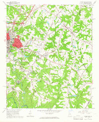 1964 Athens East1966 Print · USGSAthens and the surrounding Georgia Piedmont underwent significant postwar expansion as the university system grew and aviation matured. Genealogists can trace family landmarks like Oconee Hill Cemetery and Whitehall, while tracing old rail spurs of the Georgia Railroad.3 unique versions available
 - 1965 Map of Woodville, 1966 Print
 1965 Woodville1966 Print · USGSGreene and Oglethorpe counties are mapped in the mid-sixties, showing a landscape of rural hamlets and river forks. Researchers can trace family history through sites like Bairdstown, Durham Town, and the Bethesda Ch cemetery.2 unique versions available
 - 1966 Map of Philomath, 1967 Print
 1966 Philomath1967 Print · USGSWilkes and Taliaferro counties are shown in the mid-sixties, a period when rural Georgia was still dotted with small community centers and country chapels. Researchers can trace family roots at Philomath, Daniel Springs, or Thaxton Cem and locate many local landmarks like Victory Ch.2 unique versions available
 - 1970 Map of Jacksons Crossroads, 1973 Print
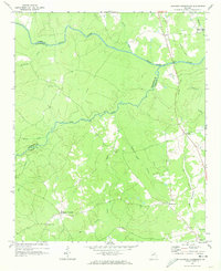 1970 Jacksons Crossroads1973 Print · USGSWilkes County and its neighbors come alive in the early 1970s as the Broad River winds through a landscape of historic small settlements. Researchers can trace the Old Railroad Grade and locate ancestral sites like Mallorysville, Clark Station Ch, and St Johns Cem.
 - 1971 Map of Sandy Cross, 1973 Print
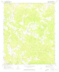 1971 Sandy Cross1973 Print · USGSOglethorpe County in the early seventies remains a landscape of tightly knit rural communities and stone works. Genealogists can trace family roots through numerous local landmarks like Mt Pleasant Ch, Point Peter, and the scattered Quarries.2 unique versions available
 - 1971 Map of Crawford, 1973 Print
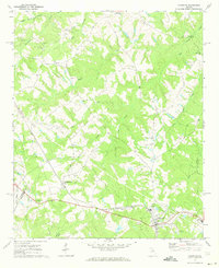 1971 Crawford1973 Print · USGSOglethorpe County in the early seventies shows a landscape of established rail towns and rural congregations. Genealogists can trace family lines through Clouds Creek Cem or locate community centers like Arnoldsville and the County High Sch.2 unique versions available
 - 1971 Map of Maxeys, 1973 Print
 1971 Maxeys1973 Print · USGSThe Oglethorpe County countryside in the early seventies shows a landscape of quiet forest and rail-side hamlets. Researchers can trace rural lineages through sites like Antioch Ch, Arnold Grove Ch, and the many cemeteries near Maxeys.
 - 1971 Map of Vesta, 1973 Print
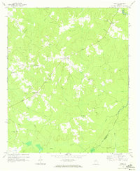 1971 Vesta1973 Print · USGSOglethorpe County in the early seventies was a landscape of granite extraction and rural congregations. Genealogists and historians can trace family locations near Saxon, Veribest, and numerous landmarks like Watkins Grove Ch or Fort Bethel Ch.2 unique versions available
 - 1971 Map of Lexington, 1973 Print
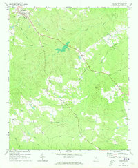 1971 Lexington1973 Print · USGSLexington and the surrounding Oglethorpe County countryside are captured here in the early seventies, showing a landscape defined by small churches and winding creeks. Trace family roots at Salem Ch, Wesley Chapel, or the Wynne Cem, and locate landmarks like the Lookout Tower on Big Mtn.2 unique versions available
 - 1971 Map of Rayle, 1973 Print
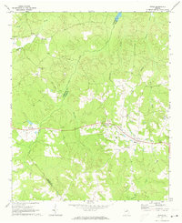 1971 Rayle1973 Print · USGSThe borderlands of Oglethorpe and Wilkes counties are captured here in the early seventies, showing a rural landscape tied to the land and local congregation. Genealogists can locate family landmarks like Chafin Cem, Stevens Grove Ch, and the settlement at Rayle.
 - 1972 Map of Penfield, 1973 Print
 1972 Penfield1973 Print · USGSGreene County in the early seventies remains a landscape of quiet rural hamlets and deep woods within the Oconee National Forest. Researchers can trace the heritage of local congregations and families at sites like Old Mercer Chapel, Shiloh Ch, and the Boswell Chapel Cem.2 unique versions available
 - 1972 Map of Danielsville South, 1974 Print
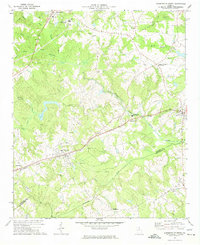 1972 Danielsville South1974 Print · USGSMadison County's agricultural and transit corridors are captured here during the 1970s. Genealogists and historians can trace family locations through numerous rural landmarks like Collier Ch, the Hitchcock Cem, and the path of the Seaboard Coast Line railroad.
Showing maps 1-25 of 119
Top cities of Oglethorpe County
Frequently asked questions
- What are the different types of historical maps available for Oglethorpe County?
- What is the oldest map of Oglethorpe County?
- Where can I purchase historical maps of Oglethorpe County for my home or office?
- Where can I download high-res historical maps of Oglethorpe County?
- Are there historical topographic maps available for Oglethorpe County?
- Is there historical aerial imagery available for Oglethorpe County?
- Where are historical maps of Oglethorpe County sourced from?