1970s Maps of Maxeys, Georgia
Explore 2 historic maps of Maxeys from the 1970s. These maps offer a rare glimpse into what life looked like during the 1970s — showing old roads, neighborhoods, homes, and landmarks that have changed or disappeared over time.
Whether you're researching your family's past, planning a metal detecting trip, or studying how Maxeys's landscape evolved across the 1970s, these high-resolution maps are a powerful tool for exploring the history of this region.
- Focus on a specific era: All maps on this page are from the 1970s, giving you a focused view of this time period.
- See what’s changed: Compare century-old streets, trails, and buildings to today's modern landscape using overlays and satellite layers.
- Research with precision: Use these maps for genealogy, historical research, land use analysis, or educational projects.
- View, download, or print: Maps are fully viewable online in high resolution, and can be downloaded or printed for your own records.
Start exploring Maxeys's history through authentic maps from the 1970s. This is your window into the past.
Maxeys, GA maps
(2)- 1971 Map of Maxeys, 1973 Print
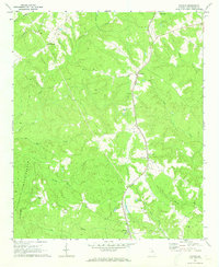 1971 Maxeys1973 Print · USGSThe Oglethorpe County countryside in the early seventies shows a landscape of quiet forest and rail-side hamlets. Researchers can trace rural lineages through sites like Antioch Ch, Arnold Grove Ch, and the many cemeteries near Maxeys.
 - 1972 Map of Penfield, 1973 Print
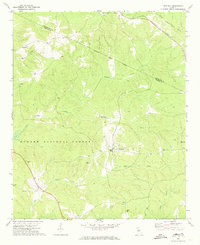 1972 Penfield1973 Print · USGSGreene County in the early seventies remains a landscape of quiet rural hamlets and deep woods within the Oconee National Forest. Researchers can trace the heritage of local congregations and families at sites like Old Mercer Chapel, Shiloh Ch, and the Boswell Chapel Cem.2 unique versions available
End of results
Showing maps 1-2 of 2
Top cities near Maxeys
- Athens historical maps
- Greensboro historical maps
- Watkinsville historical maps
- Union Point historical maps
- Winterville historical maps
- Crawford historical maps
See more
Frequently asked questions
- What are the different types of historical maps available for Maxeys?
- What is the oldest map of Maxeys?
- Where can I purchase historical maps of Maxeys for my home or office?
- Where can I download high-res historical maps of Maxeys?
- Are there historical topographic maps available for Maxeys?
- Is there historical aerial imagery available for Maxeys?
- Where are historical maps of Maxeys sourced from?