1940s Maps of Rabun County, Georgia
Explore 12 historic maps of Rabun County from the 1940s. These maps offer a rare glimpse into what life looked like during the 1940s — showing old roads, neighborhoods, homes, and landmarks that have changed or disappeared over time.
Whether you're researching your family's past, planning a metal detecting trip, or studying how Rabun County's landscape evolved across the 1940s, these high-resolution maps are a powerful tool for exploring the history of this region.
- Focus on a specific era: All maps on this page are from the 1940s, giving you a focused view of this time period.
- See what’s changed: Compare century-old streets, trails, and buildings to today's modern landscape using overlays and satellite layers.
- Research with precision: Use these maps for genealogy, historical research, land use analysis, or educational projects.
- View, download, or print: Maps are fully viewable online in high resolution, and can be downloaded or printed for your own records.
Start exploring Rabun County's history through authentic maps from the 1940s. This is your window into the past.
Rabun County, GA maps
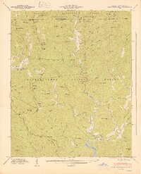
(12)- 1941 Map of Osborn
 1941 Osborn1941 Print · USGSTowns County, Georgia, and Clay County, North Carolina, appear here during the creation of the Hiwassee River reservoir system. Genealogists and hikers can trace the Appalachian Trail through the mountains or find local landmarks like Osborn, Ivy Mount Cem, and Lower Hightower Sch.2 unique versions available
 - 1943 Map of Osborn
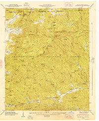
 1943 Osborn1943 Print · USGSTowns County, Georgia, and Clay County, North Carolina, appear here during the early years of the Chatuge Reservoir. Genealogists can locate family landmarks like Garrett Cem, Upper Bell Sch, and the small settlement of Osborn along Hightower Creek.
 - 1946 Map of Highlands, 1954 Print
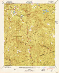
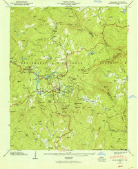 1946 Highlands1954 Print · USGSHighlands and the surrounding Nantahala heights are captured here just after the war, showing the mountain town alongside its developing reservoirs and backcountry roads. Genealogists and hikers can trace old landmarks like Clear Creek School, Horse Cove Cemetery, and the cascades of Dry Falls.5 unique versions available
 - 1946 Map of Dillard, 1956 Print
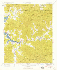
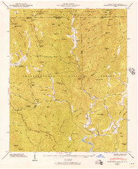
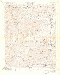
 1946 Dillard1956 Print · USGSRabun County mountain life is captured here in the years following the war, centered on the vital passage through Rabun Gap. Local historians can trace the Tallulah Falls RR and locate the Queen Mine, Kilby Mill, and the Rabun Gap Nacoochee Sch.4 unique versions available
 - 1946 Map of Hightower Bald, 1956 Print
 1946 Hightower Bald1956 Print · USGSThe Georgia and North Carolina high country is captured here in the mid-1940s as the regional landscape was being shaped by new national forest boundaries and reservoir projects. Researchers can trace the original route of the Appalachian Trail past Tate City Sch and the remote Plumorchard Ch.4 unique versions available
 - 1946 Map of Rabun Bald, 1956 Print
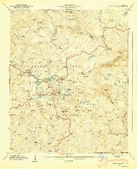
 1946 Rabun Bald1956 Print · USGSThe Blue Ridge high country of Georgia and North Carolina is surveyed here just after the war. Local researchers can find family landmarks like Locust School, Hale Church Cem, and the high-elevation flats near Rabun Bald.4 unique versions available
 - 1946 Map of Cashiers, 1957 Print
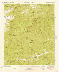
 1946 Cashiers1957 Print · USGSJackson County high country comes alive in the mid-1940s, showcasing the intersection of the Blue Ridge and the Tennessee Divide. Genealogists and historians can locate family landmarks like Upper Zachary Cem, Montvale Sch, and the community of Grimshawes.5 unique versions available
 - 1947 Map of Cashiers
 1947 Cashiers1947 Print · USGSThe Blue Ridge high country of Jackson County is meticulously detailed here in the late 1940s, centered on the Cashiers plateau. Genealogists can locate family sites like Upper Zachary Cem, the rural Montvale Sch, and the remote junction at Ellicott Rock.2 unique versions available
 - 1947 Map of Hightower Bald
 1947 Hightower Bald1947 Print · USGSThe Blue Ridge mountains at the Georgia-North Carolina border are captured here in the late 1940s as rural life centered on remote river valleys. You can locate family-named landmarks and mountain schools such as Tate City Sch, Plumorchard Ch, and the high-elevation Appalachian Trail.2 unique versions available
 - 1947 Map of Rabun Bald
 1947 Rabun Bald1947 Print · USGSThe Georgia-North Carolina borderlands appear in the late 1940s as a landscape of isolated mountain communities and forest preserves. Genealogists can locate family landmarks such as Locust School, Hale Church Cem, and the high summit of Rabun Bald.2 unique versions available
 - 1947 Map of Dillard
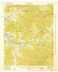
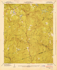
 1947 Dillard1947 Print · USGSNorth Georgia and the Carolina border are mapped here just after the war, showing the mountain communities at the headwaters of the Little Tennessee River. Genealogists and historians can locate family landmarks like Wesley Chapel Cem, Dickerson Mill, and the Rabun Gap Nacoochee Sch.2 unique versions available
 - 1947 Map of Highlands
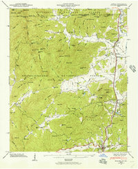
 1947 Highlands1947 Print · USGSThe mountain town of Highlands is shown here just after the war, surrounded by the peaks and waterfalls of the Nantahala National Forest. Genealogists and hikers can trace the paths of the Ellicott Rock Trail and locate sites like Clear Creek Ch or the Horse Cove Cem.2 unique versions available
End of results
Showing maps 1-12 of 12
Top cities of Rabun County
- Clayton historical maps
- Mountain City historical maps
- Tiger historical maps
- Dillard historical maps
- Sky Valley historical maps
Frequently asked questions
- What are the different types of historical maps available for Rabun County?
- What is the oldest map of Rabun County?
- Where can I purchase historical maps of Rabun County for my home or office?
- Where can I download high-res historical maps of Rabun County?
- Are there historical topographic maps available for Rabun County?
- Is there historical aerial imagery available for Rabun County?
- Where are historical maps of Rabun County sourced from?