1960s Maps of Rabun County, Georgia
Explore 5 historic maps of Rabun County from the 1960s. These maps offer a rare glimpse into what life looked like during the 1960s — showing old roads, neighborhoods, homes, and landmarks that have changed or disappeared over time.
Whether you're researching your family's past, planning a metal detecting trip, or studying how Rabun County's landscape evolved across the 1960s, these high-resolution maps are a powerful tool for exploring the history of this region.
- Focus on a specific era: All maps on this page are from the 1960s, giving you a focused view of this time period.
- See what’s changed: Compare century-old streets, trails, and buildings to today's modern landscape using overlays and satellite layers.
- Research with precision: Use these maps for genealogy, historical research, land use analysis, or educational projects.
- View, download, or print: Maps are fully viewable online in high resolution, and can be downloaded or printed for your own records.
Start exploring Rabun County's history through authentic maps from the 1960s. This is your window into the past.
Rabun County, GA maps
(5)- 1960 Map of Knoxville
 1960 Knoxville1960 Print · USGSThe Southern Appalachians come alive in the 1950s, showing the intersection of new national park tourism and deep-rooted mountain industry. Trace old rail lines like the Clinchfield RR and find high-altitude landmarks from Mt Le Conte to the Cherokee Indian Reservation.2 unique versions available
 - 1961 Map of Whetstone, 1964 Print
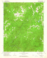 1961 Whetstone1964 Print · USGSOconee County's forested borderlands are captured here in the early sixties as the Blue Ridge foothills transition into the Chattooga River valley. Genealogists and historians can trace local landmarks like Long Creek Academy, the storied Stumphouse Tunnel, and the rural Mountain Rest community.4 unique versions available
 - 1961 Map of Satolah, 1964 Print
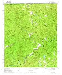 1961 Satolah1964 Print · USGSThe Georgia and South Carolina borderlands meet in the early sixties within this detailed view of the Blue Ridge foothills. Researchers can locate remote family landmarks like Page Cem and Snyder Cem or trace the winding course of the Chattooga River.3 unique versions available
 - 1964 Map of Knoxville
 1964 Knoxville1964 Print · USGSThe Southern Appalachians and Great Smokies are captured here during the mid-sixties, showing the rugged borderlands of Tennessee and North Carolina. Researchers can trace historic mountain routes like U S 441, the expanse of Pisgah National Forest, and the growing footprints of Asheville and Knoxville.
 - 1966 Map of Macedonia, 1968 Print
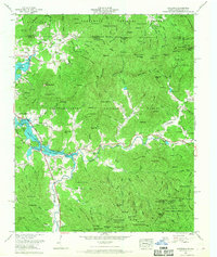 1966 Macedonia1968 Print · USGSThe North Carolina and Georgia state line cuts through these mountain valleys in the mid-sixties, where the newly created shoreline of Chatuge Lake meets old Appalachian settlements. Genealogists can trace family names at Garrett Cem, Allen Mill, and the Upper Hightower Ch congregation.
End of results
Showing maps 1-5 of 5
Top cities of Rabun County
- Clayton historical maps
- Mountain City historical maps
- Tiger historical maps
- Dillard historical maps
- Sky Valley historical maps
Frequently asked questions
- What are the different types of historical maps available for Rabun County?
- What is the oldest map of Rabun County?
- Where can I purchase historical maps of Rabun County for my home or office?
- Where can I download high-res historical maps of Rabun County?
- Are there historical topographic maps available for Rabun County?
- Is there historical aerial imagery available for Rabun County?
- Where are historical maps of Rabun County sourced from?