1970s Maps of Tattnall County, Georgia
Explore 12 historic maps of Tattnall County from the 1970s. These maps offer a rare glimpse into what life looked like during the 1970s — showing old roads, neighborhoods, homes, and landmarks that have changed or disappeared over time.
Whether you're researching your family's past, planning a metal detecting trip, or studying how Tattnall County's landscape evolved across the 1970s, these high-resolution maps are a powerful tool for exploring the history of this region.
- Focus on a specific era: All maps on this page are from the 1970s, giving you a focused view of this time period.
- See what’s changed: Compare century-old streets, trails, and buildings to today's modern landscape using overlays and satellite layers.
- Research with precision: Use these maps for genealogy, historical research, land use analysis, or educational projects.
- View, download, or print: Maps are fully viewable online in high resolution, and can be downloaded or printed for your own records.
Start exploring Tattnall County's history through authentic maps from the 1970s. This is your window into the past.
Tattnall County, GA maps
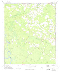
(12)- 1970 Map of Cobbtown, 1973 Print
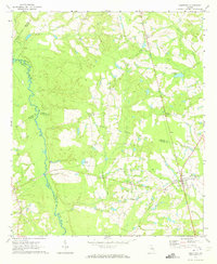 1970 Cobbtown1973 Print · USGSSoutheast Georgia in the early seventies reveals a landscape of tight-knit rural communities and river-bottom lands. Genealogists can trace family roots at Sunlight Cem and Old Reedy Creek Cem, or locate landmarks like Aline and Cobbtown.2 unique versions available
 - 1970 Map of Collins, 1973 Print
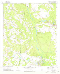
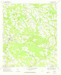 1970 Collins1973 Print · USGSThe Tattnall County countryside around Collins and Manassas appears here during the early 1970s, linked by the rail corridor. Genealogists and local historians can trace family roots through numerous sites like Old Tippins Cem and Rodgers Ch Cem.
 - 1970 Map of Metter SE, 1973 Print
 1970 Metter SE1973 Print · USGSCandler County in the early seventies is a landscape of winding river bottoms and rural congregations. Genealogists and local historians can trace the foundations of the community through landmarks like Primitive Grove Ch, Everitt Cem, and Metter Airport.2 unique versions available
 - 1970 Map of Ohoopee, 1973 Print
 1970 Ohoopee1973 Print · USGSThe Toombs and Tatnall county line follows the winding river during the early 1970s. Genealogists can locate several family landmarks and community anchors like Saturday Cem, Little Flock Ch, and the rural settlement of Ohoopee.2 unique versions available
 - 1970 Map of Reidsville West, 1973 Print
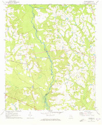
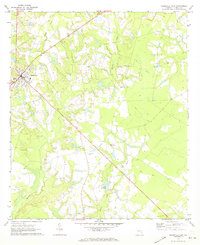
 1970 Reidsville West1973 Print · USGSReidsville and the Ohoopee River basin are captured here in the early seventies, showing a landscape defined by state institutions and rural river life. Genealogists and historians can locate the State Prison, Stanleys Store, and numerous burial grounds like Cave Cem.3 unique versions available
 - 1970 Map of Reidsville East, 1973 Print
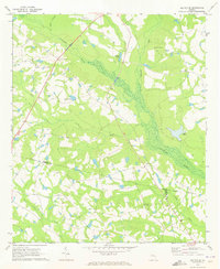
 1970 Reidsville East1973 Print · USGSTattnall County enters the early seventies as a landscape of rural family enclaves and small-town infrastructure near Reidsville. Genealogists can trace a remarkable number of local burial sites and churches, from Old Shiloh Cem to Zion Union Ch and the secluded Hammock Cem.2 unique versions available
 - 1970 Map of Altamaha, 1974 Print
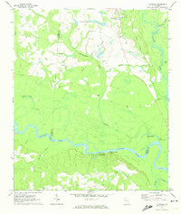 1970 Altamaha1974 Print · USGSThe Altamaha River bottomlands of Tattnall and Toombs counties were undergoing steady development in the early seventies. Genealogists and local historians can trace family roots through several rural landmarks, including Stripling Cem, Harden Cem, and Ebenezer Ch.
 - 1970 Map of Altamaha SE, 1974 Print
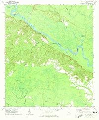 1970 Altamaha SE1974 Print · USGSThe Altamaha River bottomlands in the early 1970s reveal a landscape defined by river landings and rural family history. Researchers can trace land ties through numerous sites like Thompson Cem, Blantons Chapel, and Lower Sister Bluff Landing.
 - 1970 Map of Tison, 1974 Print
 1970 Tison1974 Print · USGSCoastal Georgia's Tattnall County is captured here in the early seventies, showcasing a landscape of river-bend borders and rural hamlets. Genealogists and historians can trace numerous family-named sites, from Sand Hill Cem to community hubs like Tison and Five Points.2 unique versions available
 - 1978 Map of Brunswick
 1978 Brunswick1978 Print · USGSThe Georgia coast and its barrier islands are captured in the late 1970s, as I-95 and the rail lines shaped the growth of coastal towns. Genealogists and historians can trace family locations across the islands or locate sites near Fort Stewart, Darien, and Ludowici.2 unique versions available
 - 1979 Map of Vidalia, 1980 Print
 1979 Vidalia1980 Print · USGSSoutheast Georgia in the late 1970s is a landscape of river-bend settlements and crossing rail lines. Researchers can trace family roots and land patterns through several towns like Vidalia, Soperton, and Mount Vernon, or locate regional landmarks like the State Prison.2 unique versions available
 - 1979 Map of Hazlehurst, 1980 Print
 1979 Hazlehurst1980 Print · USGSSoutheast Georgia in the late seventies is defined by the convergence of major rail lines and river basins in Jeff Davis and Appling counties. Genealogists and local historians can trace the development of Hazlehurst and Baxley alongside features like the Pine Grove Pipeline and the Altamaha River wetlands.
End of results
Showing maps 1-12 of 12
Top cities of Tattnall County
- Glennville historical maps
- Reidsville historical maps
- Collins historical maps
- Cobbtown historical maps
- Manassas historical maps
Frequently asked questions
- What are the different types of historical maps available for Tattnall County?
- What is the oldest map of Tattnall County?
- Where can I purchase historical maps of Tattnall County for my home or office?
- Where can I download high-res historical maps of Tattnall County?
- Are there historical topographic maps available for Tattnall County?
- Is there historical aerial imagery available for Tattnall County?
- Where are historical maps of Tattnall County sourced from?