
1970 Map of Cobbtown
USGS Topo · Published 1973About this map
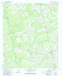
The Ohoopee River defines the western reaches of this 1970 landscape, winding through a complex junction of Emanuel, Toombs, Candler, and Tattnall counties. The settlement of Cobbtown serves as the local hub in the southeast, characterized by its Water Tank and proximity to the Sunlight Cem. This area of Georgia's coastal plain shows a dispersed pattern of rural life, with numerous country churches such as Aline Ch and New Life Ch anchoring the small communities of Aline and its surroundings.
Find a feature on this map
29 named features on this map. Tap any name to fly to it.
Don’t see what you’re looking for? This feature index may not catch every label — zoom into the map to look around manually.
Map Details
Editions of this 1970 Cobbtown Map
2 editions found
Other maps of this area

1957 · Macon
USGS Topo · 1:250,000

1958 · Macon
USGS Topo · 1:250,000

1964 · Macon
USGS Topo · 1:250,000
1970 · Collins
USGS Topo · 1:24,000
1970 · Metter
USGS Topo · 1:24,000
1970 · Metter SE
USGS Topo · 1:24,000

1970 · Nunez
USGS Topo · 1:24,000

1970 · Ohoopee
USGS Topo · 1:24,000

1970 · Lyons
USGS Topo · 1:24,000

1970 · Oak Park
USGS Topo · 1:24,000