1970 Map of Metter SE
USGS Topo · Published 1973About this map
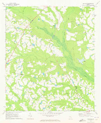
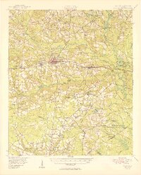
The Canoochee River carves a winding path through this corner of Candler County, defining a landscape of wetlands and timbered creek bottoms in the early 1970s. The map illustrates a rural Georgia community structured around its spiritual and social centers, including Primitive Grove Ch, Evergreen Ch, and Charlton Grove Ch. Significant water features like Bowens Pond and Laniers Pond are scattered throughout the terrain, suggesting the importance of local irrigation and fishing. Near the northern border, Metter Airport provides a modern link to the region, while the boundary lines of Tattnall and Evans counties intersect in the southern reaches of the quadrangle. For genealogists, the inclusion of family-named landmarks like Dixon Grove Cem and Everitt Cem offers valuable clues into the settlement patterns of this agrarian district.
Find a feature on this map
19 named features on this map. Tap any name to fly to it.
Don’t see what you’re looking for? This feature index may not catch every label — zoom into the map to look around manually.
Map Details
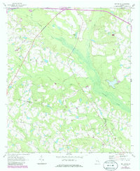
Editions of this 1970 Metter SE Map
2 editions found
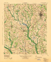
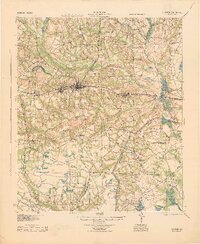
Other maps of this area

1919 · Claxton
USGS Topo · 1:62,500

1920 · Statesboro
USGS Topo · 1:62,500
1943 · Statesboro
USGS Topo · 1:62,500
1944 · Claxton
USGS Topo · 1:62,500

1947 · Savannah
USGS Topo · 1:250,000

1948 · Savannah
USGS Topo · 1:250,000
1950 · Claxton
USGS Topo · 1:62,500

1957 · Macon
USGS Topo · 1:250,000

1957 · Savannah
USGS Topo · 1:250,000

1958 · Macon
USGS Topo · 1:250,000