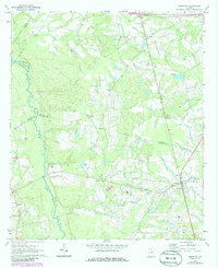
1970 Map of Cobbtown
USGS Topo · Published 1986About this map
Cobbtown and Aline anchor this landscape along the border of Tattnall, Candler, Emanuel, and Toombs counties. This 1970s era documentation, updated with photogrammetric revisions in the early 1980s, reveals a rural community defined by its dispersed churches and family cemeteries. Significant local landmarks include Eden Ch, New Eden Ch, and Cool Springs Ch, alongside several burial grounds such as Old Reedy Creek Cem and Bazemore Cem that provide vital clues for genealogical research. The Ohoopee River winds through the western portion of the sheet, joined by Beaver Creek and Wolfe Creek. The presence of a Gaging Station and a Water Tank in Cobbtown highlights the essential infrastructure supporting these small agricultural settlements during a period of steady transition.
Find a feature on this map
30 named features on this map. Tap any name to fly to it.
Don’t see what you’re looking for? This feature index may not catch every label — zoom into the map to look around manually.
Map Details
Editions of this 1970 Cobbtown Map
2 editions found
Other maps of this area

1957 · Macon
USGS Topo · 1:250,000

1958 · Macon
USGS Topo · 1:250,000

1964 · Macon
USGS Topo · 1:250,000

1970 · Cobbtown
USGS Topo · 1:24,000
1970 · Collins
USGS Topo · 1:24,000
1970 · Metter
USGS Topo · 1:24,000
1970 · Metter SE
USGS Topo · 1:24,000

1970 · Nunez
USGS Topo · 1:24,000

1970 · Ohoopee
USGS Topo · 1:24,000

1970 · Lyons
USGS Topo · 1:24,000