Old Maps of Tattnall County, Georgia for Metal Detecting
Plan your next treasure hunt with 117 historic maps of Tattnall County. Find old homesites, ghost towns, trails, and gathering spots that may be lost to time — perfect for identifying promising metal detecting locations.
- Locate forgotten sites: Uncover places like long-lost settlements, abandoned rail lines, or gathering spots.
- Plan better hunts: Use map overlays combined with LiDAR or satellite views to narrow in on historically rich areas.
- Made for detectorists: Thousands of hobbyists use these maps to discover relics, coins, and hidden history.
Use these historic maps to boost your research and find new opportunities beneath the surface of Tattnall County.
Tattnall County, GA maps
(117)- 1919 Map of Claxton
 1919 Claxton1919 Print · USGSSoutheast Georgia rail towns thrive along the Seaboard Air Line just after the Great War, showing a landscape shaped by timber and local agriculture. Genealogists can locate over twenty rural schools and crossings like Deans Crossing, Liberia School, and Hagan.3 unique versions available
 - 1920 Map of Glennville
 1920 Glennville1920 Print · USGSSoutheast Georgia in the years after the Great War shows a landscape of rail-connected timber towns and dozens of country schools. Genealogists can locate family landmarks like Vance School, trace the winding Altamaha River past Beards Bluff, or find old crossings like Flat Ford Bridge.3 unique versions available
 - 1944 Map of Claxton
 1944 Claxton1944 Print · USGSSoutheast Georgia was undergoing significant change in the 1940s as military expansion met established rail towns and rural school districts. Genealogists and historians can trace the footprint of Camp Stewart alongside family-named landmarks like Beasley Sch, Moodys Crossing, and Brewton Mill Sch.
 - 1944 Map of Glennville
 1944 Glennville1944 Print · USGSGlennville and the surrounding Georgia coastal plain are captured during the mid-1940s, showing a landscape defined by small farming communities and river commerce. Genealogists can trace family footprints through numerous local landmarks like Howard Chapel, Mendes, and the Rye Patch School.
 - 1946 Map of Brunswick, 1948 Print
 1946 Brunswick1948 Print · USGSCoastal Georgia in the mid-forties reveals a landscape defined by the Camp Stewart Military Reservation and the sprawling barrier islands. Genealogists and historians can trace the rail-and-river network through inland towns like Ludowici and Jesup, or locate coastal landmarks like the St Simon Light.
 - 1947 Map of Savannah
 1947 Savannah1947 Print · USGSCoastal Georgia and South Carolina are captured here in the mid-forties, showing the rail-and-river networks of the Lowcountry. Genealogists and researchers can trace old crossroads and river towns from Statesboro to Beaufort, alongside military sites like Camp Stewart and Parris Island.
 - 1948 Map of Brunswick
 1948 Brunswick1948 Print · USGSCoastal Georgia in the late 1940s is defined here by its labyrinthine barrier islands and the massive footprint of Camp Stewart. Genealogists and historians can trace the rail-tied growth of Jesup and Hinesville or locate coastal landmarks like St Simon Light.
 - 1948 Map of Savannah
 1948 Savannah1948 Print · USGSThe Georgia and South Carolina Lowcountry comes alive in this post-war survey of the coast and its river-fed hinterlands. Genealogists and historians can trace rail lines like the Central of Georgia RR and find established settlements such as Isle of Hope and Sylvania.
 - 1950 Map of Glennville
 1950 Glennville1950 Print · USGSGlennville and the surrounding Tattnall County timberlands are captured here at mid-century as the local economy balanced millpond industry with a growing military presence. Researchers can trace rural life through scattered landmarks like Smiley Crossroads, Donald, and the Rye Patch Sch.2 unique versions available
 - 1950 Map of Claxton
 1950 Claxton1950 Print · USGSMid-century Evans County centers on the thriving rail corridor connecting Claxton, Hagan, and Daisy during the height of the Seaboard Air Line era. Genealogists and historians can locate numerous rural landmarks like the Ennis Branch School, Sikes Chapel, and the vast Camp Stewart Military Reservation.2 unique versions available
 - 1953 Map of Waycross, 1967 Print
 1953 Waycross1967 Print · USGSSouth Georgia's agricultural and rail heartland is captured here in the mid-1950s, showing a vast network of timber and farming towns. Researchers can trace the rail lines connecting Waycross and Tifton or locate landmarks like Jefferson Davis State Park and Lake Blackshear.2 unique versions available
 - 1956 Map of Brunswick, 1968 Print
 1956 Brunswick1968 Print · USGSThe Georgia coast in the mid-twentieth century is a wild expanse of barrier islands and massive river deltas. You can trace the development of the maritime economy and military presence at Brunswick, or locate historic sites like Fort Frederica National Monument and Harris Neck National Wildlife Refuge.2 unique versions available
 - 1957 Map of Macon
 1957 Macon1957 Print · USGSMid-century Georgia comes into focus as the river-and-rail economy shifts toward a new era of aviation and highway travel. Trace family roots and vanished landmarks across the Ocmulgee River valley from Macon to the onion fields of Vidalia.
 - 1957 Map of Savannah, 1967 Print
 1957 Savannah1967 Print · USGSThe Lowcountry and Georgia coastal plain are shown here in the late fifties, prior to modern expansion. Researchers can trace the rail-and-river economy through the Central of Georgia lines and the Ogeechee River wetlands.4 unique versions available
 - 1958 Map of Macon
 1958 Macon1958 Print · USGSMiddle Georgia during the late fifties shows the post-war expansion of Warner Robins alongside the deep-rooted rail hubs of the Central of Georgia line. Researchers can trace the river-bound boundaries of numerous counties and find local landmarks like Veterans Memorial Hospital and Robins AFB.
 - 1958 Map of Waycross
 1958 Waycross1958 Print · USGSSoutheast Georgia in the late fifties remains a landscape of deep river basins and vital rail junctions. Genealogists and historians can trace family-named landmarks and rural hubs like Union Church, South Georgia College, and the sprawling Okefenokee Swamp.2 unique versions available
 - 1958 Map of Glennville NE, 1961 Print
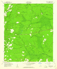 1958 Glennville NE1961 Print · USGSCoastal Georgia's rural landscape is seen here during the late 1950s as military boundaries reshaped the backcountry of Long and Liberty Counties. Genealogists can trace several vanished church sites and cemeteries including Poplar Head Cem, Smith Chapel Cem, and New Bethel Ch.2 unique versions available
 - 1958 Map of Deans Crossing, 1961 Print
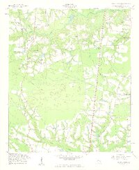 1958 Deans Crossing1961 Print · USGSTattnall and Evans counties are captured in the late fifties during a period of rural transition along Beards Creek. Genealogists can trace family roots through numerous sites like Kennedy Cem, Midway Sch, and Tar City Ch.3 unique versions available
 - 1958 Map of Glissons Millpond, 1961 Print
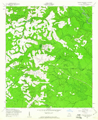 1958 Glissons Millpond1961 Print · USGSCoastal Georgia in the late fifties shows a rural landscape transitioning into the Fort Stewart Military Reservation. Researchers can locate family burial sites at Barnard Cem or trace the remnant of an Old Railroad Grade near Camp Oliver.3 unique versions available
 - 1958 Map of Glennville, 1961 Print
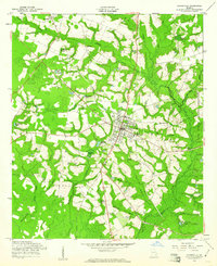 1958 Glennville1961 Print · USGSGlennville and its surrounding Tattnall County homesteads are captured here in the late fifties, showcasing a landscape of millponds and rural crossroads. Researchers can trace family roots through landmarks like the Surrency Cem, Zaraigh Ch, and Dickey Poppell Millpond.3 unique versions available
 - 1958 Map of Glennville SW, 1961 Print
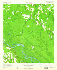 1958 Glennville SW1961 Print · USGSSoutheast Georgia's river lowlands come into focus in the late fifties where the three-way intersection of Tattnall, Long, and Wayne counties meets. Researchers can trace rural landmarks from Padgett Cem to riverside features like Beards Bluff and Yankee Reach.3 unique versions available
 - 1958 Map of Claxton, 1961 Print
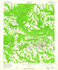 1958 Claxton1961 Print · USGSEvans County in the late fifties shows the steady rhythm of a railroad and timber economy centered on Claxton and Hagan. Researchers can trace old family landmarks and community hubs, from Sikes Chapel and Brewton Cem to the local Drive-in Theater.2 unique versions available
 - 1960 Map of Savannah
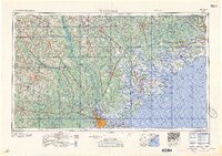 1960 Savannah1960 Print · USGSCoastal Georgia and the South Carolina Lowcountry are captured in the late fifties, showcasing the intricate web of islands and tidal rivers before modern expansion. Researchers can trace the rail lines of the Atlantic Coast Line or locate sites like Parris Island, Beaufort, and the Tybee Lighthouse.
 - 1961 Map of Savannah
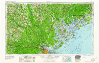 1961 Savannah1961 Print · USGSThe Georgia and South Carolina Lowcountry comes alive in this mid-century survey of coastal marshes, barrier islands, and river networks. Genealogists and historians can trace the paths of the Seaboard Air Line RR, locate family sites near Isle of Hope, or study the grounds of Fort Stewart Military Reservation.2 unique versions available
 - 1961 Map of Brunswick
 1961 Brunswick1961 Print · USGSThe Georgia coast at the start of the 1960s was a landscape of deep tidal marshes and growing military installations. Genealogists and historians can trace rail-linked towns like Limerick Station or explore coastal landmarks from Fort Frederica National Monument to Sapelo Island.
Showing maps 1-25 of 117
Top cities of Tattnall County
- Glennville historical maps
- Reidsville historical maps
- Collins historical maps
- Cobbtown historical maps
- Manassas historical maps
Frequently asked questions
- What are the different types of historical maps available for Tattnall County?
- What is the oldest map of Tattnall County?
- Where can I purchase historical maps of Tattnall County for my home or office?
- Where can I download high-res historical maps of Tattnall County?
- Are there historical topographic maps available for Tattnall County?
- Is there historical aerial imagery available for Tattnall County?
- Where are historical maps of Tattnall County sourced from?