1950s Maps of Towns County, Georgia
Explore 4 historic maps of Towns County from the 1950s. These maps offer a rare glimpse into what life looked like during the 1950s — showing old roads, neighborhoods, homes, and landmarks that have changed or disappeared over time.
Whether you're researching your family's past, planning a metal detecting trip, or studying how Towns County's landscape evolved across the 1950s, these high-resolution maps are a powerful tool for exploring the history of this region.
- Focus on a specific era: All maps on this page are from the 1950s, giving you a focused view of this time period.
- See what’s changed: Compare century-old streets, trails, and buildings to today's modern landscape using overlays and satellite layers.
- Research with precision: Use these maps for genealogy, historical research, land use analysis, or educational projects.
- View, download, or print: Maps are fully viewable online in high resolution, and can be downloaded or printed for your own records.
Start exploring Towns County's history through authentic maps from the 1950s. This is your window into the past.
Towns County, GA maps
(4)- 1954 Map of Greenville, 1965 Print
 1954 Greenville1965 Print · USGSThe Upstate and Northeast Georgia are captured here during a decade of massive transformation as new reservoirs reshaped the Piedmont. Genealogists and hikers can trace the Appalachian Trail over Brasstown Bald or locate old community centers like Demorest, Westminster, and Royston.3 unique versions available
 - 1957 Map of Jacks Gap, 1960 Print
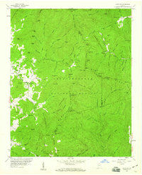 1957 Jacks Gap1960 Print · USGSThe North Georgia highlands come to life in the late fifties as the Appalachian Trail winds through these mountains. Trace local heritage at Town Creek Sch or follow the historic Unicoi Turnpike and the waters of the Nottely River.4 unique versions available
 - 1957 Map of Tray Mountain, 1960 Print
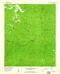 1957 Tray Mountain1960 Print · USGSThe High Blue Ridge of Georgia is captured here in the late fifties as a network of gaps and forest trails. Genealogists and hikers can trace the original path of the Appalachian Trail through Tray Mountain and locate early sites like Mountain Scene and the High Valley Boys Club.4 unique versions available
 - 1958 Map of Greenville
 1958 Greenville1958 Print · USGSThe Piedmont and Blue Ridge foothills come alive in this mid-century survey of the Upstate and Northeast Georgia. Trace the regional rail-and-river economy through the Southern Railway corridors and early reservoir developments like Lake Sidney Lanier.
End of results
Showing maps 1-4 of 4
Top cities of Towns County
Frequently asked questions
- What are the different types of historical maps available for Towns County?
- What is the oldest map of Towns County?
- Where can I purchase historical maps of Towns County for my home or office?
- Where can I download high-res historical maps of Towns County?
- Are there historical topographic maps available for Towns County?
- Is there historical aerial imagery available for Towns County?
- Where are historical maps of Towns County sourced from?