1940s Maps of Wayne County, Georgia
Explore 7 historic maps of Wayne County from the 1940s. These maps offer a rare glimpse into what life looked like during the 1940s — showing old roads, neighborhoods, homes, and landmarks that have changed or disappeared over time.
Whether you're researching your family's past, planning a metal detecting trip, or studying how Wayne County's landscape evolved across the 1940s, these high-resolution maps are a powerful tool for exploring the history of this region.
- Focus on a specific era: All maps on this page are from the 1940s, giving you a focused view of this time period.
- See what’s changed: Compare century-old streets, trails, and buildings to today's modern landscape using overlays and satellite layers.
- Research with precision: Use these maps for genealogy, historical research, land use analysis, or educational projects.
- View, download, or print: Maps are fully viewable online in high resolution, and can be downloaded or printed for your own records.
Start exploring Wayne County's history through authentic maps from the 1940s. This is your window into the past.
Wayne County, GA maps
(7)- 1943 Map of Ludowici
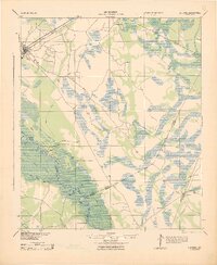 1943 Ludowici1943 Print · USGSCoastal Georgia in the early 1940s is defined by the winding Altamaha River and the vital rail junctions at Ludowici. Family historians can trace rural settlements like Bobtown and Upper Sensavilla or locate unique landmarks like the Wreck of Louise.4 unique versions available
 - 1943 Map of Jesup
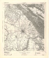 1943 Jesup1943 Print · USGSSoutheast Georgia during the war years reveals a landscape of thriving rail junctions and river landings. Genealogists and local historians can trace the foundations of Wayne County through sites like Redland P O Nesbitt Station, Midway Ch, and Doctortown.
 - 1944 Map of Everett City
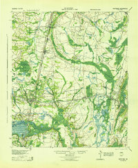
 1944 Everett City1944 Print · USGSCoastal Georgia during the mid-forties was a world of rail junctions and river landings tied to the Altamaha. Genealogists and historians can trace rail-side communities like Everett City, rural schoolhouses including Bull Island Sch, and the site of the Fort Barrington Ferry.
 - 1944 Map of Hortense
 1944 Hortense1944 Print · USGSCoastal Georgia during the mid-forties reveals a landscape defined by the Satilla River and a strategic intersection of two major railroads. Genealogists can trace family roots through rural landmarks like Manningtown, Oak Grove Ch, and Menor Sch.
 - 1944 Map of Glennville
 1944 Glennville1944 Print · USGSGlennville and the surrounding Georgia coastal plain are captured during the mid-1940s, showing a landscape defined by small farming communities and river commerce. Genealogists can trace family footprints through numerous local landmarks like Howard Chapel, Mendes, and the Rye Patch School.
 - 1946 Map of Brunswick, 1948 Print
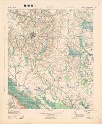
 1946 Brunswick1948 Print · USGSCoastal Georgia in the mid-forties reveals a landscape defined by the Camp Stewart Military Reservation and the sprawling barrier islands. Genealogists and historians can trace the rail-and-river network through inland towns like Ludowici and Jesup, or locate coastal landmarks like the St Simon Light.
 - 1948 Map of Brunswick
 1948 Brunswick1948 Print · USGSCoastal Georgia in the late 1940s is defined here by its labyrinthine barrier islands and the massive footprint of Camp Stewart. Genealogists and historians can trace the rail-tied growth of Jesup and Hinesville or locate coastal landmarks like St Simon Light.
End of results
Showing maps 1-7 of 7
Top cities of Wayne County
Frequently asked questions
- What are the different types of historical maps available for Wayne County?
- What is the oldest map of Wayne County?
- Where can I purchase historical maps of Wayne County for my home or office?
- Where can I download high-res historical maps of Wayne County?
- Are there historical topographic maps available for Wayne County?
- Is there historical aerial imagery available for Wayne County?
- Where are historical maps of Wayne County sourced from?