Old Maps of Wayne County, Georgia for Hiking & Exploration
Hike through history with 159 historic maps of Wayne County. Explore old trails, ghost towns, and forgotten backroads — perfect for outdoor adventurers and local explorers.
- Rediscover forgotten places: Map out old mining camps, roads, and footpaths that no longer exist on modern maps.
- Layer with modern tools: Combine with LiDAR or satellite views to plan hikes through historical terrain.
- Made for exploration: Popular among hikers, overlanders, and local history lovers.
Use these maps to find adventure and explore the hidden past of Wayne County.
Wayne County, GA maps
(159)- 1918 Map of Jesup
 1918 Jesup1918 Print · USGSWayne County was a bustling rail and river corridor during the First World War era. Genealogists can trace family roots through a dense network of local landmarks, from Millikin Crossing School to the rural Bethlehem Church and Midway Church.3 unique versions available
 - 1918 Map of Hortense
 1918 Hortense1918 Print · USGSSoutheast Georgia during the Great War era reveals a landscape shaped by river systems and steam-age railroads. Genealogists can trace family roots through numerous rural landmarks like Pendarvis School, Mt Zion Church, and the river crossing at Rosin Landing.2 unique versions available
 - 1918 Map of Everett City
 1918 Everett City1918 Print · USGSCoastal Georgia at the end of the Great War was a world of vast river swamps and emerging rail junctions. Genealogists and historians can trace family locations through isolated landmarks like Bull Island School, the Ft Barrington Ferry, and the timber-driven siding at Thalmann.2 unique versions available
 - 1920 Map of Glennville
 1920 Glennville1920 Print · USGSSoutheast Georgia in the years after the Great War shows a landscape of rail-connected timber towns and dozens of country schools. Genealogists can locate family landmarks like Vance School, trace the winding Altamaha River past Beards Bluff, or find old crossings like Flat Ford Bridge.3 unique versions available
 - 1920 Map of Everett City, 1944 Print
 1920 Everett City1944 Print · USGSCoastal Glynn County was a hub of railroad and river activity during the early twentieth century. Researchers can trace family-named landings and vanished rail stops like Thalmann, the Union Industrial School, and the historic Ft Barrington Ferry.
 - 1943 Map of Ludowici
 1943 Ludowici1943 Print · USGSCoastal Georgia in the early 1940s is defined by the winding Altamaha River and the vital rail junctions at Ludowici. Family historians can trace rural settlements like Bobtown and Upper Sensavilla or locate unique landmarks like the Wreck of Louise.4 unique versions available
 - 1943 Map of Jesup
 1943 Jesup1943 Print · USGSSoutheast Georgia during the war years reveals a landscape of thriving rail junctions and river landings. Genealogists and local historians can trace the foundations of Wayne County through sites like Redland P O Nesbitt Station, Midway Ch, and Doctortown.
 - 1944 Map of Everett City
 1944 Everett City1944 Print · USGSCoastal Georgia during the mid-forties was a world of rail junctions and river landings tied to the Altamaha. Genealogists and historians can trace rail-side communities like Everett City, rural schoolhouses including Bull Island Sch, and the site of the Fort Barrington Ferry.
 - 1944 Map of Hortense
 1944 Hortense1944 Print · USGSCoastal Georgia during the mid-forties reveals a landscape defined by the Satilla River and a strategic intersection of two major railroads. Genealogists can trace family roots through rural landmarks like Manningtown, Oak Grove Ch, and Menor Sch.
 - 1944 Map of Glennville
 1944 Glennville1944 Print · USGSGlennville and the surrounding Georgia coastal plain are captured during the mid-1940s, showing a landscape defined by small farming communities and river commerce. Genealogists can trace family footprints through numerous local landmarks like Howard Chapel, Mendes, and the Rye Patch School.
 - 1946 Map of Brunswick, 1948 Print
 1946 Brunswick1948 Print · USGSCoastal Georgia in the mid-forties reveals a landscape defined by the Camp Stewart Military Reservation and the sprawling barrier islands. Genealogists and historians can trace the rail-and-river network through inland towns like Ludowici and Jesup, or locate coastal landmarks like the St Simon Light.
 - 1948 Map of Brunswick
 1948 Brunswick1948 Print · USGSCoastal Georgia in the late 1940s is defined here by its labyrinthine barrier islands and the massive footprint of Camp Stewart. Genealogists and historians can trace the rail-tied growth of Jesup and Hinesville or locate coastal landmarks like St Simon Light.
 - 1950 Map of Glennville
 1950 Glennville1950 Print · USGSGlennville and the surrounding Tattnall County timberlands are captured here at mid-century as the local economy balanced millpond industry with a growing military presence. Researchers can trace rural life through scattered landmarks like Smiley Crossroads, Donald, and the Rye Patch Sch.2 unique versions available
 - 1953 Map of Waycross, 1967 Print
 1953 Waycross1967 Print · USGSSouth Georgia's agricultural and rail heartland is captured here in the mid-1950s, showing a vast network of timber and farming towns. Researchers can trace the rail lines connecting Waycross and Tifton or locate landmarks like Jefferson Davis State Park and Lake Blackshear.2 unique versions available
 - 1956 Map of Brunswick, 1968 Print
 1956 Brunswick1968 Print · USGSThe Georgia coast in the mid-twentieth century is a wild expanse of barrier islands and massive river deltas. You can trace the development of the maritime economy and military presence at Brunswick, or locate historic sites like Fort Frederica National Monument and Harris Neck National Wildlife Refuge.2 unique versions available
 - 1958 Map of Waycross
 1958 Waycross1958 Print · USGSSoutheast Georgia in the late fifties remains a landscape of deep river basins and vital rail junctions. Genealogists and historians can trace family-named landmarks and rural hubs like Union Church, South Georgia College, and the sprawling Okefenokee Swamp.2 unique versions available
 - 1958 Map of Glennville SW, 1961 Print
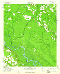 1958 Glennville SW1961 Print · USGSSoutheast Georgia's river lowlands come into focus in the late fifties where the three-way intersection of Tattnall, Long, and Wayne counties meets. Researchers can trace rural landmarks from Padgett Cem to riverside features like Beards Bluff and Yankee Reach.3 unique versions available
 - 1961 Map of Brunswick
 1961 Brunswick1961 Print · USGSThe Georgia coast at the start of the 1960s was a landscape of deep tidal marshes and growing military installations. Genealogists and historians can trace rail-linked towns like Limerick Station or explore coastal landmarks from Fort Frederica National Monument to Sapelo Island.
 - 1970 Map of Doctortown, 1973 Print
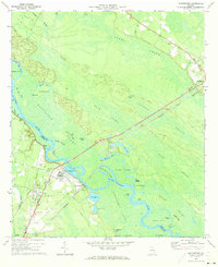 1970 Doctortown1973 Print · USGSThe Altamaha River bottomlands in the early seventies reveal a world of interconnected swamps and river-dependent industry. Genealogists and historians can locate Doctortown and Ludowici, or trace landmarks like the Elem Ch and the Drive-in Theater.3 unique versions available
 - 1970 Map of Jesup West, 1973 Print
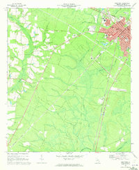 1970 Jesup West1973 Print · USGSWayne County, Georgia, underwent significant modernization in the 1970s as the rail hub of Jesup expanded westward. Genealogists and historians can trace community roots through numerous country churches like Satilla Church and rural landmarks such as the Jesup-Wayne County Airport.2 unique versions available
 - 1970 Map of Jesup NW, 1973 Print
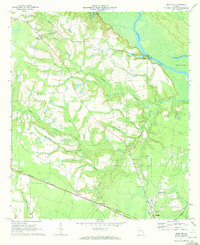 1970 Jesup NW1973 Print · USGSWayne County just north of Jesup is captured here during the 1970s, showing a landscape defined by the Altamaha River and rural crossroads. Genealogists and historians can trace family roots through several country churches like Bethesda Ch and Blanton Grove Ch.2 unique versions available
 - 1970 Map of Jesup East, 1974 Print
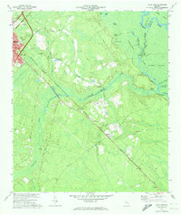 1970 Jesup East1974 Print · USGSWayne County is documented in the 1970s as a vital junction for the Southern and Seaboard Coast Line railroads. Genealogists and historians can trace the rural communities of Odessa and Gardi or locate family-named landmarks like Bethlehem Ch and Plank Landing.2 unique versions available
 - 1970 Map of Altamaha SE, 1974 Print
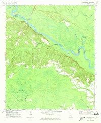 1970 Altamaha SE1974 Print · USGSThe Altamaha River bottomlands in the early 1970s reveal a landscape defined by river landings and rural family history. Researchers can trace land ties through numerous sites like Thompson Cem, Blantons Chapel, and Lower Sister Bluff Landing.
 - 1970 Map of Altamaha SW, 1974 Print
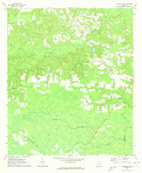 1970 Altamaha SW1974 Print · USGSSoutheast Georgia’s timber and farming lands are captured here in the early 1970s, as the rural landscape transitioned into the modern era. Researchers can trace family history through sites like Easons Cem, the Tenmile Lookout Tower, and the remote settlement of Alisons.
 - 1971 Map of Odum, 1973 Print
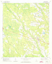 1971 Odum1973 Print · USGSWayne County's pine woods and wetlands appear in detail during the early seventies, centered on the railroad town of Odum. Researchers can locate family landmarks like Aspinwall Cem or trace the timber-lined tracks of the SOUTHERN railway through Brentwood.2 unique versions available
Showing maps 1-25 of 159
Top cities of Wayne County
Frequently asked questions
- What are the different types of historical maps available for Wayne County?
- What is the oldest map of Wayne County?
- Where can I purchase historical maps of Wayne County for my home or office?
- Where can I download high-res historical maps of Wayne County?
- Are there historical topographic maps available for Wayne County?
- Is there historical aerial imagery available for Wayne County?
- Where are historical maps of Wayne County sourced from?