Old Maps of Omao, Hawaii for Metal Detecting
Plan your next treasure hunt with 9 historic maps of Omao. Find old homesites, ghost towns, trails, and gathering spots that may be lost to time — perfect for identifying promising metal detecting locations.
- Locate forgotten sites: Uncover places like long-lost settlements, abandoned rail lines, or gathering spots.
- Plan better hunts: Use map overlays combined with LiDAR or satellite views to narrow in on historically rich areas.
- Made for detectorists: Thousands of hobbyists use these maps to discover relics, coins, and hidden history.
Use these historic maps to boost your research and find new opportunities beneath the surface of Omao.
Omao, HI maps
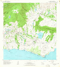
(9)- 1954 Map of Kauai
 1954 Kauai1954 Print · USGSKauai and Niihau are shown during a period of transition in the early fifties as plantation-era infrastructure began to change. Researchers can trace the Kilauea Sugar Plantation Railroad, the Anahola Settlement, and remote sites on Niihau like Puuwai.
 - 1963 Map of Koloa, 1965 Print
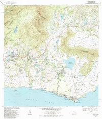
 1963 Koloa1965 Print · USGSSouthern Kauai in the early sixties reveals a landscape shaped by sugar and sea, from the plantation heritage of Koloa to the developing shores of Poipu. Researchers can trace old irrigation systems, the Koloa Mill, and historical sites like Nomilo Fishpond.2 unique versions available
 - 1967 Map of Kauai
 1967 Kauai1967 Print · USGSThe Garden Isle and Niihau are shown here in the mid-sixties, capturing the island's transition from plantation roots to a more modern infrastructure. Genealogists can trace family connections in Moloaa Settlement or find coastal landmarks like Nonopapa and Kilauea Point Light.
 - 1970 Map of Kauai, 1974 Print
 1970 Kauai1974 Print · USGSThe islands of Kauai and Niihau are shown during the early 1970s, capturing the balance between military expansion and preserved wilderness. Researchers can trace the layout of Niihau's elusive villages like Puwai or explore Kauai's industrial landscape at Koloa Mill and Port Allen.2 unique versions available
 - 1978 Map of Koloa, 1981 Print
 1978 Koloa1981 Print · USGSThe southern coast of Kauai comes into focus in the late seventies as local agriculture and residential growth meet the sea. Researchers can trace the layout of Koloa and Kalaheo while surveying landmarks like Waita Reservoir and Alexander Reservation.
 - 1983 Map of Koloa, 1984 Print
 1983 Koloa1984 Print · USGSThe southern coast of Kauai comes alive in the early eighties, showing the agricultural and coastal development of the islands. Researchers can trace the Old Railroad Grade and locate historic sites like Koloa Mill, Hoai Heiau, and Koloa Cemetery.2 unique versions available
 - 2013 Map of Koloa, 2013 Print
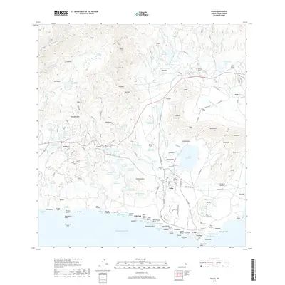
 2013 Koloa2013 Print · USGSCovers Omao, including Kipu, Lawai, and other nearby areas
 - 2017 Map of Koloa, 2017 Print
 2017 Koloa2017 Print · USGSCovers Omao, including Kipu, Lawai, and other nearby areas
 - 2024 Map of Koloa, 2024 Print
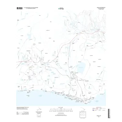
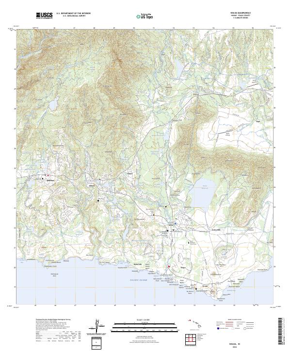 2024 Koloa2024 Print · USGSSouth Kauai in the early twenty-first century remains defined by its sugar-era footprint and coastal expansion. Researchers can trace land use through Kōloa Mill, local heritage at Koloa Hawaiian Protestant Church Cem, and the vast Waita Reservoir.
End of results
Showing maps 1-9 of 9
Top cities near Omao
Frequently asked questions
- What are the different types of historical maps available for Omao?
- What is the oldest map of Omao?
- Where can I purchase historical maps of Omao for my home or office?
- Where can I download high-res historical maps of Omao?
- Are there historical topographic maps available for Omao?
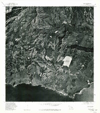
- Is there historical aerial imagery available for Omao?
- Where are historical maps of Omao sourced from?