Old Maps of Olowalu, Hawaii for Hiking & Exploration
Hike through history with 9 historic maps of Olowalu. Explore old trails, ghost towns, and forgotten backroads — perfect for outdoor adventurers and local explorers.
- Rediscover forgotten places: Map out old mining camps, roads, and footpaths that no longer exist on modern maps.
- Layer with modern tools: Combine with LiDAR or satellite views to plan hikes through historical terrain.
- Made for exploration: Popular among hikers, overlanders, and local history lovers.
Use these maps to find adventure and explore the hidden past of Olowalu.
Olowalu, HI maps
(9)- 1954 Map of Maui
 1954 Maui1954 Print · USGSThe central Hawaiian Islands are shown during the mid-fifties, detailing the agricultural and coastal infrastructure of Maui, Lanai, and Molokai. Genealogists and researchers can trace plantation-era history at Haliimaile Camp, locate old harbors like Kaumalapau Harbor, or explore the early bounds of Haleakala National Park.
 - 1955 Map of Olowalu, 1957 Print
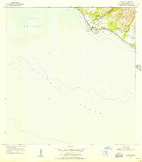 1955 Olowalu1957 Print · USGSCoastal Maui in the mid-fifties shows a landscape defined by sugar ruins and sacred Hawaiian sites along the leeward shore. Researchers can locate the Mill (Ruins), trace the irrigation network of Ukumehame Reservoirs, and find Kaiwaloa Heiau.2 unique versions available
 - 1966 Map of Maui
 1966 Maui1966 Print · USGSThe central islands of Maui, Molokai, Lanai, and Kahoolawe are shown in detail during the mid-1960s as plantation life and early tourism coexisted. Genealogists and researchers can trace family locations in old plantation towns like Puunene, the harbor at Lahaina, and Hoolehua on Molokai.
 - 1974 Map of Maui
 1974 Maui1974 Print · USGSMid-century Hawaii is captured here through the detailed landscapes of Maui, Molokai, Lanai, and Kahoolawe as they appeared in the 1970s. Researchers can trace the layout of island hubs like Lahaina and Lanai City alongside remote landmarks like Wainapanapa Cave.2 unique versions available
 - 1983 Map of Olowalu
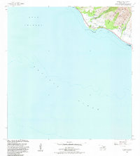 1983 Olowalu1983 Print · USGSCoastal Maui in the early eighties shows a transition from historical irrigation to modern recreation. Researchers can trace land use through the Olowalu Shaft, find the local Heiau, and locate the Olowalu Wharf along the shoreline.2 unique versions available
 - 1992 Map of Olowalu, 1999 Print
 1992 Olowalu1999 Print · USGSCoastal West Maui in the 1990s was a landscape defined by its vital water systems and shoreline settlements. Researchers can trace the local water infrastructure from the Ukumehame Reservoir to the Olowalu Wharf, while locating family sites at Kilea and Mopua.
 - 2013 Map of Olowalu, 2013 Print
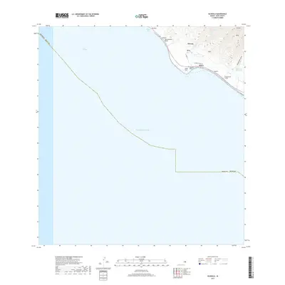
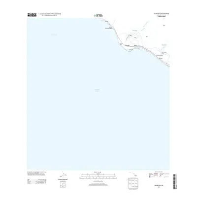 2013 Olowalu2013 Print · USGSCovers Olowalu, including Maui County, United States, and other nearby areas
 - 2017 Map of Olowalu, 2017 Print
 2017 Olowalu2017 Print · USGSCovers Olowalu, including Maui County, United States, and other nearby areas
 - 2024 Map of Olowalu, 2024 Print
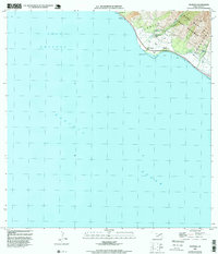
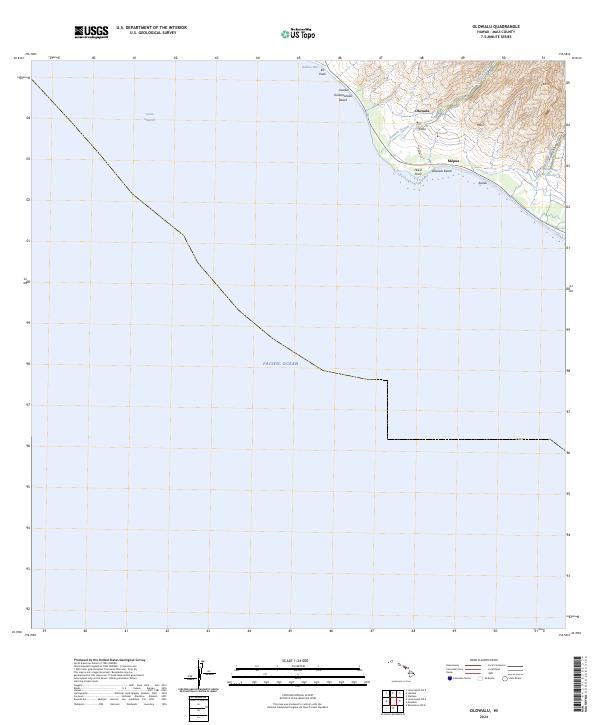 2024 Olowalu2024 Print · USGSCoastal West Maui is documented here in the early twenty-first century, showing the intersection of mountain watersheds and seaside settlements. Trace the vital water systems of the Olowalu Ditch or locate family-named coastal landmarks like Hekili Point and Kailiili.
End of results
Showing maps 1-9 of 9
Top cities near Olowalu
Frequently asked questions
- What are the different types of historical maps available for Olowalu?
- What is the oldest map of Olowalu?
- Where can I purchase historical maps of Olowalu for my home or office?
- Where can I download high-res historical maps of Olowalu?
- Are there historical topographic maps available for Olowalu?
- Is there historical aerial imagery available for Olowalu?
- Where are historical maps of Olowalu sourced from?