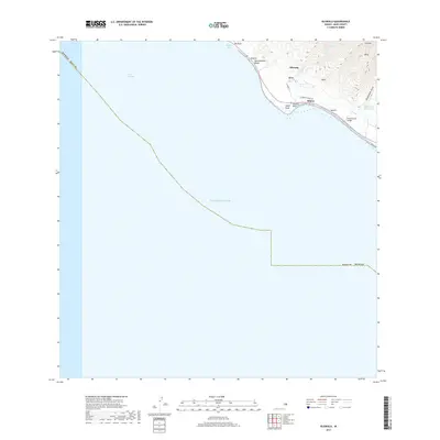
2017 Map of Olowalu
USGS Topo · Published 2017About this map
Olowalu and the small coastal settlements of Mōpua and Kilea anchor this West Maui coastal survey. The map details a landscape defined by the intersection of steep volcanic ridges and the Pacific Ocean, where human infrastructure is largely confined to the narrow littoral strip. Water management is a primary feature of the terrain, evidenced by the Olowalu Ditch winding along the higher contours and the Ukumehame Reservoirs situated near Ukumehame Gulch. This irrigation network reflects the area's agricultural history, specifically the requirements of sugar cultivation that once dominated the flats around Olowalu Stream.
Find a feature on this map
24 named features on this map. Tap any name to fly to it.
Don’t see what you’re looking for? This feature index may not catch every label — zoom into the map to look around manually.
Map Details
Editions of this 2017 Olowalu Map
This is the sole edition of this map. No revisions or reprints were ever made.
Other maps of this area

1929 · Kahoolawe
USGS Topo · 1:62,500

1954 · Maui
USGS Topo · 1:250,000

1954 · Maalaea
USGS Topo · 1:24,000

1955 · Olowalu
USGS Topo · 1:24,000

1955 · Wailuku
USGS Topo · 1:24,000

1956 · Lahaina
USGS Topo · 1:24,000

1966 · Maui
USGS Topo · 1:250,000

1974 · Maui
USGS Topo · 1:250,000

1977 · Wailuku
USGS Topo · 1:24,000
1978 · Lahaina
USGS Topo · 1:24,000