
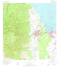
1955 Map of Wailuku
USGS Topo · Published 1957About this map
The urban and industrial landscape of Central Maui is defined here by the growth of Wailuku and the sugar-driven economy of Puunene. The map documents a mid-century period where modern civic infrastructure like the Central Maui Memorial Hospital and Baldwin High School stood alongside ancient spiritual sites including Pihana Heiau and Halekii Heiau. Industrial life is evidenced by the complex network of irrigation features such as the Spreckels Ditch and the Waihee Ditch, which supported the surrounding plantation lands and the Sugar Mill near Iao Stream.
Find a feature on this map
99 named features on this map. Tap any name to fly to it.
Don’t see what you’re looking for? This feature index may not catch every label — zoom into the map to look around manually.
Map Details
Editions of this 1955 Wailuku Map
2 editions found
Other maps of this area

1954 · Maui
USGS Topo · 1:250,000

1954 · Maalaea
USGS Topo · 1:24,000

1954 · Paia
USGS Topo · 1:24,000

1954 · Puu O Kali
USGS Topo · 1:24,000

1955 · Olowalu
USGS Topo · 1:24,000

1955 · Kahakuloa
USGS Topo · 1:24,000

1956 · Lahaina
USGS Topo · 1:24,000

1956 · Honolua
USGS Topo · 1:24,000

1966 · Maui
USGS Topo · 1:250,000

1974 · Maui
USGS Topo · 1:250,000